Abeloya
Welcome to Abeloya, a Polar island in the Barentsz Sea, part of the majestic Arctic Ocean. This guide offers a comprehensive overview of what makes Abeloya unique – from its geography and climate to its population, infrastructure, and beyond. Dive into the details:
- Geography and Size: Explore the island’s size and location.
- Climate and Weather: Weather patterns and temperature.
- Topography and Nature: Uncover the natural wonders of the island.
- Infrastructure and Travelling: Insights on reaching, staying, and making the most of your visit.
- News and Headlines: Latest News.
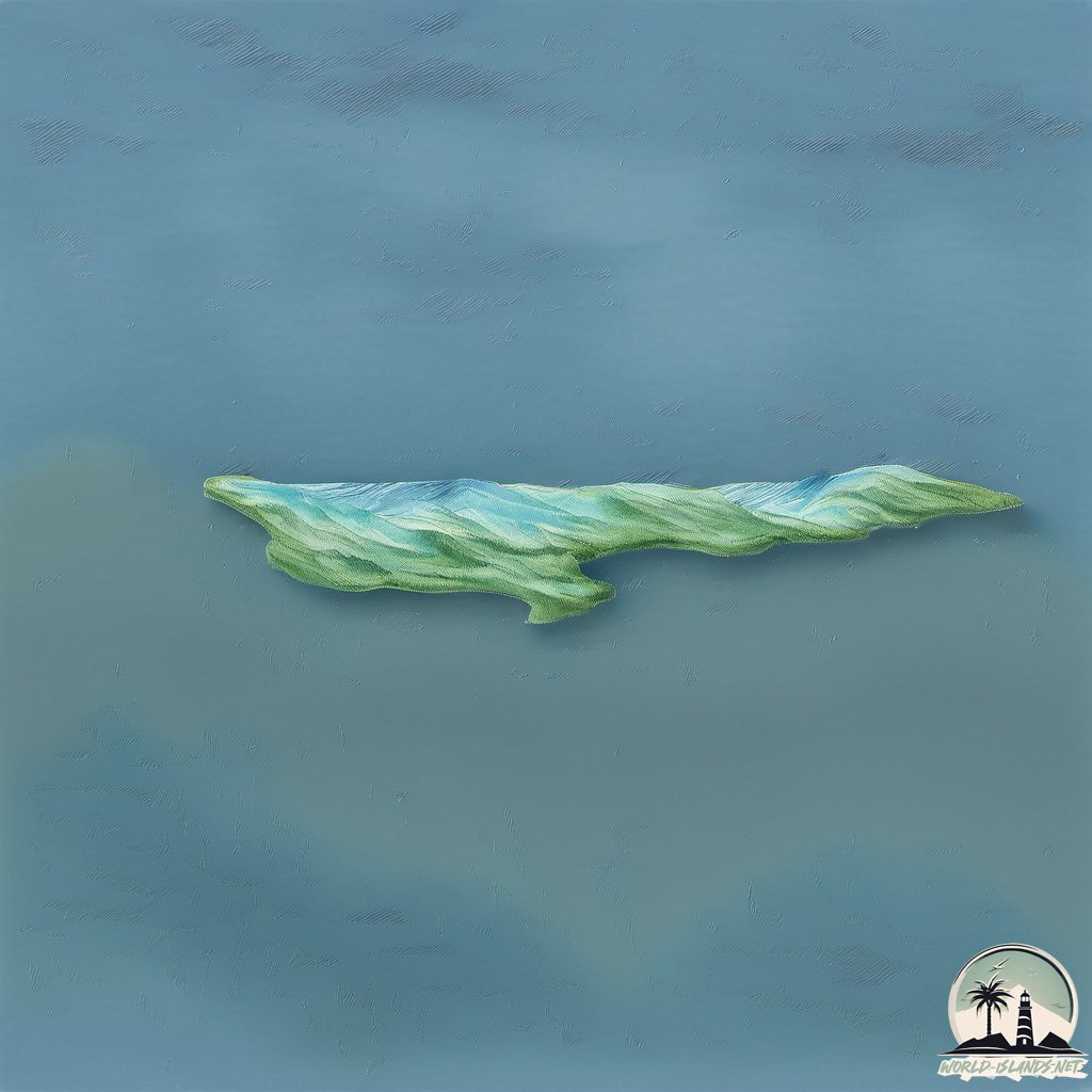
Geography and size of Abeloya
Size: 13.4 km²
Coastline: 29.6 km
Ocean: Arctic Ocean
Sea: Barentsz Sea
Continent: Europe
Abeloya is a Medium Island spanning 13 km² with a coastline of 30 km.
Archipel: Svalbard – A Norwegian archipelago in the Arctic Ocean, known for its rugged remote terrain, polar bears, and as a center for Arctic research.
Tectonic Plate: Eurasia – One of the world’s largest tectonic plates, the Eurasian Plate covers a significant portion of Europe and Asia. It’s characterized by diverse geological features, including the Ural Mountains, the European Plain, and the Himalayas formed from its collision with the Indian Plate.
The geographic heart of the island is pinpointed at these coordinates:
Latitude: 78.98901128 / Longitude: 30.18912384
Climate and weather of Abeloya
Climate Zone: Polar
Climate Details: Tundra
Temperature: Cold
Climate Characteristics: The tundra climate features long, extremely cold winters and short, cool summers. Vegetation is limited to mosses, lichens, and small shrubs due to the low temperatures and short growing seasons. Biodiversity is low, but some specialized species thrive.
Topography and nature of Abeloya
Timezone: UTC+01:00
Timezone places: Europe/Paris
Max. Elevation: 29 m
Mean Elevation: 23 m
Vegetation: Sparse Vegetation
Tree Coverage: 85%
The mean elevation is 23 m. The highest elevation on the island reaches approximately 29 meters above sea level. The island is characterized by Plains: Flat, low-lying lands characterized by a maximum elevation of up to 200 meters. On islands, plains are typically coastal lowlands or central flat areas.
Dominating Vegetation: Sparse Vegetation
These regions have limited plant growth, typically due to extreme conditions like aridity or poor soils. Vegetation is scattered and consists of hardy plant species. Abeloya has a tree cover of 85 %.
Vegetation: 2 vegetation zones – Low Diversity Island
Islands with two distinct vegetation zones offer slightly more ecological variety. These zones could be due to differences in elevation, moisture, or other environmental factors. While still limited in biodiversity, these islands may offer a contrast between the two zones, such as a coastline with mangroves and an inland area with grassland.
Infrastructure and Travelling to Abeloya
Does the island have a public airport? no.
There is no public and scheduled airport on Abeloya. The nearest airport is Berlevåg Airport, located 908 km away.
Does the island have a major port? no.
There are no major ports on Abeloya. The closest major port is BERLEVAG, approximately 907 km away.
The mean population of Abeloya is 0 per km². Abeloya is Uninhabited. The island belongs to Norway.
Continuing your journey, Kongsoya is the next notable island, situated merely km away.
abeloya island eas alarm

Norway is classified as Developed region: nonG7: Developed economies outside of the Group of Seven, characterized by high income and advanced economic structures. The level of income is High income: OECD.
News – Latest Updates and Headlines from Abeloya
Stay informed with the most recent news and important headlines from Abeloya. Here’s a roundup of the latest developments.
- Feed has no items.
Please note: The data used here has been primarily extracted from satellite readings. Deviations from exact values may occur, particularly regarding the height of elevations and population density. Land area and coastline measurements refer to average values at mean high tide.