Dyke
Welcome to Dyke, a Temperate island in the South Atlantic Ocean, part of the majestic Atlantic Ocean. This guide offers a comprehensive overview of what makes Dyke unique – from its geography and climate to its population, infrastructure, and beyond. Dive into the details:
- Geography and Size: Explore the island’s size and location.
- Climate and Weather: Weather patterns and temperature.
- Topography and Nature: Uncover the natural wonders of the island.
- Infrastructure and Travelling: Insights on reaching, staying, and making the most of your visit.
- News and Headlines: Latest News.
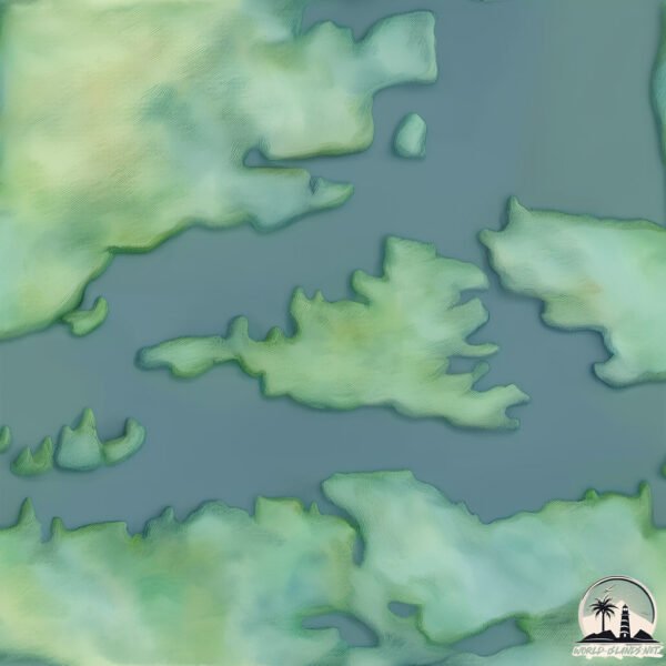
Geography and size of Dyke
Size: 15.9 km²
Coastline: 36.7 km
Ocean: Atlantic Ocean
Sea: South Atlantic Ocean
Continent: South America
Dyke is a Medium Island spanning 16 km² with a coastline of 37 km.
Archipel: Falkland Islands – Located in the South Atlantic Ocean, this British Overseas Territory is known for its rugged terrain, biodiversity, and historical significance.
Tectonic Plate: South America – A major plate covering the South American continent and part of the Atlantic Ocean, known for the Andes mountain range and significant seismic and volcanic activity.
The geographic heart of the island is pinpointed at these coordinates:
Latitude: -51.99133486 / Longitude: -60.88645077
Climate and weather of Dyke
Climate Zone: Temperate
Climate Details: Subpolar Oceanic Climate
Temperature: Cold Summer
Climate Characteristics: Predominantly cold with cool summers and no dry season. Often found in coastal areas at higher latitudes or on islands.
Topography and nature of Dyke
Timezone: UTC-04:00
Timezone places: America/La_Paz
Max. Elevation: 52 m
Mean Elevation: 23 m
Vegetation: Herbaceous Cover
Tree Coverage: 60%
The mean elevation is 23 m. The highest elevation on the island reaches approximately 52 meters above sea level. The island is characterized by Plains: Flat, low-lying lands characterized by a maximum elevation of up to 200 meters. On islands, plains are typically coastal lowlands or central flat areas.
Dominating Vegetation: Herbaceous Cover
Comprising mainly of grasses, herbs, and ferns, these areas are common in prairies, meadows, and savannas, and can vary widely in species composition. Dyke has a tree cover of 60 %.
Vegetation: 7 vegetation zones – Very Highly Diverse Island
Islands in this range are ecological powerhouses, showcasing a wide array of vegetation zones. Each zone, from lush rainforests to arid scrublands, coastal mangroves to mountainous regions, contributes to a complex and interdependent ecosystem. These islands are often hotspots of biodiversity, supporting numerous species and intricate ecological processes.
Infrastructure and Travelling to Dyke
Does the island have a public airport? no.
There is no public and scheduled airport on Dyke. The nearest airport is Mount Pleasant Airport, located 267 km away.
Does the island have a major port? no.
There are no major ports on Dyke. The closest major port is STANLEY, approximately 336 km away.
The mean population of Dyke is 0 per km². Dyke is Uninhabited. The island belongs to Falkland Is..
The name of the island resonates across different cultures and languages. Here is how it is known around the world: Arabic: جزيرة فوكلاند الغربية; German: Westfalkland; Spanish: Isla Gran Malvina; French: île de Grande Malouine; Portuguese: Malvina Ocidental; Russian: Западный Фолкленд; Chinese: 大马尔维纳岛
Continuing your journey, Weddel is the next notable island, situated merely km away.
The Soggy Dollar Bar on Jost Van Dyke, in the British Virgin Islands. Voted best in the Caribbean!


Falkland Is. is classified as Developed region: G7: Group of Seven – Major advanced economies, including Canada, France, Germany, Italy, Japan, the United Kingdom, and the United States. The level of income is High income: OECD.
News – Latest Updates and Headlines from Dyke
Stay informed with the most recent news and important headlines from Dyke. Here’s a roundup of the latest developments.
Please note: The data used here has been primarily extracted from satellite readings. Deviations from exact values may occur, particularly regarding the height of elevations and population density. Land area and coastline measurements refer to average values at mean high tide.