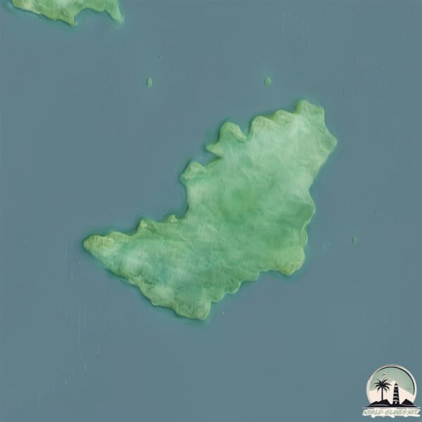
Welcome to Pulau Taneti, a Tropical island in the Molukka Sea, part of the majestic Pacific Ocean. This guide offers a comprehensive overview of what makes Pulau Taneti unique – from its geography and climate to its population, infrastructure, and beyond. Dive into the details:
Geography and size of Pulau Taneti
Size: 31.1 km²
Coastline: 40.2 km
Ocean: Pacific Ocean
Sea: Molukka Sea
Continent: Oceania
Pulau Taneti is a Medium Island spanning 31 km² with a coastline of 40 km.
Archipel: Melanesia – A subregion of Oceania in the southwestern Pacific Ocean, including countries like Fiji, Solomon Islands, and Vanuatu, known for their diverse cultures and languages.
Tectonic Plate: Birds Head – Also known as the Bird’s Head Plate, it is a small tectonic plate in the vicinity of the Bird’s Head Peninsula in West Papua. The plate is noted for its interactions with the Pacific, Australian, and Philippine Sea plates, contributing to the geological complexity of the region.
The geographic heart of the island is pinpointed at these coordinates:
Latitude: -0.10770184 / Longitude: 127.2418979
Climate and weather of Pulau Taneti
Climate Zone: Tropical
Climate Details: Tropical Rainforest Climate
Temperature: Hot
Climate Characteristics: This climate is typified by heavy rainfall throughout the year, high humidity, and consistently high temperatures, leading to lush rainforests and rich biodiversity. Seasonal temperature variations are minimal.
Topography and nature of Pulau Taneti
Timezone: UTC+09:00
Timezone places: Asia/Tokyo
Max. Elevation: 140 m
Mean Elevation: 55 m
Vegetation: Evergreen Broadleaf Forest
Tree Coverage: 81%
The mean elevation is 55 m. The highest elevation on the island reaches approximately 140 meters above sea level. The island is characterized by Plains: Flat, low-lying lands characterized by a maximum elevation of up to 200 meters. On islands, plains are typically coastal lowlands or central flat areas.
Dominating Vegetation: Evergreen Broadleaf Forest
Characterized by dense, lush canopies of broadleaf trees that retain their leaves year-round. These forests are typically found in tropical and subtropical regions and are known for their high biodiversity. Pulau Taneti has a tree cover of 81 %.
Vegetation: 7 vegetation zones – Very Highly Diverse Island
Islands in this range are ecological powerhouses, showcasing a wide array of vegetation zones. Each zone, from lush rainforests to arid scrublands, coastal mangroves to mountainous regions, contributes to a complex and interdependent ecosystem. These islands are often hotspots of biodiversity, supporting numerous species and intricate ecological processes.
Infrastructure and Travelling to Pulau Taneti
Does the island have a public airport? no.
There is no public and scheduled airport on Pulau Taneti. The nearest airport is Sultan Babullah Airport, located 101 km away.
Does the island have a major port? no.
There are no major ports on Pulau Taneti. The closest major port is LABUHA, approximately 61 km away.
The mean population of Pulau Taneti is 43 per km². Pulau Taneti is Gently Populated. The island belongs to Indonesia.
Continuing your journey, Pulau Muari is the next notable island, situated merely km away.
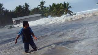
Double Strike di Pulau Taneti Maluku utara
Double Strike di Pulau Taneti Maluku utara
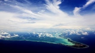
Extreme king tide recorded on Vaitupu -the largest atoll in Tuvalu
Recording of a king tide event on Vaitupu, the largest atoll in ...
Recording of a king tide event on Vaitupu, the largest atoll in Tuvalu. Rising sea levels driven by climate change will make such ...
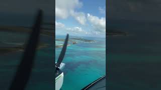
VISIT ONE OF THE WORLD'S MOST REMOTE ISLANDS: Fanning Island
Visit remote Fanning island - a small dot in the Pacific Ocean about ...
Visit remote Fanning island - a small dot in the Pacific Ocean about 900 miles south of Hawaii. In the local language, Fanning ...
Flying in the islands #310
10 Top Attractions in Kiribati
Subscribe to : ...
Coronavirus (Covid-19) lockdown after flight brings Covid (Kiribati) - BBC News - 22nd January 2022
The Kiribati island nation was one of the world's last Covid-free ...
The Kiribati island nation was one of the world's last Covid-free places. Now it's under lockdown. The Pacific island nation of ...
Melanesia and Micronesia Children's mix racial Kiribati half Solomon islands
A week in Kiribati (the old Gilbert Islands) in 2011
Parliament Building in Tarawa Atoll, Kiribati
Parliament Building in Tarawa Atoll, Kiribati In 1979 the Gilbert ...
Parliament Building in Tarawa Atoll, Kiribati In 1979 the Gilbert Islands, Banaba, the Phoenix and the Line Islands became the ...
Climate Change Impacts : Kiribati's Water Paradox | Echo the Eco
Kiribati, a country of 33 Pacific Islands, is experiencing an ...
Kiribati, a country of 33 Pacific Islands, is experiencing an especially urgent crisis. By the end of the century, melting glaciers and ...
Discovering a New Fly Fishing Flat on Tabuaeran Kiribati - 4K VLOG 181
An exploratory fly fishing adventure leads us to the most remote part ...
An exploratory fly fishing adventure leads us to the most remote part on the already remote Fanning Island in Kiribati. Weaving ...
🔥 E Nanoroo Atuum (Tikitaie) 🔥By Kay Land x Heny x Yo T feat. DJay Flavor
This track tells a powerful story about a young girl caught up in ...
This track tells a powerful story about a young girl caught up in situations too heavy for her age. It's a warning wrapped in rhythm ...
Geographic Revisionism: Chinese Land Reclamation & Ambitions in the Southwest Pacific by Nitya Labh
Through William & Mary's Global Research Institute, Project on ...
Through William & Mary's Global Research Institute, Project on International Security and Peace (PIPS) fellows spend a year ...
Drowning Paradise Island Nation Facing Extinction
Nov. 21 (Bloomberg) -- The Pacific island nation of Kiribati looks ...
Nov. 21 (Bloomberg) -- The Pacific island nation of Kiribati looks like a paradise but its days are numbered. As global climate ...
Part 2 of our Fiji trip - Malamala & Naisoso Island
Hey Everyone, We are finally here! Feeling so grateful and blessed to ...
Hey Everyone, We are finally here! Feeling so grateful and blessed to be here and just soaking in every moment. Getting to spend ...
Tei Abemama Neiei 2025
A beautiful love song from Abemama Island, Kiribati. "Tei Abemama ...
A beautiful love song from Abemama Island, Kiribati. "Tei Abemama Neiei" tells a story of pure island love and unforgettable ...
Kiribati Diplomatic Shift: Choosing Taiwan's Friendships (2004)
Pawn of the Pacific (2004): The issue of Taiwan's sovereignty has ...
Pawn of the Pacific (2004): The issue of Taiwan's sovereignty has fueled a Pacific Cold War. Both China and Taiwan stand ...
Chief Welcomed Us In His Village On FIJI Remote Island 🇫🇯
diislandfamily #tiktokcouplegoals #livinginaustralia #fiji ...
diislandfamily #tiktokcouplegoals #livinginaustralia #fiji #fijianmusic #fijitiktok #fijiislands #fijiculture #jamaican #argentine ...
Suva, Fiji - Port of Suva #1 - Regent Cruise - 10 Jan 2020
Kiribati Language Week, a strong cultural connection
For Kiribati Language Week, we sit down with one of our amazing ...
For Kiribati Language Week, we sit down with one of our amazing Pacific Learners contributors, Sutee Baiteke. We ask her about ...
How to Pronounce Kiribati? (CORRECTLY)
This video shows you how to pronounce Kiribati (country, island, ...
This video shows you how to pronounce Kiribati (country, island, pronunciation guide). Hear more COUNTRY NAMES ...
Kiribati: The President's Dilemma
The Pacific islands of Kiribati were among the last places to be ...
The Pacific islands of Kiribati were among the last places to be colonized by humans. But now, because of rising sea levels, they ...
China-Pasifik Gelar Pertemuan Menlu ke-3 di Xiamen
MetroTV, Menteri Luar Negeri China, Wang Yi, memimpin bersama ...
MetroTV, Menteri Luar Negeri China, Wang Yi, memimpin bersama Pertemuan Ketiga Para Menteri Luar Negeri ...
Indonesia is classified as Emerging region: MIKT: Mexico, Indonesia, South Korea, and Turkey – Economies recognized for their development potential and emerging market status. The level of income is Lower middle income.
News – Latest Updates and Headlines from Pulau Taneti
Stay informed with the most recent news and important headlines from Pulau Taneti. Here’s a roundup of the latest developments.
Loading...
Please note: The data used here has been primarily extracted from satellite readings. Deviations from exact values may occur, particularly regarding the height of elevations and population density. Land area and coastline measurements refer to average values at mean high tide.