Welcome to Dyer Island, a Temperate island in the South Atlantic Ocean, part of the majestic Atlantic Ocean. This guide offers a comprehensive overview of what makes Dyer Island unique – from its geography and climate to its population, infrastructure, and beyond. Dive into the details:
Geography and size of Dyer Island
Size: 1.059 km²
Coastline: 7.8 km
Ocean: Atlantic Ocean
Sea: South Atlantic Ocean
Continent: Africa
Dyer Island is a Small Island spanning 1.1 km² with a coastline of 7.8 km.
Archipel: –
Tectonic Plate: Australia – A major tectonic plate covering Australia, New Zealand, and parts of the Indian and Pacific Oceans, known for its relative stability and occasional seismic activity.
The geographic heart of the island is pinpointed at these coordinates:
Latitude: -34.68300564 / Longitude: 19.41334617
Climate and weather of Dyer Island
Climate Zone: Temperate
Climate Details: Warm-Summer Mediterranean Climate
Temperature: Warm Summer
Climate Characteristics: Characterized by warm, dry summers and mild, wet winters, typical of coastal areas with abundant sunshine Rain is more common in the winter months, maintaining a moderate climate.
Topography and nature of Dyer Island
Timezone: UTC+02:00
Timezone places: Africa/Johannesburg
Max. Elevation: -2 m
Mean Elevation: -6 m
Vegetation: Sparse Vegetation with Trees/Shrubs
Tree Coverage: 47%
The mean elevation is -6 m. Remarkably, this unique island barely emerges above the sea level, showcasing nature’s fascinating interplay with the ocean. The island is characterized by Plains: Flat, low-lying lands characterized by a maximum elevation of up to 200 meters. On islands, plains are typically coastal lowlands or central flat areas.
Dominating Vegetation: Sparse Vegetation with Trees/Shrubs
Areas where grasses and other herbaceous plants are prevalent, but with occasional presence of trees and shrubs. Often found in semi-arid regions or grasslands. Dyer Island has a tree cover of 47 %.
Vegetation: 1 vegetation zones – Minimal Diversity Island
These islands exhibit the most basic level of ecological diversity, often characterized by a single dominant vegetation type. This could be due to extreme environmental conditions, limited land area, or significant human impact. They represent unique ecosystems where specific species have adapted to thrive in these singular environments.
Infrastructure and Travelling to Dyer Island
Does the island have a public airport? no.
There is no public and scheduled airport on Dyer Island. The nearest airport is Cape Town International Airport, located 119 km away.
Does the island have a major port? no.
There are no major ports on Dyer Island. The closest major port is SIMONSTOWN, approximately 121 km away.
The mean population of Dyer Island is per km². Dyer Island is . The island belongs to South Africa.
Continuing your journey, Bengalena is the next notable island, situated merely km away.
How Great White Sharks hunt around the Dyer Island ecosystem
Near the Southernmost tip of Africa, the Dyer Island ecosystem is home to the Marine Big 5. Here you will find Cape Fur seals, ...How Great White Sharks hunt around the Dyer Island ecosystem
Near the Southernmost tip of Africa, the Dyer Island ecosystem is home ...
Near the Southernmost tip of Africa, the Dyer Island ecosystem is home to the Marine Big 5. Here you will find Cape Fur seals, ...
Spectacular Whales open season for Dyer Island Cruises
Whale Watching cannot get better than this!! ..curious whales ...
Whale Watching cannot get better than this!! ..curious whales entertaing the guests with kelp, rubbing against the boat, diving ...
a Trip with Dyer Island Cruises' Whale Whisperer
RSG se Haidee Muller, "Oggend op RSG" (uitgesaai 10 Desember 2014) het ...
RSG se Haidee Muller, "Oggend op RSG" (uitgesaai 10 Desember 2014) het gaan walvisse kyk saam met Dyer Island Cruises se ...
Bronze Whaler Sharks at Dyer Island - Gansbaai, South Africa
Activist attempts the first ever swim to dyer island
Dyer Island, South Africa: Due to great white shark population which ...
Dyer Island, South Africa: Due to great white shark population which congregate around the seal colony on the island, this swim ...
Gansbaai: Marine Dynamics & Dyer Island Cruises
Marine Dynamics Tours together with sister company, Dyer Island ...
Marine Dynamics Tours together with sister company, Dyer Island Cruises, are the ONLY shark cage diving and whale watching ...
Xplorio™ Gansbaai - Dyer Island Cruises Whale & Marine Big 5 Eco Tours
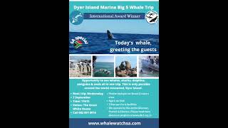
Opportunity to see whales, sharks, dolphins, penguins and seals all in ...
Opportunity to see whales, sharks, dolphins, penguins and seals all in one trip. This is only possible around the world-renowned, ...
SHARKS AT DYER ISLAND 2016
Shark in Shark Alley at Dyer Island wit Brian McFarlaine.
Shark in Shark Alley at Dyer Island wit Brian McFarlaine.
Xplorio™ Gansbaai - Dyer Island Cruises Whale & Marine Big 5 Eco Tours - Whale Watching
Come and experience the "Serengeti of the sea" around the ...
Come and experience the "Serengeti of the sea" around the world-renowned Dyer Island Ecosystem.
Volkswagen Supports Dyer Island Conservation Trust
Volkswagen joined hands with the Dyer Island Conservation Trust in ...
Volkswagen joined hands with the Dyer Island Conservation Trust in support of protecting the area's fragile marine eco-system.
Whale Watching around Dyer Island, Gansbaai South Africa
Embark on a thrilling adventure along the captivating shores of ...
Embark on a thrilling adventure along the captivating shores of Gansbaai, South Africa, with our exclusive whale watching and ...
Marine Dynamics & Dyer Island Conservation Trust
Marine Dynamics Tours together with sister company, Dyer Island ...
Marine Dynamics Tours together with sister company, Dyer Island Cruises, are shark cage diving and whale watching companies ...
Dyer Island Conservation Trust Projects Reel
The Dyer Island Conservation Trust was founded in 2006 by Wilfred ...
The Dyer Island Conservation Trust was founded in 2006 by Wilfred Chivell, a true ocean warrior and the owner of Marine ...
Dyer Island Conservation Trust Promotional Video
THE DYER ISLAND CONSERVATION TRUST was founded in 2006 by Wilfred ...
THE DYER ISLAND CONSERVATION TRUST was founded in 2006 by Wilfred Chivell. The Dyer Island Conservation Trust ...
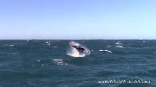
Breaching Humpback | Dyer Island Cruises
Dyer Island is home to one of the broadest arrays of marine wildlife ...
Dyer Island is home to one of the broadest arrays of marine wildlife species in South Africa, and with Dyer Island Cruises there's a ...
Dyer Island Conservation Trust - Discover, Protect, Educate
Dyer Island Conservation Trust is a registered non-profit organisation ...
Dyer Island Conservation Trust is a registered non-profit organisation based in Gansbaai, South Africa. Established in 2006 by ...
Xplorio™ Gansbaai - Dyer Island Cruises Whale & Marine Big 5 Eco Tours -
Opportunity to see whales, sharks, dolphins, penguins and seals all in ...
Opportunity to see whales, sharks, dolphins, penguins and seals all in one trip. This is only possible around the world-renowned, ...
How many great white sharks are in Gansbaai, South Africa? | Dyer Island Conservation Trust
Xplorio™ Gansbaai - Dyer Island Cruises Whale & Marine Big 5 Eco Tours - Next Tour: 19 April 2023
Spoil your family or loved one with an exhilarating Marine Big 5 ...
Spoil your family or loved one with an exhilarating Marine Big 5 adventure around the Dyer Island Ecosystem.
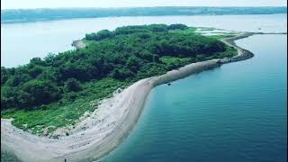
Dyer Island - Rhode Island July 2021 | #aerial #view #dyer
This is aerial footage of Dyer Island near Portsmouth, Rhode Island ...
This is aerial footage of Dyer Island near Portsmouth, Rhode Island using Mavic Air 2s. #ri #rhodeisland #island #views.
Tagging and tracking Great White sharks around the Dyer Island ecosystem
This week's live #ScienceSavesSharks session will see Dickie Chivell ...
This week's live #ScienceSavesSharks session will see Dickie Chivell interviewing Dyer Island Conservation Trust biologist, ...
Grootbos | Marine Big 5 at Dyer Island
Xplorio™ Gansbaai - Dyer Island Cruises - Next Dyer Island Marine Big 5 Tour: 21 September 2022
Join us and spoil your family or loved one with an exhilarating Marine ...
Join us and spoil your family or loved one with an exhilarating Marine Big 5 adventure around the Dyer Island Ecosystem.
Dead great white shark retrieved from Dyer Island, Gansbaai | Dyer Island Conservation Trust
Wednesday 18.06.2012 Cage diving operators alerted Wilfred Chivell ...
Wednesday 18.06.2012 Cage diving operators alerted Wilfred Chivell (Dyer Island Conservation Trust -
http://www.dict.org.za) to a ...
LEGO NINJAGO | Season 2 Episode 2: Dyer Island
When the ninja connect Jay's disappearance to Prime Empire, they set ...
When the ninja connect Jay's disappearance to Prime Empire, they set out to Dyer Island to seek answers from the game's ...
South Africa is classified as Emerging region: G20: Group of Twenty – Major economies comprising both developed and emerging countries, representing the world’s largest economies. The level of income is Upper middle income.
News – Latest Updates and Headlines from Dyer Island
Stay informed with the most recent news and important headlines from Dyer Island. Here’s a roundup of the latest developments.
Loading...
Please note: The data used here has been primarily extracted from satellite readings. Deviations from exact values may occur, particularly regarding the height of elevations and population density. Land area and coastline measurements refer to average values at mean high tide.