Motutapu
Welcome to Motutapu, a Temperate island in the South Pacific Ocean, part of the majestic Pacific Ocean. This guide offers a comprehensive overview of what makes Motutapu unique – from its geography and climate to its population, infrastructure, and beyond. Dive into the details:
- Geography and Size: Explore the island’s size and location.
- Climate and Weather: Weather patterns and temperature.
- Topography and Nature: Uncover the natural wonders of the island.
- Infrastructure and Travelling: Insights on reaching, staying, and making the most of your visit.
- News and Headlines: Latest News.
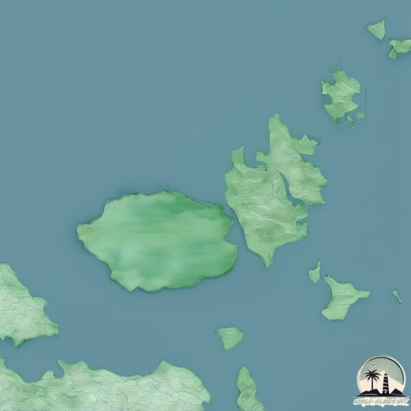
Geography and size of Motutapu
Size: 40 km²
Coastline: 54.9 km
Ocean: Pacific Ocean
Sea: South Pacific Ocean
Continent: Oceania
Motutapu is a Medium Island spanning 40 km² with a coastline of 55 km.
Archipel: Polynesia – A region of more than 1,000 islands in the central and southern Pacific Ocean, known for their diverse Polynesian cultures, stunning landscapes, and marine biodiversity.
Tectonic Plate: Australia – A major tectonic plate covering Australia, New Zealand, and parts of the Indian and Pacific Oceans, known for its relative stability and occasional seismic activity.
The geographic heart of the island is pinpointed at these coordinates:
Latitude: -36.77742745 / Longitude: 174.88442365
Climate and weather of Motutapu
Climate Zone: Temperate
Climate Details: Temperate Oceanic Climate
Temperature: Warm Summer
Climate Characteristics: Known for its moderate year-round temperatures with ample rainfall and no dry season. Warm summers are characteristic.
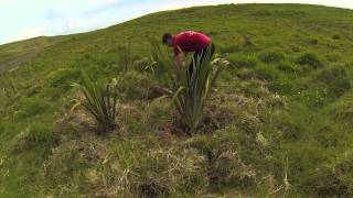
Topography and nature of Motutapu
Timezone: UTC+12:00
Timezone places: Pacific/Auckland
Max. Elevation: 167 m
Mean Elevation: 49 m
Vegetation: Evergreen Broadleaf Forest
Tree Coverage: 62%
The mean elevation is 49 m. The highest elevation on the island reaches approximately 167 meters above sea level. The island is characterized by Plains: Flat, low-lying lands characterized by a maximum elevation of up to 200 meters. On islands, plains are typically coastal lowlands or central flat areas.
Dominating Vegetation: Evergreen Broadleaf Forest
Characterized by dense, lush canopies of broadleaf trees that retain their leaves year-round. These forests are typically found in tropical and subtropical regions and are known for their high biodiversity. Motutapu has a tree cover of 62 %.
Vegetation: 7 vegetation zones – Very Highly Diverse Island
Islands in this range are ecological powerhouses, showcasing a wide array of vegetation zones. Each zone, from lush rainforests to arid scrublands, coastal mangroves to mountainous regions, contributes to a complex and interdependent ecosystem. These islands are often hotspots of biodiversity, supporting numerous species and intricate ecological processes.
Infrastructure and Travelling to Motutapu
Does the island have a public airport? no.
There is no public and scheduled airport on Motutapu. The nearest airport is Auckland International Airport, located 24 km away.
Does the island have a major port? no.
There are no major ports on Motutapu. The closest major port is AUCKLAND, approximately 9 km away.
The mean population of Motutapu is 1 per km². Motutapu is Gently Populated. The island belongs to New Zealand.
Continuing your journey, Waiheke is the next notable island, situated merely km away.
Motutapu Island Part ll


New Zealand is classified as Developed region: G7: Group of Seven – Major advanced economies, including Canada, France, Germany, Italy, Japan, the United Kingdom, and the United States. The level of income is High income: OECD.
News – Latest Updates and Headlines from Motutapu
Stay informed with the most recent news and important headlines from Motutapu. Here’s a roundup of the latest developments.
Please note: The data used here has been primarily extracted from satellite readings. Deviations from exact values may occur, particularly regarding the height of elevations and population density. Land area and coastline measurements refer to average values at mean high tide.