Zembra
Welcome to Zembra, a Temperate island in the Mediterranean Sea – Western Basin, part of the majestic Atlantic Ocean. This guide offers a comprehensive overview of what makes Zembra unique – from its geography and climate to its population, infrastructure, and beyond. Dive into the details:
- Geography and Size: Explore the island’s size and location.
- Climate and Weather: Weather patterns and temperature.
- Topography and Nature: Uncover the natural wonders of the island.
- Infrastructure and Travelling: Insights on reaching, staying, and making the most of your visit.
- News and Headlines: Latest News.
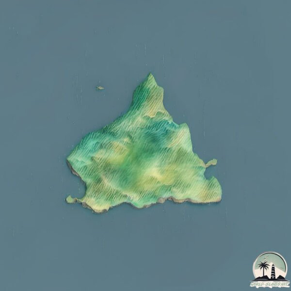
Geography and size of Zembra
Size: 4.049 km²
Coastline: 10.5 km
Ocean: Atlantic Ocean
Sea: Mediterranean Sea – Western Basin
Continent: Africa
Zembra is a Small Island spanning 4 km² with a coastline of 10.5 km.
Archipel: –
Tectonic Plate: Aegean Sea – Located in the eastern Mediterranean, this microplate is characterized by seismic and volcanic activity due to its interaction with the Eurasian and African Plates.
The geographic heart of the island is pinpointed at these coordinates:
Latitude: 37.12571823 / Longitude: 10.80487749
Climate and weather of Zembra
Climate Zone: Temperate
Climate Details: Hot-Summer Mediterranean Climate
Temperature: Hot Summer
Climate Characteristics: Characterized by hot, dry summers and mild, wet winters, typical of coastal areas with abundant sunshine.
Topography and nature of Zembra
Timezone: UTC+01:00
Timezone places: Europe/Paris
Max. Elevation: 289 m
Mean Elevation: 137 m
Vegetation: Evergreen Broadleaf Forest
Tree Coverage: 51%
The mean elevation is 137 m. The highest elevation on the island reaches approximately 289 meters above sea level. The island is characterized by Hills: Gently sloping landforms with rounded tops, having a maximum elevation between 200 and 500 meters. Hills contribute to a varied landscape on islands.
Dominating Vegetation: Evergreen Broadleaf Forest
Characterized by dense, lush canopies of broadleaf trees that retain their leaves year-round. These forests are typically found in tropical and subtropical regions and are known for their high biodiversity. Zembra has a tree cover of 51 %.
Vegetation: 5 vegetation zones – Highly Diverse Island
With five different vegetation zones, these islands offer a rich tapestry of ecosystems. The variety could include dense forests, open meadows, wetlands, coastal zones, and more. This level of diversity supports an intricate web of life, with each zone playing a vital role in the overall ecological health and balance of the island.
Infrastructure and Travelling to Zembra
Does the island have a public airport? no.
There is no public and scheduled airport on Zembra. The nearest airport is Tunis Carthage International Airport, located 69 km away.
Does the island have a major port? no.
There are no major ports on Zembra. The closest major port is RADES, approximately 64 km away.
The mean population of Zembra is 124 per km². Zembra is Moderately Inhabited. The island belongs to Italy.
Continuing your journey, Isola di Pantelleria is the next notable island, situated merely km away.
Discovering the Untouched Beauty of Zembra & Zembretta Islands | A Mesmerizing Drone Documentary 🌴🌊


Italy is classified as Developed region: G7: Group of Seven – Major advanced economies, including Canada, France, Germany, Italy, Japan, the United Kingdom, and the United States. The level of income is High income: OECD.
News – Latest Updates and Headlines from Zembra
Stay informed with the most recent news and important headlines from Zembra. Here’s a roundup of the latest developments.
Please note: The data used here has been primarily extracted from satellite readings. Deviations from exact values may occur, particularly regarding the height of elevations and population density. Land area and coastline measurements refer to average values at mean high tide.