Baranof
Welcome to Baranof, a Continental island in the The Coastal Waters of Southeast Alaska and British Columbia, part of the majestic Pacific Ocean. This guide offers a comprehensive overview of what makes Baranof unique – from its geography and climate to its population, infrastructure, and beyond. Dive into the details:
- Geography and Size: Explore the island’s size and location.
- Climate and Weather: Weather patterns and temperature.
- Topography and Nature: Uncover the natural wonders of the island.
- Infrastructure and Travelling: Insights on reaching, staying, and making the most of your visit.
- News and Headlines: Latest News.
Geography and size of Baranof
Size: 4225 km²
Coastline: 2236 km
Ocean: Pacific Ocean
Sea: The Coastal Waters of Southeast Alaska and British Columbia
Continent: North America
Baranof is a Very Large Island spanning 4225 km² with a coastline of 2236 km.
Archipel: Alexander Archipelago – A group of about 1,100 islands off the southeast coast of Alaska, USA, known for their temperate rainforests and indigenous Tlingit culture.
Tectonic Plate: North America – Covers North America and parts of the Atlantic and Arctic Oceans, characterized by diverse geological features and varying levels of seismic activity.
The geographic heart of the island is pinpointed at these coordinates:
Latitude: 56.95845177 / Longitude: -135.04613273
Climate and weather of Baranof
Climate Zone: Continental
Climate Details: Subarctic Climate
Temperature: Cold Summer
Climate Characteristics: Characterized by long, extremely cold winters and short, cool summers, often found in northern latitudes of North America and Eurasia.
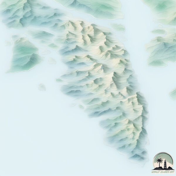
Topography and nature of Baranof
Timezone: UTC-09:00
Timezone places: America/Anchorage
Max. Elevation: 1643 m Baranof Is. HP
Mean Elevation: 417 m
Vegetation: Mixed Forest
Tree Coverage: 44%
The mean elevation is 417 m. Dominating the island’s landscape, the majestic “Baranof Is. HP” rises as the highest peak, soaring to impressive heights. The island is characterized by Mountains: High, steeply elevated landforms. Characterized by both a high maximum elevation (over 500 meters) and a high mean elevation, creating rugged, mountainous terrains on islands.
Dominating Vegetation: Mixed Forest
A combination of both deciduous and evergreen trees, often found in transitional zones between forest types. These forests offer a diverse habitat for various wildlife species. Baranof has a tree cover of 44 %.
Vegetation: 13 vegetation zones – Exceptionally Diverse Island
Islands with more than ten vegetation zones are among the most ecologically rich and varied in the world. These islands are akin to miniature continents, boasting an incredible array of ecosystems. The sheer range of habitats, from high peaks to deep valleys, rainforests to deserts, creates a mosaic of life that is unparalleled. They are crucial for conservation and ecological studies.
Infrastructure and Travelling to Baranof
Does the island have a public airport? no.
There is no public and scheduled airport on Baranof. The nearest airport is Sitka Rocky Gutierrez Airport, located 1 km away.
Does the island have a major port? yes.
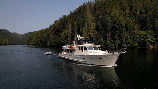
Baranof is home to a major port. The following ports are situated on the island: BIG PORT WALTER, PORT ARMSTRONG, PORT CONCLUSION, PORT ALEXANDER, SITKA.
The mean population of Baranof is 2 per km². Baranof is Gently Populated. The island belongs to United States of America.
Continuing your journey, Halleck is the next notable island, situated merely km away.
Reflections Seven. Baranof Island - West & East Coasts. SE Alaska


United States of America is classified as Developed region: G7: Group of Seven – Major advanced economies, including Canada, France, Germany, Italy, Japan, the United Kingdom, and the United States. The level of income is High income: OECD.
News – Latest Updates and Headlines from Baranof
Stay informed with the most recent news and important headlines from Baranof. Here’s a roundup of the latest developments.
Social Media Posts about Baranof
Please note: The data used here has been primarily extracted from satellite readings. Deviations from exact values may occur, particularly regarding the height of elevations and population density. Land area and coastline measurements refer to average values at mean high tide.