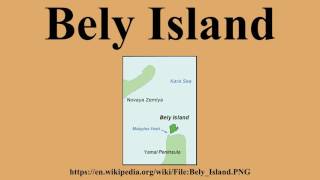
Bely
Welcome to Bely, a Polar island in the Kara Sea, part of the majestic Arctic Ocean. This guide offers a comprehensive overview of what makes Bely unique – from its geography and climate to its population, infrastructure, and beyond. Dive into the details:
- Geography and Size: Explore the island’s size and location.
- Climate and Weather: Weather patterns and temperature.
- Topography and Nature: Uncover the natural wonders of the island.
- Infrastructure and Travelling: Insights on reaching, staying, and making the most of your visit.
- News and Headlines: Latest News.
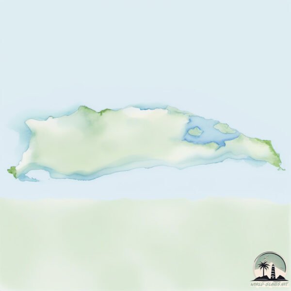
Geography and size of Bely
Size: 1800 km²
Coastline: 725 km
Ocean: Arctic Ocean
Sea: Kara Sea
Continent: Asia
Bely is a Very Large Island spanning 1800 km² with a coastline of 725 km.
Archipel: –
Tectonic Plate: North America – Covers North America and parts of the Atlantic and Arctic Oceans, characterized by diverse geological features and varying levels of seismic activity.
The geographic heart of the island is pinpointed at these coordinates:
Latitude: 73.24337286 / Longitude: 70.67592486
Climate and weather of Bely
Climate Zone: Polar
Climate Details: Tundra
Temperature: Cold
Climate Characteristics: The tundra climate features long, extremely cold winters and short, cool summers. Vegetation is limited to mosses, lichens, and small shrubs due to the low temperatures and short growing seasons. Biodiversity is low, but some specialized species thrive.
Topography and nature of Bely
Timezone: UTC+06:00
Timezone places: Asia/Almaty
Max. Elevation: 2 m
Mean Elevation: -2 m
Vegetation: Herbaceous Cover
Tree Coverage: 24%
The mean elevation is -2 m. The highest elevation on the island reaches approximately 2 meters above sea level. The island is characterized by Plains: Flat, low-lying lands characterized by a maximum elevation of up to 200 meters. On islands, plains are typically coastal lowlands or central flat areas.
Dominating Vegetation: Herbaceous Cover
Comprising mainly of grasses, herbs, and ferns, these areas are common in prairies, meadows, and savannas, and can vary widely in species composition. Bely has a tree cover of 24 %.
Vegetation: 5 vegetation zones – Highly Diverse Island
With five different vegetation zones, these islands offer a rich tapestry of ecosystems. The variety could include dense forests, open meadows, wetlands, coastal zones, and more. This level of diversity supports an intricate web of life, with each zone playing a vital role in the overall ecological health and balance of the island.
Infrastructure and Travelling to Bely
Does the island have a public airport? no.
There is no public and scheduled airport on Bely. The nearest airport is Sabetta International Airport, located 219 km away.
Does the island have a major port? no.
There are no major ports on Bely. The closest major port is PORT DIKSON, approximately 983 km away.
The mean population of Bely is 1 per km². Bely is Uninhabited. The island belongs to Russia.
The name of the island resonates across different cultures and languages. Here is how it is known around the world: Arabic: بيلي; German: Bely; Spanish: Isla de Bely; French: Bely; Portuguese: Ilha Belyi; Russian: Белый; Chinese: 別雷島
Continuing your journey, Bezymyannyy is the next notable island, situated merely km away.
Over the weather station on Bely Island, Siberia


Russia is classified as Emerging region: BRIC: Brazil, Russia, India, and China – Economies noted for their rapid growth and increasing influence on global affairs. The level of income is Upper middle income.
News – Latest Updates and Headlines from Bely
Stay informed with the most recent news and important headlines from Bely. Here’s a roundup of the latest developments.
Social Media Posts about Bely
Please note: The data used here has been primarily extracted from satellite readings. Deviations from exact values may occur, particularly regarding the height of elevations and population density. Land area and coastline measurements refer to average values at mean high tide.