Welcome to Enrique, a Temperate island in the South Pacific Ocean, part of the majestic Pacific Ocean. This guide offers a comprehensive overview of what makes Enrique unique – from its geography and climate to its population, infrastructure, and beyond. Dive into the details:
Geography and size of Enrique
Size: 13.3 km²
Coastline: 35.2 km
Ocean: Pacific Ocean
Sea: South Pacific Ocean
Continent: South America
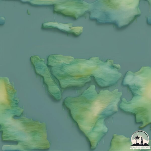
Enrique is a Medium Island spanning 13 km² with a coastline of 35 km.
Archipel: –
Tectonic Plate: South America – A major plate covering the South American continent and part of the Atlantic Ocean, known for the Andes mountain range and significant seismic and volcanic activity.
The geographic heart of the island is pinpointed at these coordinates:
Latitude: -44.31518942 / Longitude: -73.12788253
Climate and weather of Enrique
Climate Zone: Temperate
Climate Details: Temperate Oceanic Climate
Temperature: Warm Summer
Climate Characteristics: Known for its moderate year-round temperatures with ample rainfall and no dry season. Warm summers are characteristic.
Topography and nature of Enrique
Timezone: UTC-04:00
Timezone places: America/La_Paz
Max. Elevation: 361 m
Mean Elevation: 148 m
Vegetation: Evergreen Broadleaf Forest
Tree Coverage: 98%
The mean elevation is 148 m. The highest elevation on the island reaches approximately 361 meters above sea level. The island is characterized by Hills: Gently sloping landforms with rounded tops, having a maximum elevation between 200 and 500 meters. Hills contribute to a varied landscape on islands.
Dominating Vegetation: Evergreen Broadleaf Forest
Characterized by dense, lush canopies of broadleaf trees that retain their leaves year-round. These forests are typically found in tropical and subtropical regions and are known for their high biodiversity. Enrique has a tree cover of 98 %.
Vegetation: 3 vegetation zones – Moderately Diverse Island
These islands start to show a broader range of ecological niches. With three vegetation zones, they may offer a mix of ecosystems like coastal areas, inland woods, and perhaps a distinct wetland or dry area. This diversity supports a wider range of flora and fauna, making these islands more ecologically complex than those with minimal diversity.
Infrastructure and Travelling to Enrique
Does the island have a public airport? no.
There is no public and scheduled airport on Enrique. The nearest airport is Mocopulli Airport, located 226 km away.
Does the island have a major port? no.
There are no major ports on Enrique. The closest major port is PUERTO CHACABUCO, approximately 130 km away.
The mean population of Enrique is 0 per km². Enrique is Uninhabited. The island belongs to Chile.
Continuing your journey, Manuel is the next notable island, situated merely km away.
Enrique Iglesias - Rhythm Divine
NEW SONG - ESPACIO EN TU CORAZON Remix with Ana Mena ...
Enrique Iglesias - Rhythm Divine (Lyrics)
Enrique Iglesias - Rhythm Divine (Lyrics) Spotify Playlist : ...
Enrique Iglesias, Yotuel - Fría (Official Video)
Enrique Iglesias & Yotuel- Fría (Official Video) Music: Apple Music: ...
Rhythm Divine - Enrique Iglesias
Lyrics From the coast of Ipanema To the Island of Capri All the way to ...
Lyrics From the coast of Ipanema To the Island of Capri All the way to Guadeloupe I will follow you wherever you may be From the ...
Elizma Theron, Ray Dylan - Islands in the Stream
Music video by Elizma Theron, Ray Dylan performing Islands in the ...
Music video by Elizma Theron, Ray Dylan performing Islands in the Stream.(P) 2016 SME Africa (Pty) Ltd.
ENRIQUE - THE ISLAND
ENRIQUE - THE ISLAND (VIDEO OFFICIAL) | ELECTRONICA MIXTAPE 3 ...
ENRIQUE - THE ISLAND (VIDEO OFFICIAL) | ELECTRONICA MIXTAPE 3 Suscríbete Al canal de Enrique: ...
Maine Royaan x Somebody's Me (JAZ Scape Mashup) • Tanveer Evan • Enrique Iglesias
Tanveer Evan x Enrique Iglesias Jazscape Edit . Video :- Upreverb .
Tanveer Evan x Enrique Iglesias Jazscape Edit . Video :- Upreverb .
Enrique Iglesias - Live at The Isle Of MTV Malta (2014 HD 1080p)
NEW SONG - MOVE TO MIAMI feat. Pitbull (Click "SHOW MORE" below) Watch ...
ENRIQUE GIL EYES NEVER LIES 💔 #enriquegil #lizasoberano
Enrique Iglesias - Heart Attack (Official Music Video)
Official Music Video for Enrique Iglesias - Heart Attack. Listen to ...
Official Music Video for Enrique Iglesias - Heart Attack. Listen to Enrique's album Final Vol.1 on: YouTube: ...
Hero (Enrique Iglesias Cover by Walumah) 2023 Fresh Island Reggae Music 🎶
Prodz by Walumah @ Underground Records KBS STB M u Chol ya.
Prodz by Walumah @ Underground Records KBS STB M u Chol ya.
Enrique Iglesias - I Like It (Jersey Shore Version) ft. Pitbull
Official Music Video for Enrique Iglesias - I Like It (Jersey Shore ...
Official Music Video for Enrique Iglesias - I Like It (Jersey Shore Version) ft. Pitbull. Listen to Enrique's album Final Vol.1 on: ...
Asi Es La Vida - Enrique Iglesias & Maria Becerra Nueva Bachata Dance [Ataca x Alemana]
🔥 Andrea y Enrique: NUEVA PAREJA que desata el CAOS en La Isla de las Tentaciones 9 💥😱
En este vídeo te muestro cómo Andrea y Enrique: la nueva pareja que ...
En este vídeo te muestro cómo Andrea y Enrique: la nueva pareja que desata el caos en La Isla de las Tentaciones llega a la villa ...
On an island - Enrique el Mozambique (ensayo)
Cover de David Gilmour tocado en un ensayo. Nicolas Coria Nogueira: ...
Cover de David Gilmour tocado en un ensayo. Nicolas Coria Nogueira: Voz y guitarra acústica Juan Manuel Ledo: Teclados ...
#pov through a game of truth or dare I show you your boyfriends true colors…#shorts
Why Not Me (Enrique Iglesias) sung by the kids of Mararison Island
See Experience Mararison Island, a travel guide post at ...
See Experience Mararison Island, a travel guide post at readsstock.wordpress.com.
25. El Perdón (Forgiveness) - Nicky Jam & Enrique Iglesias | Official Vídeo
25. El Perdón (Forgiveness) - Nicky Jam & Enrique Iglesias | Official ...
25. El Perdón (Forgiveness) - Nicky Jam & Enrique Iglesias | Official Vídeo @NickyJamTV ® © 2015 Mira mi nuevo video ...
Enrique Resort in Mararison Island #beachvibes #discoverantique
Enrique/ Lonely Shepherd/ 9/ 1/2025/ Coney Island/ NYC
Enrique/ Lonely Shepherd/ 9/ 1/2025/ Coney Island/ NYC.
Enrique/ Lonely Shepherd/ 9/ 1/2025/ Coney Island/ NYC.
Enrique Iglesias - Rhythm Divine (Live in Florida 1999)
Live performance of "Rhythm Divine" by Enrique Iglesias (Florida ...
Live performance of "Rhythm Divine" by Enrique Iglesias (Florida 1999). The song is from the album "Enrique", 1999.
Enrique Was a Native of Moluccas Island
Helmy Yahya, author of Enrique Maluku, wrote a book based on ...
Helmy Yahya, author of Enrique Maluku, wrote a book based on Maximillianus Transylvanus's Victoria's survivors interviews.
#pov we play truth or dare at a party…#shorts
Rhythm Divine | Cover by - Anukriti @EnriqueIglesias
If you like my singing | please Like / Share & Subscribe also follow ...
Survival Island#4k
Survival Island#4k Subscribe to the Balles Media: YouTube Channel for ...
Survival Island#4k Subscribe to the Balles Media: YouTube Channel for the latest movie trailers, clips, and more: ...
Chile is classified as Emerging region: G20: Group of Twenty – Major economies comprising both developed and emerging countries, representing the world’s largest economies. The level of income is Upper middle income.
News – Latest Updates and Headlines from Enrique
Stay informed with the most recent news and important headlines from Enrique. Here’s a roundup of the latest developments.
Loading...
Please note: The data used here has been primarily extracted from satellite readings. Deviations from exact values may occur, particularly regarding the height of elevations and population density. Land area and coastline measurements refer to average values at mean high tide.


![Asi Es La Vida - Enrique Iglesias & Maria Becerra Nueva Bachata Dance [Ataca x Alemana]](https://i.ytimg.com/vi/e-f_QOMO7Pw/mqdefault.jpg)


