Welcome to Frazier Island, a Continental island in the Hudson Bay, part of the majestic Arctic Ocean. This guide offers a comprehensive overview of what makes Frazier Island unique – from its geography and climate to its population, infrastructure, and beyond. Dive into the details:
Geography and size of Frazier Island
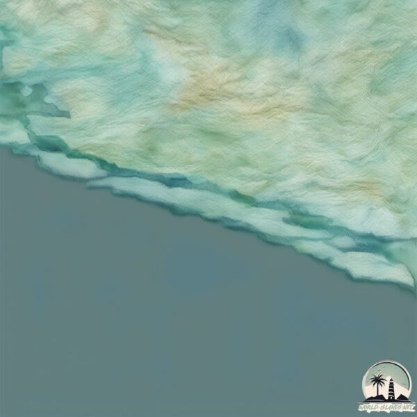
Size: 22.3 km²
Coastline: 42.8 km
Ocean: Arctic Ocean
Sea: Hudson Bay
Continent: North America
Frazier Island is a Medium Island spanning 22 km² with a coastline of 43 km.
Archipel: –
Tectonic Plate: North America – Covers North America and parts of the Atlantic and Arctic Oceans, characterized by diverse geological features and varying levels of seismic activity.
The geographic heart of the island is pinpointed at these coordinates:
Latitude: 58.3037822 / Longitude: -77.88417766
Climate and weather of Frazier Island
Climate Zone: Continental
Climate Details: Dry-Summer Subarctic Climate
Temperature: Cold Summer
Climate Characteristics: Short, mild summers with significantly less moisture, and prolonged cold periods. Found in northern, inland regions.
Topography and nature of Frazier Island
Timezone: UTC-05:00
Timezone places: America/New_York
Max. Elevation: 55 m
Mean Elevation: 21 m
Vegetation: Herbaceous Cover
Tree Coverage: 23%
The mean elevation is 21 m. The highest elevation on the island reaches approximately 55 meters above sea level. The island is characterized by Plains: Flat, low-lying lands characterized by a maximum elevation of up to 200 meters. On islands, plains are typically coastal lowlands or central flat areas.
Dominating Vegetation: Herbaceous Cover
Comprising mainly of grasses, herbs, and ferns, these areas are common in prairies, meadows, and savannas, and can vary widely in species composition. Frazier Island has a tree cover of 23 %.
Vegetation: 5 vegetation zones – Highly Diverse Island
With five different vegetation zones, these islands offer a rich tapestry of ecosystems. The variety could include dense forests, open meadows, wetlands, coastal zones, and more. This level of diversity supports an intricate web of life, with each zone playing a vital role in the overall ecological health and balance of the island.
Infrastructure and Travelling to Frazier Island
Does the island have a public airport? no.
There is no public and scheduled airport on Frazier Island. The nearest airport is Inukjuak Airport, located 18 km away.
Does the island have a major port? no.
There are no major ports on Frazier Island. The closest major port is CHICOUTIMI (PORT SAGUENAY), approximately 1323 km away.
The mean population of Frazier Island is 0 per km². Frazier Island is Uninhabited. The island belongs to Canada.
Continuing your journey, Leonard is the next notable island, situated merely km away.
Must-do experiences on K'gari (Formerly Fraser Island)
Here are the best things to do on K'Gari (Fraser Island) in Queensland. 1. Cool off at Lake Mckenzie 2. Float down Eli Creek 3.Must-do experiences on K'gari (Formerly Fraser Island)
Here are the best things to do on K'Gari (Fraser Island) in ...
Here are the best things to do on K'Gari (Fraser Island) in Queensland. 1. Cool off at Lake Mckenzie 2. Float down Eli Creek 3.
Steve Irwin Explores Isolated Fraser Island | The Crocodile Hunter | Animal Planet
Fraser Island is the largest sand island in the world. Off mainland ...
Fraser Island is the largest sand island in the world. Off mainland Australia, the island has beaches, rainforests and a variety of ...
Australia Nature Documentary 4K | K’gari (Fraser Island) | Wildlife and Natural History
Off Queensland's eastern coast, 250km North of Brisbane is the island ...
Off Queensland's eastern coast, 250km North of Brisbane is the island of K'Gari (formerly Fraser Island), the largest sand island on ...
FRASER ISLAND MADNESS! MARLIN caught 50m off the beach + BEST BEACH CAMP IN AUS! 4WD24/7 on K'Gari
The boys have hit the sand! Join Shaun, Graham and the crew as we ...
The boys have hit the sand! Join Shaun, Graham and the crew as we tackle the WORLD'S LARGEST SAND ISLAND…..with a ...
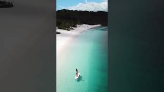
Fraser Island in 4K | Queensland | Australia Nature
A 4K cinematic tour of the world's largest sand island Fraser Island ...
A 4K cinematic tour of the world's largest sand island Fraser Island K'Gari located in Queensland Australia. Fraser Island is ...
Kingfisher Bay Resort | K'gari (Fraser Island)
World Heritage-listed K'gari (Fraser Island) untamed wilderness and ...
World Heritage-listed K'gari (Fraser Island) untamed wilderness and rugged, natural charm entices from the first, providing 4WD ...
Tourists bitten in string of dingo attacks on K'gari (Fraser Island) | ABC News
A 10-year-old boy has been attacked and dragged under water by a dingo ...
A 10-year-old boy has been attacked and dragged under water by a dingo on K'gari (Fraser Island) less than two weeks after ...
K'GARI, Australia: Travel GUIDE to Fraser Island, the MOST UNIQUE Sand Island in the WORLD in 4K
Welcome to K'gari (Fraser Island), formerly known as Fraser Island — ...
Welcome to K'gari (Fraser Island), formerly known as Fraser Island — the world's largest sand island and one of the absolute ...
Fraser Island Beauty Meets Danger on Australia's Sand Island
Top 10 Most Dangerous Places On Earth watch the full video on our ...
Top 10 Most Dangerous Places On Earth watch the full video on our channel @TheRealGlobalTourist #travel #tourism.
Fraser Island travel guide: showing you 3 different tours
Join me in this exciting video as I adventure through Fraser Island, ...
Join me in this exciting video as I adventure through Fraser Island, also known as K'Gari, Australia's natural paradise. If you're ...
The BEST things to DO on K'GARI (Fraser Island) - The World's Largest Sand Island
Hey friends, Max and Em here again! Join us in this video as we chat ...
Hey friends, Max and Em here again! Join us in this video as we chat about The BEST things to DO on K'GARI (Fraser Island) ...
7 things to see and do at K’gari Fraser Island #visitaustralia #camping #4x4 #touristattraction
Is K'GARI (Fraser Island) worth it?
Fraser Island, offically renamed to K'gari has been rinsed online for ...
Fraser Island, offically renamed to K'gari has been rinsed online for years and years and the big debate of what's better... Fraser or ...
ONE week in 4x4 PARADISE. Fraser Island K'gari
This week on Aussie Arvos we explore the 4x4 Paradise known Fraser ...
This week on Aussie Arvos we explore the 4x4 Paradise known Fraser Island (K'Gari) T-SHIRTS & HOODIES AVAILABLE NOW!
Kingfisher Bay Resort K'gari (Fraser Island) | Full Resort Tour + Lake McKenzie
Welcome to Kingfisher Bay Resort Fraser Island (K'gari)! This is a ...
Welcome to Kingfisher Bay Resort Fraser Island (K'gari)! This is a full Kingfisher Bay Resort tour and a walk-through video for ...
We’re on the LARGEST SAND ISLAND in the World! Fraser Island (K'gari) in Winter
This week, we board the Manta Ray Barge and take the Dmax across to ...
This week, we board the Manta Ray Barge and take the Dmax across to the largest sand-island in the world, K'gari, or as it's more ...
Trailer boat fishing Hervey Bay’s Wathumba Creek to Rooney Point on magnificent Fraser Island!
Join me on a four day fishing trip doing one of my favourite things, ...
Join me on a four day fishing trip doing one of my favourite things, chasing juvenile Black Marlin on my own boat around beautiful ...
FRASER ISLAND AT ITS BEST! Shauno's 200 vs Graham's Y62 - insane tailor fishing & Ngkala Rocks fails
Graham & Shauno are BACK for an adventure on an island that leads to ...
Graham & Shauno are BACK for an adventure on an island that leads to more bucketlist plans, weekend shed build & Friday ...
The best things to do on Fraser Island!
The Best Things to do on Fraser Island. Lake McKenzie, Eli Creek, ...
The Best Things to do on Fraser Island. Lake McKenzie, Eli Creek, Champagne Pools and so much more!
You haven't seen Fraser Island like this before...
What started out as a weekend with mates - turned to chaos overnight. ...
What started out as a weekend with mates - turned to chaos overnight. Cyclone Oma threatened QLD's coastline early 2019 - and ...
TOP 10 FRASER ISLAND Best Hotels | Accommodations
Best hotels in Fraser Island Hotels in Fraser Island: ...
5 Reasons to Visit Fraser Island #roadtrip #australia #fraserisland #travel #exploreaustralia
Why You Need to Visit Fraser Island 0:03 - Lake McKenzie 0:04 - Eli ...
Why You Need to Visit Fraser Island 0:03 - Lake McKenzie 0:04 - Eli Creek 0:06 - S.S. Maheno 0:09 - Driving on sand 0:10 ...
Exploring Fraser Island by 4WD (K'Gari)
In this episode we head over to Fraser Island for a week of 4WDing, ...
In this episode we head over to Fraser Island for a week of 4WDing, camping & exploring. Checking out all the best spots this ...
The Ultimate Guide to K’gari (Fraser Island)
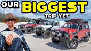
We've hit K'gari (formerly Fraser Island) with a fully loaded 4WD, a ...
We've hit K'gari (formerly Fraser Island) with a fully loaded 4WD, a stash of fishing gear and enough ice to chill a small brewery.
Fraser Islands MOST remote Camps
We are on a mission to show Harry Fisher the most remote sections of ...
We are on a mission to show Harry Fisher the most remote sections of Kgari Island (FRASER) in this epic family trip !
https://www.
Canada is classified as Developed region: G7: Group of Seven – Major advanced economies, including Canada, France, Germany, Italy, Japan, the United Kingdom, and the United States. The level of income is High income: OECD.
News – Latest Updates and Headlines from Frazier Island
Stay informed with the most recent news and important headlines from Frazier Island. Here’s a roundup of the latest developments.
Loading...
Please note: The data used here has been primarily extracted from satellite readings. Deviations from exact values may occur, particularly regarding the height of elevations and population density. Land area and coastline measurements refer to average values at mean high tide.