Holm of Mel
Welcome to Holm of Mel, a Temperate island in the North Sea, part of the majestic Atlantic Ocean. This guide offers a comprehensive overview of what makes Holm of Mel unique – from its geography and climate to its population, infrastructure, and beyond. Dive into the details:
- Geography and Size: Explore the island’s size and location.
- Climate and Weather: Weather patterns and temperature.
- Topography and Nature: Uncover the natural wonders of the island.
- Infrastructure and Travelling: Insights on reaching, staying, and making the most of your visit.
- News and Headlines: Latest News.
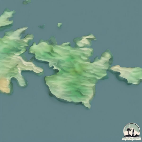
Geography and size of Holm of Mel
Size: 28.3 km²
Coastline: 40 km
Ocean: Atlantic Ocean
Sea: North Sea
Continent: Europe
Holm of Mel is a Medium Island spanning 28 km² with a coastline of 40 km.
Archipel: Shetland Islands – Located northeast of mainland Scotland, these islands are known for their rugged terrain, unique cultural heritage, and abundant birdlife.
Tectonic Plate: North America – Covers North America and parts of the Atlantic and Arctic Oceans, characterized by diverse geological features and varying levels of seismic activity.
The geographic heart of the island is pinpointed at these coordinates:
Latitude: 60.14865932 / Longitude: -1.09332261
Climate and weather of Holm of Mel
Climate Zone: Temperate
Climate Details: Temperate Oceanic Climate
Temperature: Warm Summer
Climate Characteristics: Known for its moderate year-round temperatures with ample rainfall and no dry season. Warm summers are characteristic.
Topography and nature of Holm of Mel
Timezone: UTC±00:00
Timezone places: Europe/London
Max. Elevation: 216 m
Mean Elevation: 99 m
Vegetation: Open Woodland
Tree Coverage: 61%
The mean elevation is 99 m. The highest elevation on the island reaches approximately 216 meters above sea level. The island is characterized by Hills: Gently sloping landforms with rounded tops, having a maximum elevation between 200 and 500 meters. Hills contribute to a varied landscape on islands.
Dominating Vegetation: Open Woodland
Characterized by sparsely distributed trees with open canopy allowing sunlight to penetrate, supporting grasses and shrubs underneath. Often found in drier or transitional environments. Holm of Mel has a tree cover of 61 %.
Vegetation: 13 vegetation zones – Exceptionally Diverse Island
Islands with more than ten vegetation zones are among the most ecologically rich and varied in the world. These islands are akin to miniature continents, boasting an incredible array of ecosystems. The sheer range of habitats, from high peaks to deep valleys, rainforests to deserts, creates a mosaic of life that is unparalleled. They are crucial for conservation and ecological studies.
Infrastructure and Travelling to Holm of Mel
Does the island have a public airport? no.
There is no public and scheduled airport on Holm of Mel. The nearest airport is Lerwick / Tingwall Airport, located 11 km away.
Does the island have a major port? no.
There are no major ports on Holm of Mel. The closest major port is LERWICK, approximately 2 km away.
The mean population of Holm of Mel is 13 per km². Holm of Mel is Gently Populated. The island belongs to United Kingdom.
Continuing your journey, Holm of Sandwick is the next notable island, situated merely km away.
Celebrities who support Palestine 🇵🇸 and Israel 🇮🇱


United Kingdom is classified as Developed region: G7: Group of Seven – Major advanced economies, including Canada, France, Germany, Italy, Japan, the United Kingdom, and the United States. The level of income is High income: OECD.
News – Latest Updates and Headlines from Holm of Mel
Stay informed with the most recent news and important headlines from Holm of Mel. Here’s a roundup of the latest developments.
Please note: The data used here has been primarily extracted from satellite readings. Deviations from exact values may occur, particularly regarding the height of elevations and population density. Land area and coastline measurements refer to average values at mean high tide.