Welcome to Ibiza, a Dry island in the Balearic (Iberian Sea), part of the majestic Atlantic Ocean. This guide offers a comprehensive overview of what makes Ibiza unique – from its geography and climate to its population, infrastructure, and beyond. Dive into the details:
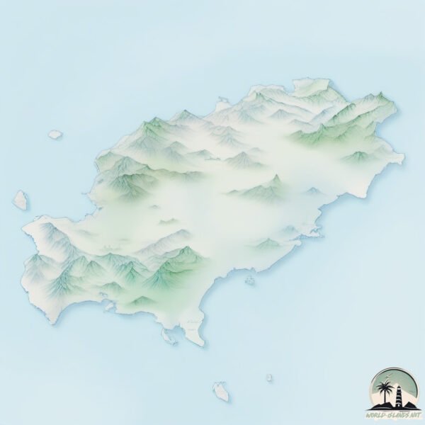
Geography and size of Ibiza
Size: 569.8 km²
Coastline: 187.5 km
Ocean: Atlantic Ocean
Sea: Balearic (Iberian Sea)
Continent: Europe
Ibiza is a Large Island spanning 570 km² with a coastline of 188 km.
Archipel: Balearic Islands – An archipelago off eastern Spain in the Mediterranean Sea, known for their vibrant culture, beautiful beaches, and popular tourist destinations like Mallorca and Ibiza.
Tectonic Plate: Eurasia – One of the world’s largest tectonic plates, the Eurasian Plate covers a significant portion of Europe and Asia. It’s characterized by diverse geological features, including the Ural Mountains, the European Plain, and the Himalayas formed from its collision with the Indian Plate.
The geographic heart of the island is pinpointed at these coordinates:
Latitude: 38.98379415 / Longitude: 1.41104914
Climate and weather of Ibiza
Climate Zone: Dry
Climate Details: Cold Semi-Arid (Steppe) Climate
Temperature: Cold
Climate Characteristics: Characterized by hot summers and cold winters, this climate is typically found on the edges of continental zones. It receives sufficient precipitation to avoid desert conditions.
Topography and nature of Ibiza
Timezone: UTC+01:00
Timezone places: Europe/Paris
Max. Elevation: 352 m
Mean Elevation: 113 m
Vegetation: Agricultural Mosaic
Tree Coverage: 25%
The mean elevation is 113 m. The highest elevation on the island reaches approximately 352 meters above sea level. The island is characterized by Hills: Gently sloping landforms with rounded tops, having a maximum elevation between 200 and 500 meters. Hills contribute to a varied landscape on islands.
Dominating Vegetation: Agricultural Mosaic
A mix of cropland and natural vegetation, often seen in rural landscapes where agricultural fields are interspersed with patches of natural habitats. Ibiza has a tree cover of 25 %.
Vegetation: 14 vegetation zones – Exceptionally Diverse Island
Islands with more than ten vegetation zones are among the most ecologically rich and varied in the world. These islands are akin to miniature continents, boasting an incredible array of ecosystems. The sheer range of habitats, from high peaks to deep valleys, rainforests to deserts, creates a mosaic of life that is unparalleled. They are crucial for conservation and ecological studies.
Infrastructure and Travelling to Ibiza
Does the island have a public airport? yes.
Ibiza has a public and scheduled airport. The following airports are located on this island: Ibiza Airport.
Does the island have a major port? yes.
Ibiza is home to a major port. The following ports are situated on the island: .
The mean population of Ibiza is 294 per km². Ibiza is Moderately Inhabited. The island belongs to Spain.
The name of the island resonates across different cultures and languages. Here is how it is known around the world: Arabic: يابسة; German: Ibiza; Spanish: Ibiza; French: Ibiza; Portuguese: Ibiza; Russian: Ивиса; Chinese: 伊维萨岛
Continuing your journey, Isla de Formentera is the next notable island, situated merely km away.
Ibiza Overview: The Best Areas to Stay & Visit in 2026... 🇪🇸🏝️
In this quick overview, we travel around Ibiza to check out some of the best areas to stay and visit! Join over 63000 members and ...Ibiza Overview: The Best Areas to Stay & Visit in 2026... 🇪🇸🏝️
In this quick overview, we travel around Ibiza to check out some of ...
In this quick overview, we travel around Ibiza to check out some of the best areas to stay and visit! Join over 63000 members and ...
Should YOU Visit Ibiza? - Island Tour
Ibiza is one of the Balearic Islands in the Mediterranean Sea. It's ...
Ibiza is one of the Balearic Islands in the Mediterranean Sea. It's well known for the lively nightlife in Ibiza Town and Sant Antoni, ...
Uncovering Ibiza's DARK and DANGEROUS secrets! - BBC
Zara McDermott visits Wayne Lineker's club in Ibiza. Ibiza: Secrets of ...
Zara McDermott visits Wayne Lineker's club in Ibiza. Ibiza: Secrets of the Party Island. Zara McDermott explores the secret of the ...
The Forbidden Island of Es Vedrà - Ibiza: Pirates, Sirens, and UFOs?
Welcome to Legends Unveiled — where myth, legend, and history come ...
Welcome to Legends Unveiled — where myth, legend, and history come alive! In today's journey, we set sail to one of the most ...
10 Best Things To Do In IBIZA Spain 2026
Ibiza is one of the most popular places to visit in Europe during the ...
Ibiza is one of the most popular places to visit in Europe during the summer.. But is it still worth it? 10 Best Things To Do in Ibiza ...
Ibiza - #island #spain #placestovisit #party #geography #culture #europe
15 Things to KNOW BEFORE YOU GO to Ibiza Spain 🇪🇸 | First Time in Ibiza
Don't miss these things to know before you go to Ibiza Spain to make ...
Don't miss these things to know before you go to Ibiza Spain to make the most out of your first time in Ibiza. This Ibiza Spain Travel ...
Mallorca vs Ibiza 🌴 Which Balearic Island Is Best for You in 2026
Mallorca vs Ibiza Which Balearic Island Is Best for You in 2026, Is it ...
Mallorca vs Ibiza Which Balearic Island Is Best for You in 2026, Is it better to go to Mallorca or Ibiza? if you are Planning a trip to ...
🇪🇸 Ibiza, Spain: The Island of Old Charms and Mediterranean Paradise #travel #island #ibiza #spain
Discover the magic of Ibiza, Spain, a perfect blend of historic charm ...
Discover the magic of Ibiza, Spain, a perfect blend of historic charm and Mediterranean paradise. Explore the ancient streets of ...
Top 12amazing things to do in Ibiza Island, Spain - Travel Video
Top 12 amazing things to do in Ibiza Island, Spain - Travel Video Get ...
Top 12 amazing things to do in Ibiza Island, Spain - Travel Video Get ready to explore Ibiza, the ultimate Mediterranean ...
Ibiza Travel Guide 2026 - Is This The Best Mediterranean Island?
Ibiza, Spain Travel Guide 2026 Is Ibiza still worth it? From legendary ...
Ibiza, Spain Travel Guide 2026 Is Ibiza still worth it? From legendary nightlife and iconic sunsets to hidden beaches and ...
Ibiza Is The Best And Most Insane Party Island In The World.
Ibiza Is The Best And Most Insane Party Island In The World. Enjoy the ...
Ibiza Is The Best And Most Insane Party Island In The World. Enjoy the perfect views, beaches and extreme luxury of Ibiza.
IBIZA BEFORE CLUBS TOOK OVER THE ISLAND
Ibiza before clubs took over the island. We're revealing Ibiza's ...
Ibiza before clubs took over the island. We're revealing Ibiza's hidden stories don't miss out! Follow us and become part of the ...
The Secret Life of Ibiza: From Club Classics to Off-Grid Paradise | Documentary
The small Balearic island of Ibiza attracts almost three million ...
The small Balearic island of Ibiza attracts almost three million tourists every summer. With its legendary nightlife and iconic DJs, ...
Beautiful Ibiza #island #spain #nature #tourist #views #cave #ocean #yacht #travel #europe #sea
Ibiza, Spain - 4K Walking Video - Top 5 Beaches and Swimming Spots
This 4K walking tour visits several amazing beaches in Ibiza, Spain ...
This 4K walking tour visits several amazing beaches in Ibiza, Spain filmed from July 5 to July 7, 2024. The walk on each beach ...
Ibiza — Best Island in The World! Full Island Tour
Is IBIZA Worth the Hype?! (Just a Party Island?)
Ibiza Spain is the famous party island but is this travel destination ...
Ibiza Spain is the famous party island but is this travel destination worth it? Experience the island and see how to travel Ibiza ...
Ibiza: One Season Too Many? (Documentary) BBC Stories
Superstar DJs and world-famous clubs normally make the headlines about ...
Superstar DJs and world-famous clubs normally make the headlines about Ibiza. But every season puts more pressure on the ...
[4K] Ibiza 2026 🇪🇸 Mediterranean Coastlines & Seaside Parties Aerial Views Deep House Chill Music
Welcome to WONDER PLACES 4K , your go-to spot for stunning 4K ...
Welcome to WONDER PLACES 4K , your go-to spot for stunning 4K landscapes from every corner of the world! ✨ [4K] Ibiza ...
Ibiza 4K | Discover Island Paradise and Sunset Beaches in Spain With Deep House Chill
Escape to the vibrant island of Ibiza in this stunning 4K journey ...
Escape to the vibrant island of Ibiza in this stunning 4K journey through golden beaches, turquoise waters, and unforgettable ...
Top Tourist Destinations in Ibiza ☀️
1. Cala Comte Beach – Turquoise waters and stunning cliffs. 2. Dalt ...
1. Cala Comte Beach – Turquoise waters and stunning cliffs. 2. Dalt Vila – A UNESCO World Heritage site full of history. 3.
How expensive is Ibiza REALLY?
The side to Ibiza most do not see
In the shadow of Ibiza's luxurious capital lie shanty towns and ...
In the shadow of Ibiza's luxurious capital lie shanty towns and makeshift camps filled with workers who can no longer afford the ...
Discover Ibiza, the magic island that has it all
Discover more about Palladium Hotel Group and book your room now at: ...
Discover more about Palladium Hotel Group and book your room now at:
http://bit.ly/2rxrUXM Suscribe to our channel now to keep ...
Spain is classified as Developed region: nonG7: Developed economies outside of the Group of Seven, characterized by high income and advanced economic structures. The level of income is High income: OECD.
News – Latest Updates and Headlines from Ibiza
Stay informed with the most recent news and important headlines from Ibiza. Here’s a roundup of the latest developments.
Loading...
Please note: The data used here has been primarily extracted from satellite readings. Deviations from exact values may occur, particularly regarding the height of elevations and population density. Land area and coastline measurements refer to average values at mean high tide.


![[4K] Ibiza 2026 🇪🇸 Mediterranean Coastlines & Seaside Parties Aerial Views Deep House Chill Music](https://i.ytimg.com/vi/zCTocRnnMKQ/mqdefault.jpg)