Inno Shima
Welcome to Inno Shima, a Temperate island in the Seto Naikai or Inland Sea, part of the majestic Pacific Ocean. This guide offers a comprehensive overview of what makes Inno Shima unique – from its geography and climate to its population, infrastructure, and beyond. Dive into the details:
- Geography and Size: Explore the island’s size and location.
- Climate and Weather: Weather patterns and temperature.
- Topography and Nature: Uncover the natural wonders of the island.
- Infrastructure and Travelling: Insights on reaching, staying, and making the most of your visit.
- News and Headlines: Latest News.
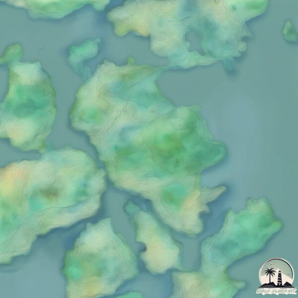
Geography and size of Inno Shima
Size: 35.8 km²
Coastline: 40.4 km
Ocean: Pacific Ocean
Sea: Seto Naikai or Inland Sea
Continent: Asia
Inno Shima is a Medium Island spanning 36 km² with a coastline of 40 km.
Archipel: Japan – An East Asian archipelago comprising four main islands and numerous smaller ones, known for its rich history, technological advances, and distinct culture.
Tectonic Plate: Amur – A minor tectonic plate in the region of the Amur River at the border of Russia and China, involved in complex interactions with the Pacific and Eurasian plates.
The geographic heart of the island is pinpointed at these coordinates:
Latitude: 34.31984286 / Longitude: 133.1727906
Climate and weather of Inno Shima
Climate Zone: Temperate
Climate Details: Humid Subtropical Climate
Temperature: Hot Summer
Climate Characteristics: With continuous rainfall and hot summers, this climate is common in some coastal regions, supporting diverse vegetation.
Topography and nature of Inno Shima
Timezone: UTC+09:00
Timezone places: Asia/Tokyo
Max. Elevation: 282 m
Mean Elevation: 68 m
Vegetation: Deciduous Broadleaf Forest
Tree Coverage: 49%
The mean elevation is 68 m. The highest elevation on the island reaches approximately 282 meters above sea level. The island is characterized by Hills: Gently sloping landforms with rounded tops, having a maximum elevation between 200 and 500 meters. Hills contribute to a varied landscape on islands.
Dominating Vegetation: Deciduous Broadleaf Forest
Composed of broadleaf trees that shed their leaves seasonally. These forests are commonly found in temperate zones and experience distinct seasonal changes. Inno Shima has a tree cover of 49 %.
Vegetation: 11 vegetation zones – Exceptionally Diverse Island
Islands with more than ten vegetation zones are among the most ecologically rich and varied in the world. These islands are akin to miniature continents, boasting an incredible array of ecosystems. The sheer range of habitats, from high peaks to deep valleys, rainforests to deserts, creates a mosaic of life that is unparalleled. They are crucial for conservation and ecological studies.
Infrastructure and Travelling to Inno Shima
Does the island have a public airport? no.
There is no public and scheduled airport on Inno Shima. The nearest airport is Hiroshima Airport, located 26 km away.
Does the island have a major port? yes.
Inno Shima is home to a major port. The following ports are situated on the island: HABU KO.
The mean population of Inno Shima is 497 per km². Inno Shima is Moderately Inhabited. The island belongs to Japan.
The name of the island resonates across different cultures and languages. Here is how it is known around the world: Arabic: هونشو; German: Honshū; Spanish: Honshū; French: Honshū; Portuguese: Honshu; Russian: Хонсю; Chinese: 本州
Continuing your journey, Ikuchi Jima is the next notable island, situated merely km away.
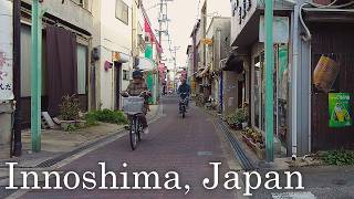
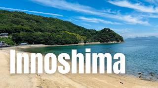
My Trip to Innoshima Hiroshima Japan - The Town Watched Over by a Shrine Where Cherry Blossoms Bloom

Japan is classified as Developed region: G7: Group of Seven – Major advanced economies, including Canada, France, Germany, Italy, Japan, the United Kingdom, and the United States. The level of income is High income: OECD.
News – Latest Updates and Headlines from Inno Shima
Stay informed with the most recent news and important headlines from Inno Shima. Here’s a roundup of the latest developments.
Please note: The data used here has been primarily extracted from satellite readings. Deviations from exact values may occur, particularly regarding the height of elevations and population density. Land area and coastline measurements refer to average values at mean high tide.