Welcome to Isla Tierra Bomba, a Tropical island in the Caribbean Sea, part of the majestic Atlantic Ocean. This guide offers a comprehensive overview of what makes Isla Tierra Bomba unique – from its geography and climate to its population, infrastructure, and beyond. Dive into the details:
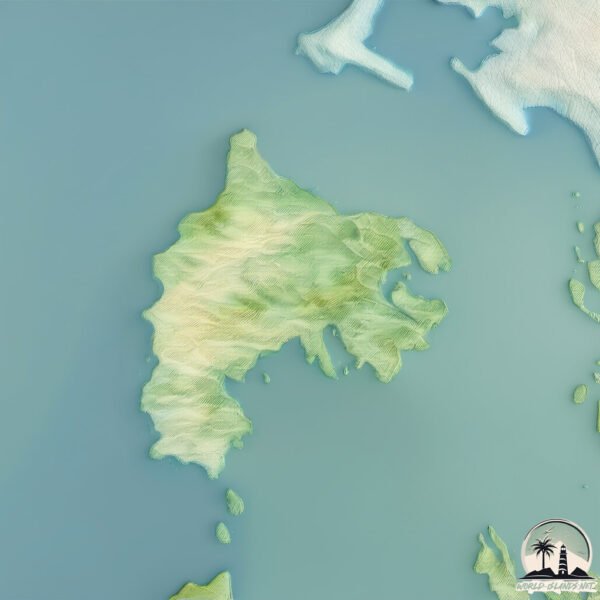
Geography and size of Isla Tierra Bomba
Size: 20.2 km²
Coastline: 33.3 km
Ocean: Atlantic Ocean
Sea: Caribbean Sea
Continent: South America
Isla Tierra Bomba is a Medium Island spanning 20 km² with a coastline of 33 km.
Archipel: –
Tectonic Plate: Africa – One of the world’s largest tectonic plates, covering the African continent and parts of the surrounding oceans, known for its stability with some active rift zones.
The geographic heart of the island is pinpointed at these coordinates:
Latitude: 10.3514226 / Longitude: -75.57043887
Climate and weather of Isla Tierra Bomba
Climate Zone: Tropical
Climate Details: Tropical Savanna, Wet
Temperature: Hot
Climate Characteristics: Defined by distinct wet and dry seasons with high temperatures year-round. Pronounced rainfall occurs during the wet season, while the dry season is marked by drought.
Topography and nature of Isla Tierra Bomba
Timezone: UTC-05:00
Timezone places: America/New_York
Max. Elevation: 43 m
Mean Elevation: 20 m
Vegetation: Evergreen Broadleaf Forest
Tree Coverage: 79%
The mean elevation is 20 m. The highest elevation on the island reaches approximately 43 meters above sea level. The island is characterized by Plains: Flat, low-lying lands characterized by a maximum elevation of up to 200 meters. On islands, plains are typically coastal lowlands or central flat areas.
Dominating Vegetation: Evergreen Broadleaf Forest
Characterized by dense, lush canopies of broadleaf trees that retain their leaves year-round. These forests are typically found in tropical and subtropical regions and are known for their high biodiversity. Isla Tierra Bomba has a tree cover of 79 %.
Vegetation: 8 vegetation zones – Very Highly Diverse Island
Islands in this range are ecological powerhouses, showcasing a wide array of vegetation zones. Each zone, from lush rainforests to arid scrublands, coastal mangroves to mountainous regions, contributes to a complex and interdependent ecosystem. These islands are often hotspots of biodiversity, supporting numerous species and intricate ecological processes.
Infrastructure and Travelling to Isla Tierra Bomba
Does the island have a public airport? no.
There is no public and scheduled airport on Isla Tierra Bomba. The nearest airport is Rafael Nuñez International Airport, located 9 km away.
Does the island have a major port? no.
There are no major ports on Isla Tierra Bomba. The closest major port is EL BOSQUE, approximately 4 km away.
The mean population of Isla Tierra Bomba is 2154 per km². Isla Tierra Bomba is Densely Populated. The island belongs to Colombia.
Continuing your journey, Atrato Delta is the next notable island, situated merely km away.
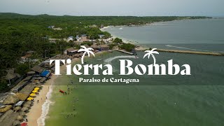
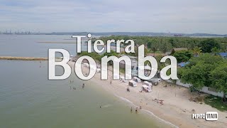
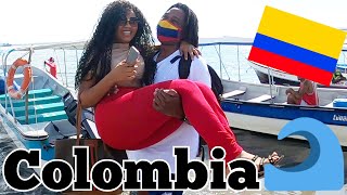
Colombia's Party Island: Isla Tierra Bomba
We escaped Cartagena for a few days at this nearby island. facilities are basic, no real 5 star hotels here but the vibe is good.Colombia's Party Island: Isla Tierra Bomba
We escaped Cartagena for a few days at this nearby island. facilities ...
We escaped Cartagena for a few days at this nearby island. facilities are basic, no real 5 star hotels here but the vibe is good.
🌴EXPLORANDO la Magia de Isla TIERA BOMBA🌴 CARTAGENA de INDIAS 🇨🇴 COLOMBIA🇨🇴 ¡Paraíso Caribeño! 💯🇨🇴✈️
En este video, exploraremos las hermosas playas de la Isla TIERRA ...
En este video, exploraremos las hermosas playas de la Isla TIERRA BOMBA, un paraíso cercano a CARTAGENA. Desde ...
Tierra Bomba Island - Colombia
Tourofcolombia #traveltheworld #Colombia #TierraBomba #Cartagena ...
Tourofcolombia #traveltheworld #Colombia #TierraBomba #Cartagena #Island Tierra Bomba Island - Colombia Please Subscribe ...
Tierra Bomba | El Secreto Mejor Guardado de Cartagena 🌴🌊
Explora con nosotros Tierra Bomba, un verdadero paraíso a solo unos ...
Explora con nosotros Tierra Bomba, un verdadero paraíso a solo unos minutos de Cartagena! Este video te llevará a descubrir ...
TIERRA BOMBA, Cartagena ¿Cómo llegar? ¿Qué hacer?
Mis amigos viajeros de todas partes, uno de los planes más bacanos de ...
Mis amigos viajeros de todas partes, uno de los planes más bacanos de Cartagena es llegar en lancha a Tierra Bomba y sus ...
Tierra Bomba Island off the coast of Cartagena Colombia
Day one of my trip to Colombia. Visited Tierra Bomba Island, which is ...
Day one of my trip to Colombia. Visited Tierra Bomba Island, which is an island about 15 minutes away from mainland Cartagena.
Tierra Bomba Island | Cartagena | Colombia 🇨🇴
Come enjoy this speed boat journey with us from cartagena beach to ...
Come enjoy this speed boat journey with us from cartagena beach to Tierra Bomba Island #cartagena #colombia #travel ...
ancestral lounch beach 🌴isla de tierra bomba #cartagena
Cartagena Tierra Bomba, Episode 1
In this episode we travel from Bogota to Cartagena Colombia. Our final ...
In this episode we travel from Bogota to Cartagena Colombia. Our final destination is the hotel, Fenix Beach, on the island Tierra ...
Isla de Tierra Bomba no tiene agua y el mar se está llevando las casas
En esta zona hay una gran apatía política, pues sienten que les ...
En esta zona hay una gran apatía política, pues sienten que les prometen pero no les cumplen. No tienen agua potable y, ...
Tierra Bomba Isla Tour | Cartagena [4K] 🚶📹🏖️🚤❤️🌏 #walktripl29 #travel #colombiancity #beach
Welcome to Walk Trip L29, your gateway to immersive travel experiences ...
Welcome to Walk Trip L29, your gateway to immersive travel experiences through scenic hikes around the world. Join us as we ...
LA PLAYA MAS LINDA DE TIERRA BOMBA? como la pase y cuanto me gaste en esta isla al sur de #cartagena
LA PLAYA MAS LINDA DE TIERRA BOMBA? como la pase y cuanto me gaste en ...
LA PLAYA MAS LINDA DE TIERRA BOMBA? como la pase y cuanto me gaste en esta isla al sur de #cartagena #Cultura, ...
Descubre un paraíso en la isla de tierra bomba #cartagena #playa #aventura #vacaciones
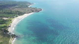
VISITA ÁEREA A LA ISLA DE TIERRA BOMBA COLOMBIA EN 4K
viajes, #turismo, #tour, #cartagena, #colombia, #paisajes, #mar, ...
viajes, #turismo, #tour, #cartagena, #colombia, #paisajes, #mar, #tierrabomba, #isla,
Tierra Bomba | Cartagena [4k] 🚶📹🚤🏖️❤️🌏 #walktripl29 #travel #colombiancity #beach #cartagena #trip
Embark on an unforgettable journey to Tierra Bomba Island, a tropical ...
Embark on an unforgettable journey to Tierra Bomba Island, a tropical gem just a short boat ride from the vibrant city of Cartagena, ...
Island Tierra Bomba - Cartagena - Isla Tierra Bomba
Island Tierra Bomba - Isla Tierra Bomba near Cartagena, Colombia 16 ...
Island Tierra Bomba - Isla Tierra Bomba near Cartagena, Colombia 16 november 2021.
palmarito beach tierra bomba punta arena #colombia #estrellatours #estrellatourscartagena
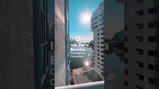
📍Isla Tierra Bomba, Cartagena, Colombia
Isla Tierra Bomba, ubicada frente a la costa de Cartagena, Colombia, ...
Isla Tierra Bomba, ubicada frente a la costa de Cartagena, Colombia, es un destino que ofrece una combinación única de historia ...
Cartagena Beach Island Tierra Bomba Travel Tour - What You Need To Know!
Cartagena Beach Island Tierra BombaTour. In this video, I go on a ...
Cartagena Beach Island Tierra BombaTour. In this video, I go on a Cartagena Island tour and explore the beaches of Tierra ...
Tierra Bomba Island Tour | Cartagena [4K] 🚶📹⛱️🌥️❤️🌏 | A tropical gem, just a short boat ride away
Welcome to Walk Trip L29, your gateway to immersive travel experiences ...
Welcome to Walk Trip L29, your gateway to immersive travel experiences through scenic hikes around the world. Join us as we ...
Video Drone Playa Tierra Bomba - Cartagena de Indias
Recorrido aéreo sobre Isla Tierra Bomba, ubicada en la costa del ...
Recorrido aéreo sobre Isla Tierra Bomba, ubicada en la costa del Caribe colombiano, cerca de Cartagena.
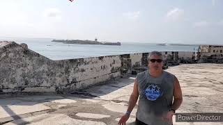
COLOMBIA - San Fernando Fortress on Tierra Bomba
San Fernando fortress is on Tierra Bomba island just off Cartagena and ...
San Fernando fortress is on Tierra Bomba island just off Cartagena and was used to protect the mainland from pirates. if you are ...
Vistas Aéreas de Tierra Bomba en 4K: La Joya de Cartagena
Explora Tierra Bomba desde una nueva perspectiva en este video con ...
Explora Tierra Bomba desde una nueva perspectiva en este video con impresionantes vistas aéreas en 4K. Sumérgete en la ...
TIERRA BOMBA ISLAND LOCATED IN THE BAY OF CARTAGENA, COLOMBIA. PLAYA DORADA, FENIX BEACH SUMMER 2021
The TierraBomba island located in the bay of Cartagena, Colombia has ...
The TierraBomba island located in the bay of Cartagena, Colombia has beautiful beaches like Playa Dorada and Fenix Beach.
🏖️Isla Tierra Bomba - Cartagena / Santuario Beach
Descubre la Isla de Tierra Bomba en Cartagena 🏝️ ¡Acompáñanos en una ...
Descubre la Isla de Tierra Bomba en Cartagena 🏝️ ¡Acompáñanos en una increíble experiencia en Santuario Beach! Pasamos ...
Colombia is classified as Developing region: Regions characterized by lower income levels, with economies in the process of industrialization and modernization. The level of income is Upper middle income.
News – Latest Updates and Headlines from Isla Tierra Bomba
Stay informed with the most recent news and important headlines from Isla Tierra Bomba. Here’s a roundup of the latest developments.
Loading...
Please note: The data used here has been primarily extracted from satellite readings. Deviations from exact values may occur, particularly regarding the height of elevations and population density. Land area and coastline measurements refer to average values at mean high tide.


![Tierra Bomba Isla Tour | Cartagena [4K] 🚶📹🏖️🚤❤️🌏 #walktripl29 #travel #colombiancity #beach](https://i.ytimg.com/vi/S23h7YJg4Q0/mqdefault.jpg)


![Tierra Bomba | Cartagena [4k] 🚶📹🚤🏖️❤️🌏 #walktripl29 #travel #colombiancity #beach #cartagena #trip](https://i.ytimg.com/vi/qArHjAmKA-k/mqdefault.jpg)


![Tierra Bomba Island Tour | Cartagena [4K] 🚶📹⛱️🌥️❤️🌏 | A tropical gem, just a short boat ride away](https://i.ytimg.com/vi/PdBxZ6d3SxE/mqdefault.jpg)