Isola di Montecristo
Welcome to Isola di Montecristo, a Dry island in the Tyrrhenian Sea, part of the majestic Atlantic Ocean. This guide offers a comprehensive overview of what makes Isola di Montecristo unique – from its geography and climate to its population, infrastructure, and beyond. Dive into the details:
- Geography and Size: Explore the island’s size and location.
- Climate and Weather: Weather patterns and temperature.
- Topography and Nature: Uncover the natural wonders of the island.
- Infrastructure and Travelling: Insights on reaching, staying, and making the most of your visit.
- News and Headlines: Latest News.
Geography and size of Isola di Montecristo
Size: 10.4 km²
Coastline: 17 km
Ocean: Atlantic Ocean
Sea: Tyrrhenian Sea
Continent: Europe
Isola di Montecristo is a Medium Island spanning 10 km² with a coastline of 17 km.
Archipel: Mediterranean islands – Encompassing numerous islands in the Mediterranean Sea, each with its own unique culture, history, and natural beauty, from the Balearics to the Greek islands.
Tectonic Plate: Eurasia – One of the world’s largest tectonic plates, the Eurasian Plate covers a significant portion of Europe and Asia. It’s characterized by diverse geological features, including the Ural Mountains, the European Plain, and the Himalayas formed from its collision with the Indian Plate.
The geographic heart of the island is pinpointed at these coordinates:
Latitude: 42.33191782 / Longitude: 10.30908632
Climate and weather of Isola di Montecristo
Climate Zone: Dry
Climate Details: Cold Semi-Arid (Steppe) Climate
Temperature: Cold
Climate Characteristics: Characterized by hot summers and cold winters, this climate is typically found on the edges of continental zones. It receives sufficient precipitation to avoid desert conditions.
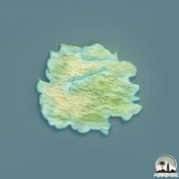
Topography and nature of Isola di Montecristo
Timezone: UTC+01:00
Timezone places: Europe/Paris
Max. Elevation: 441 m
Mean Elevation: 219 m
Vegetation: Sparse Vegetation
Tree Coverage: 13%
The mean elevation is 219 m. The highest elevation on the island reaches approximately 441 meters above sea level. The island is characterized by Hills: Gently sloping landforms with rounded tops, having a maximum elevation between 200 and 500 meters. Hills contribute to a varied landscape on islands.
Dominating Vegetation: Sparse Vegetation
These regions have limited plant growth, typically due to extreme conditions like aridity or poor soils. Vegetation is scattered and consists of hardy plant species. Isola di Montecristo has a tree cover of 13 %.
Vegetation: 8 vegetation zones – Very Highly Diverse Island
Islands in this range are ecological powerhouses, showcasing a wide array of vegetation zones. Each zone, from lush rainforests to arid scrublands, coastal mangroves to mountainous regions, contributes to a complex and interdependent ecosystem. These islands are often hotspots of biodiversity, supporting numerous species and intricate ecological processes.
Infrastructure and Travelling to Isola di Montecristo
Does the island have a public airport? no.
There is no public and scheduled airport on Isola di Montecristo. The nearest airport is Marina Di Campo Airport, located 46 km away.
Does the island have a major port? no.
There are no major ports on Isola di Montecristo. The closest major port is PORTOFERRAIO, approximately 52 km away.
The mean population of Isola di Montecristo is 0 per km². Isola di Montecristo is Uninhabited. The island belongs to Italy.
Continuing your journey, Isola Pianosa is the next notable island, situated merely km away.
Italy is classified as Developed region: G7: Group of Seven – Major advanced economies, including Canada, France, Germany, Italy, Japan, the United Kingdom, and the United States. The level of income is High income: OECD.
News – Latest Updates and Headlines from Isola di Montecristo
Stay informed with the most recent news and important headlines from Isola di Montecristo. Here’s a roundup of the latest developments.
Please note: The data used here has been primarily extracted from satellite readings. Deviations from exact values may occur, particularly regarding the height of elevations and population density. Land area and coastline measurements refer to average values at mean high tide.