Izena Jima
Welcome to Izena Jima, a Temperate island in the Eastern China Sea, part of the majestic Pacific Ocean. This guide offers a comprehensive overview of what makes Izena Jima unique – from its geography and climate to its population, infrastructure, and beyond. Dive into the details:
- Geography and Size: Explore the island’s size and location.
- Climate and Weather: Weather patterns and temperature.
- Topography and Nature: Uncover the natural wonders of the island.
- Infrastructure and Travelling: Insights on reaching, staying, and making the most of your visit.
- News and Headlines: Latest News.
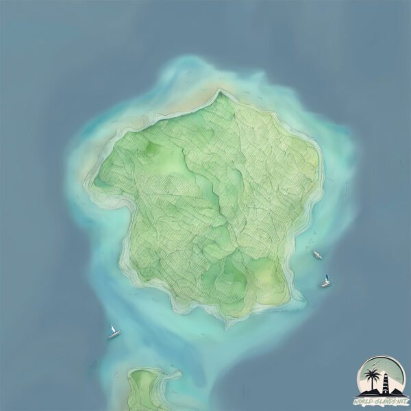
Geography and size of Izena Jima
Size: 13.9 km²
Coastline: 19.3 km
Ocean: Pacific Ocean
Sea: Eastern China Sea
Continent: Asia
Izena Jima is a Medium Island spanning 14 km² with a coastline of 19 km.
Archipel: Ryukyu Islands – A chain of Japanese islands stretching southwest from Kyushu to Taiwan, known for their unique Okinawan culture and subtropical climate.
Tectonic Plate: Philippine Sea – An oceanic tectonic plate beneath the Philippine Sea, east of the Philippines. It’s involved in complex interactions with the surrounding Eurasian, Pacific, and Indo-Australian plates, leading to significant volcanic and seismic activity in the region.
The geographic heart of the island is pinpointed at these coordinates:
Latitude: 26.93399958 / Longitude: 127.9370111
Climate and weather of Izena Jima
Climate Zone: Temperate
Climate Details: Humid Subtropical Climate
Temperature: Hot Summer
Climate Characteristics: With continuous rainfall and hot summers, this climate is common in some coastal regions, supporting diverse vegetation.
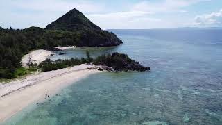
Topography and nature of Izena Jima
Timezone: UTC+09:00
Timezone places: Asia/Tokyo
Max. Elevation: 51 m
Mean Elevation: 24 m
Vegetation: Agricultural Mosaic
Tree Coverage: 39%
The mean elevation is 24 m. The highest elevation on the island reaches approximately 51 meters above sea level. The island is characterized by Plains: Flat, low-lying lands characterized by a maximum elevation of up to 200 meters. On islands, plains are typically coastal lowlands or central flat areas.
Dominating Vegetation: Agricultural Mosaic
A mix of cropland and natural vegetation, often seen in rural landscapes where agricultural fields are interspersed with patches of natural habitats. Izena Jima has a tree cover of 39 %.
Vegetation: 9 vegetation zones – Very Highly Diverse Island
Islands in this range are ecological powerhouses, showcasing a wide array of vegetation zones. Each zone, from lush rainforests to arid scrublands, coastal mangroves to mountainous regions, contributes to a complex and interdependent ecosystem. These islands are often hotspots of biodiversity, supporting numerous species and intricate ecological processes.
Infrastructure and Travelling to Izena Jima
Does the island have a public airport? no.
There is no public and scheduled airport on Izena Jima. The nearest airport is Yoron Airport, located 51 km away.
Does the island have a major port? no.
There are no major ports on Izena Jima. The closest major port is KIN WAN, approximately 55 km away.
The mean population of Izena Jima is 101 per km². Izena Jima is Moderately Inhabited. The island belongs to Japan.
Continuing your journey, Ilheya is the next notable island, situated merely km away.
Izena Island

Japan is classified as Developed region: G7: Group of Seven – Major advanced economies, including Canada, France, Germany, Italy, Japan, the United Kingdom, and the United States. The level of income is High income: OECD.
News – Latest Updates and Headlines from Izena Jima
Stay informed with the most recent news and important headlines from Izena Jima. Here’s a roundup of the latest developments.
Please note: The data used here has been primarily extracted from satellite readings. Deviations from exact values may occur, particularly regarding the height of elevations and population density. Land area and coastline measurements refer to average values at mean high tide.