
Kosrae Island
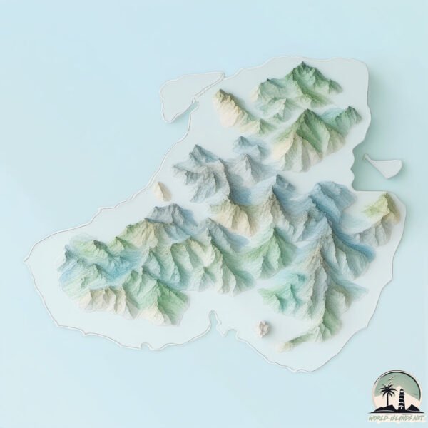
Welcome to Kosrae Island, a Tropical island in the North Pacific Ocean, part of the majestic Pacific Ocean. This guide offers a comprehensive overview of what makes Kosrae Island unique – from its geography and climate to its population, infrastructure, and beyond. Dive into the details:
- Geography and Size: Explore the island’s size and location.
- Climate and Weather: Weather patterns and temperature.
- Topography and Nature: Uncover the natural wonders of the island.
- Infrastructure and Travelling: Insights on reaching, staying, and making the most of your visit.
- News and Headlines: Latest News.
Geography and size of Kosrae Island
Size: 116.2 km²
Coastline: 62.7 km
Ocean: Pacific Ocean
Sea: North Pacific Ocean
Continent: Oceania
Kosrae Island is a Large Island spanning 116 km² with a coastline of 63 km.
Archipel: Micronesia – A region in the western Pacific Ocean comprising thousands of small islands, known for their unique cultures, languages, and marine ecosystems.
Tectonic Plate: Sunda – Extends across Southeast Asia, encompassing parts of the Sunda Shelf, known for its interaction with the Australian Plate, contributing to volcanic activity in Indonesia.
The geographic heart of the island is pinpointed at these coordinates:
Latitude: 5.31086478 / Longitude: 162.9761931
Climate and weather of Kosrae Island
Climate Zone: Tropical
Climate Details: Tropical Rainforest Climate
Temperature: Hot
Climate Characteristics: This climate is typified by heavy rainfall throughout the year, high humidity, and consistently high temperatures, leading to lush rainforests and rich biodiversity. Seasonal temperature variations are minimal.
Topography and nature of Kosrae Island
Timezone: UTC+11:00
Timezone places: Pacific/Guadalcanal
Max. Elevation: 382 m
Mean Elevation: 108 m
Vegetation: Evergreen Broadleaf Forest
Tree Coverage: 58%
The mean elevation is 108 m. The highest elevation on the island reaches approximately 382 meters above sea level. The island is characterized by Hills: Gently sloping landforms with rounded tops, having a maximum elevation between 200 and 500 meters. Hills contribute to a varied landscape on islands.
Dominating Vegetation: Evergreen Broadleaf Forest
Characterized by dense, lush canopies of broadleaf trees that retain their leaves year-round. These forests are typically found in tropical and subtropical regions and are known for their high biodiversity. Kosrae Island has a tree cover of 58 %.
Vegetation: 10 vegetation zones – Very Highly Diverse Island
Islands in this range are ecological powerhouses, showcasing a wide array of vegetation zones. Each zone, from lush rainforests to arid scrublands, coastal mangroves to mountainous regions, contributes to a complex and interdependent ecosystem. These islands are often hotspots of biodiversity, supporting numerous species and intricate ecological processes.
Infrastructure and Travelling to Kosrae Island
Does the island have a public airport? yes.
Kosrae Island has a public and scheduled airport. The following airports are located on this island: Kosrae International Airport.
Does the island have a major port? yes.
Kosrae Island is home to a major port. The following ports are situated on the island: .
The mean population of Kosrae Island is 45 per km². Kosrae Island is Gently Populated. The island belongs to Federated States of Micronesia.
The name of the island resonates across different cultures and languages. Here is how it is known around the world: Arabic: كوسراي; Spanish: Kosrae; French: Kosrae; Portuguese: Kosrae; Russian: Кусаие; Chinese: 科斯雷
Continuing your journey, Pohnpei is the next notable island, situated merely km away.
Federated States of Micronesia is classified as Developing region: Regions characterized by lower income levels, with economies in the process of industrialization and modernization. The level of income is Lower middle income.
News – Latest Updates and Headlines from Kosrae Island
Stay informed with the most recent news and important headlines from Kosrae Island. Here’s a roundup of the latest developments.
- NEC completes construction of approximately 2,250 km EMCS submarine cable linking Pacific island nations - NECon 15 May 2026
NEC completes construction of approximately 2,250 km EMCS submarine cable linking Pacific island nations NEC
- This Iconic Flight Departs Honolulu And Continues To The World’s Most Remote Islands - Beat of Hawaiion 21 March 2026
This Iconic Flight Departs Honolulu And Continues To The World’s Most Remote Islands Beat of Hawaii
- Kosrae Marks a Milestone with Handover of Newly Renovated Biosecurity Facility - FSM Governmenton 19 February 2026
Kosrae Marks a Milestone with Handover of Newly Renovated Biosecurity Facility FSM Government
- Micronesia: Island US military veterans struggle to get healthcare - RNZon 30 January 2026
Micronesia: Island US military veterans struggle to get healthcare RNZ
- From war captivity to Rabi: A Banaban elder’s story - Fiji Sunon 17 December 2025
From war captivity to Rabi: A Banaban elder’s story Fiji Sun
- Island hopping in Micronesia - Key Aeroon 12 September 2025
Island hopping in Micronesia Key Aero
- The Micronesian island of Kosrae just celebrated 40 years of the Church - Church Newson 14 August 2025
The Micronesian island of Kosrae just celebrated 40 years of the Church Church News
- EMCS subsea cable lands on island of Nauru - Data Center Dynamicson 12 August 2025
EMCS subsea cable lands on island of Nauru Data Center Dynamics
- Starlink Gateway System Now Live in Kosrae! - FSM Governmenton 3 March 2025
Starlink Gateway System Now Live in Kosrae! FSM Government
- Pacific Southwest Region : Feature Story - Conserving a Rare Tropical Wetland Forest - US Forest Service (.gov)on 3 October 2024
Pacific Southwest Region : Feature Story - Conserving a Rare Tropical Wetland Forest US Forest Service (.gov)
Please note: The data used here has been primarily extracted from satellite readings. Deviations from exact values may occur, particularly regarding the height of elevations and population density. Land area and coastline measurements refer to average values at mean high tide.