Lanzarote
Welcome to Lanzarote, a Dry island in the North Atlantic Ocean, part of the majestic Atlantic Ocean. This guide offers a comprehensive overview of what makes Lanzarote unique – from its geography and climate to its population, infrastructure, and beyond. Dive into the details:
- Geography and Size: Explore the island’s size and location.
- Climate and Weather: Weather patterns and temperature.
- Topography and Nature: Uncover the natural wonders of the island.
- Infrastructure and Travelling: Insights on reaching, staying, and making the most of your visit.
- News and Headlines: Latest News.
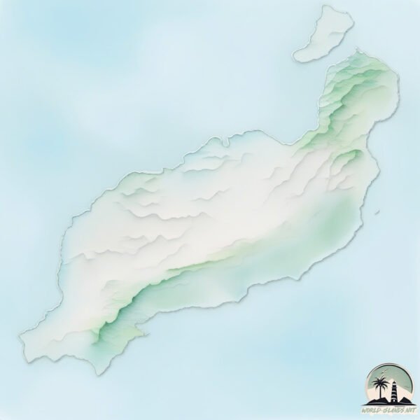
Geography and size of Lanzarote
Size: 817.9 km²
Coastline: 197.1 km
Ocean: Atlantic Ocean
Sea: North Atlantic Ocean
Continent: Africa
Lanzarote is a Large Island spanning 818 km² with a coastline of 197 km.
Archipel: Canary Islands – A Spanish archipelago off the coast of northwestern Africa, known for their volcanic landscapes, unique ecosystems, and vibrant cultures.
Tectonic Plate: Africa – One of the world’s largest tectonic plates, covering the African continent and parts of the surrounding oceans, known for its stability with some active rift zones.
The geographic heart of the island is pinpointed at these coordinates:
Latitude: 29.02432461 / Longitude: -13.64140761
Climate and weather of Lanzarote
Climate Zone: Dry
Climate Details: Hot Deserts Climate
Temperature: Hot
Climate Characteristics: Dominated by extremely hot temperatures, this climate is marked by minimal rainfall and barren landscapes. Nights often experience drastic temperature drops.
Topography and nature of Lanzarote
Timezone: UTC±00:00
Timezone places: Europe/Lisbon
Max. Elevation: 618 m
Mean Elevation: 174 m
Vegetation: Shrubland
Tree Coverage: 11%
The mean elevation is 174 m. The highest elevation on the island reaches approximately 618 meters above sea level. The island is characterized by Plateau: Elevated flatlands rising sharply above the surrounding area, with a maximum elevation over 500 meters but a mean elevation less than 300 meters, forming unique highland areas on islands.
Dominating Vegetation: Shrubland
Dominated by shrubs and small bushes, these areas are typical in dry, rocky, or sandy environments, as well as in regions with poor soil fertility. Lanzarote has a tree cover of 11 %.
Vegetation: 11 vegetation zones – Exceptionally Diverse Island
Islands with more than ten vegetation zones are among the most ecologically rich and varied in the world. These islands are akin to miniature continents, boasting an incredible array of ecosystems. The sheer range of habitats, from high peaks to deep valleys, rainforests to deserts, creates a mosaic of life that is unparalleled. They are crucial for conservation and ecological studies.
Infrastructure and Travelling to Lanzarote
Does the island have a public airport? yes.
Lanzarote has a public and scheduled airport. The following airports are located on this island: César Manrique-Lanzarote Airport.
Does the island have a major port? no.
There are no major ports on Lanzarote. The closest major port is ARRECIFE, approximately 1 km away.
The mean population of Lanzarote is 197 per km². Lanzarote is Moderately Inhabited. The island belongs to Spain.
The name of the island resonates across different cultures and languages. Here is how it is known around the world: Arabic: لانزاروت; German: Lanzarote; Spanish: Lanzarote; French: Lanzarote; Portuguese: Lanzarote; Russian: Лансароте; Chinese: 兰萨罗特岛
Continuing your journey, Graciosa Island is the next notable island, situated merely km away.
Should You Visit Lanzarote? - Canary Islands


Spain is classified as Developed region: nonG7: Developed economies outside of the Group of Seven, characterized by high income and advanced economic structures. The level of income is High income: OECD.
News – Latest Updates and Headlines from Lanzarote
Stay informed with the most recent news and important headlines from Lanzarote. Here’s a roundup of the latest developments.
Please note: The data used here has been primarily extracted from satellite readings. Deviations from exact values may occur, particularly regarding the height of elevations and population density. Land area and coastline measurements refer to average values at mean high tide.