Little Nicobar
Welcome to Little Nicobar, a Tropical island in the Andaman or Burma Sea, part of the majestic Indian Ocean. This guide offers a comprehensive overview of what makes Little Nicobar unique – from its geography and climate to its population, infrastructure, and beyond. Dive into the details:
- Geography and Size: Explore the island’s size and location.
- Climate and Weather: Weather patterns and temperature.
- Topography and Nature: Uncover the natural wonders of the island.
- Infrastructure and Travelling: Insights on reaching, staying, and making the most of your visit.
- News and Headlines: Latest News.
Geography and size of Little Nicobar
Size: 142.6 km²
Coastline: 74 km
Ocean: Indian Ocean
Sea: Andaman or Burma Sea
Continent: Seven seas (open ocean)
Little Nicobar is a Large Island spanning 143 km² with a coastline of 74 km.
Archipel: Nicobar Islands – Part of a group of islands in the Indian Ocean, these are known for their stunning beaches, diverse ecosystems, and unique indigenous cultures.
Tectonic Plate: Pacific – The world’s largest tectonic plate, covering much of the Pacific Ocean, known for the Pacific Ring of Fire with extensive seismic and volcanic activity.
The geographic heart of the island is pinpointed at these coordinates:
Latitude: 7.33596971 / Longitude: 93.68521646
Climate and weather of Little Nicobar
Climate Zone: Tropical
Climate Details: Tropical Rainforest Climate
Temperature: Hot
Climate Characteristics: This climate is typified by heavy rainfall throughout the year, high humidity, and consistently high temperatures, leading to lush rainforests and rich biodiversity. Seasonal temperature variations are minimal.
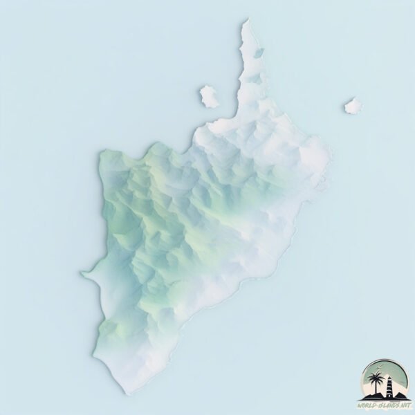
Topography and nature of Little Nicobar
Timezone: UTC+05:30
Timezone places:
Max. Elevation: 323 m
Mean Elevation: 102 m
Vegetation: Evergreen Broadleaf Forest
Tree Coverage: 65%
The mean elevation is 102 m. The highest elevation on the island reaches approximately 323 meters above sea level. The island is characterized by Hills: Gently sloping landforms with rounded tops, having a maximum elevation between 200 and 500 meters. Hills contribute to a varied landscape on islands.
Dominating Vegetation: Evergreen Broadleaf Forest
Characterized by dense, lush canopies of broadleaf trees that retain their leaves year-round. These forests are typically found in tropical and subtropical regions and are known for their high biodiversity. Little Nicobar has a tree cover of 65 %.
Vegetation: 8 vegetation zones – Very Highly Diverse Island
Islands in this range are ecological powerhouses, showcasing a wide array of vegetation zones. Each zone, from lush rainforests to arid scrublands, coastal mangroves to mountainous regions, contributes to a complex and interdependent ecosystem. These islands are often hotspots of biodiversity, supporting numerous species and intricate ecological processes.
Infrastructure and Travelling to Little Nicobar
Does the island have a public airport? no.
There is no public and scheduled airport on Little Nicobar. The nearest airport is Sultan Iskandar Muda International Airport, located 274 km away.
Does the island have a major port? no.
There are no major ports on Little Nicobar. The closest major port is SABANG, approximately 238 km away.
The mean population of Little Nicobar is 7 per km². Little Nicobar is Gently Populated. The island belongs to India.
The name of the island resonates across different cultures and languages. Here is how it is known around the world: Arabic: جزيرة نيكوبار الكبرى; German: Groß Nikobar; Spanish: Isla Gran Nicobar; French: Grande Nicobar; Portuguese: Grande Nicobar; Russian: Большой Никобар; Chinese: 大尼科巴島
Continuing your journey, Great Nicobar is the next notable island, situated merely km away.
Isolated Andaman a& Nicobar Islanders explained


India is classified as Emerging region: BRIC: Brazil, Russia, India, and China – Economies noted for their rapid growth and increasing influence on global affairs. The level of income is Lower middle income.
News – Latest Updates and Headlines from Little Nicobar
Stay informed with the most recent news and important headlines from Little Nicobar. Here’s a roundup of the latest developments.
Please note: The data used here has been primarily extracted from satellite readings. Deviations from exact values may occur, particularly regarding the height of elevations and population density. Land area and coastline measurements refer to average values at mean high tide.