Madre Sal
Welcome to Madre Sal, a Tropical island in the North Pacific Ocean, part of the majestic Pacific Ocean. This guide offers a comprehensive overview of what makes Madre Sal unique – from its geography and climate to its population, infrastructure, and beyond. Dive into the details:
- Geography and Size: Explore the island’s size and location.
- Climate and Weather: Weather patterns and temperature.
- Topography and Nature: Uncover the natural wonders of the island.
- Infrastructure and Travelling: Insights on reaching, staying, and making the most of your visit.
- News and Headlines: Latest News.
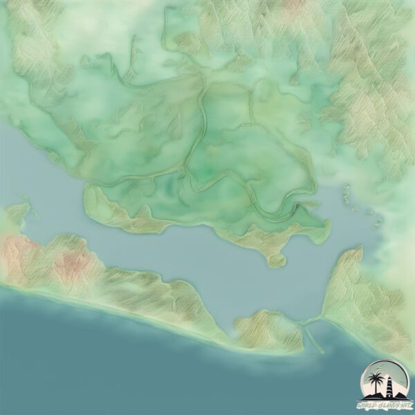
Geography and size of Madre Sal
Size: 12.1 km²
Coastline: 22.8 km
Ocean: Pacific Ocean
Sea: North Pacific Ocean
Continent: North America
Madre Sal is a Medium Island spanning 12 km² with a coastline of 23 km.
Archipel: –
Tectonic Plate: North America – Covers North America and parts of the Atlantic and Arctic Oceans, characterized by diverse geological features and varying levels of seismic activity.
The geographic heart of the island is pinpointed at these coordinates:
Latitude: 13.22072703 / Longitude: -88.49586652
Climate and weather of Madre Sal
Climate Zone: Tropical
Climate Details: Tropical Savanna, Wet
Temperature: Hot
Climate Characteristics: Defined by distinct wet and dry seasons with high temperatures year-round. Pronounced rainfall occurs during the wet season, while the dry season is marked by drought.
Topography and nature of Madre Sal
Timezone: UTC-06:00
Timezone places: America/Chicago
Max. Elevation: 11 m
Mean Elevation: 7 m
Vegetation: Mangrove Forest
Tree Coverage: 93%
The mean elevation is 7 m. The highest elevation on the island reaches approximately 11 meters above sea level. The island is characterized by Plains: Flat, low-lying lands characterized by a maximum elevation of up to 200 meters. On islands, plains are typically coastal lowlands or central flat areas.
Dominating Vegetation: Mangrove Forest
Found in coastal areas and river deltas, these unique wetland ecosystems are adapted to saline conditions and are crucial for coastal protection and biodiversity. Madre Sal has a tree cover of 93 %.
Vegetation: 3 vegetation zones – Moderately Diverse Island
These islands start to show a broader range of ecological niches. With three vegetation zones, they may offer a mix of ecosystems like coastal areas, inland woods, and perhaps a distinct wetland or dry area. This diversity supports a wider range of flora and fauna, making these islands more ecologically complex than those with minimal diversity.
Infrastructure and Travelling to Madre Sal
Does the island have a public airport? no.
There is no public and scheduled airport on Madre Sal. The nearest airport is Monseñor Óscar Arnulfo Romero International Airport, located 63 km away.
Does the island have a major port? no.
There are no major ports on Madre Sal. The closest major port is LA UNION, approximately 70 km away.
The mean population of Madre Sal is 167 per km². Madre Sal is Moderately Inhabited. The island belongs to El Salvador.
Continuing your journey, San Dionisio is the next notable island, situated merely km away.
Madre Sal desalinization plant


El Salvador is classified as Developing region: Regions characterized by lower income levels, with economies in the process of industrialization and modernization. The level of income is Lower middle income.
News – Latest Updates and Headlines from Madre Sal
Stay informed with the most recent news and important headlines from Madre Sal. Here’s a roundup of the latest developments.
Please note: The data used here has been primarily extracted from satellite readings. Deviations from exact values may occur, particularly regarding the height of elevations and population density. Land area and coastline measurements refer to average values at mean high tide.