Maitland
Welcome to Maitland, a Continental island in the The Coastal Waters of Southeast Alaska and British Columbia, part of the majestic Pacific Ocean. This guide offers a comprehensive overview of what makes Maitland unique – from its geography and climate to its population, infrastructure, and beyond. Dive into the details:
- Geography and Size: Explore the island’s size and location.
- Climate and Weather: Weather patterns and temperature.
- Topography and Nature: Uncover the natural wonders of the island.
- Infrastructure and Travelling: Insights on reaching, staying, and making the most of your visit.
- News and Headlines: Latest News.
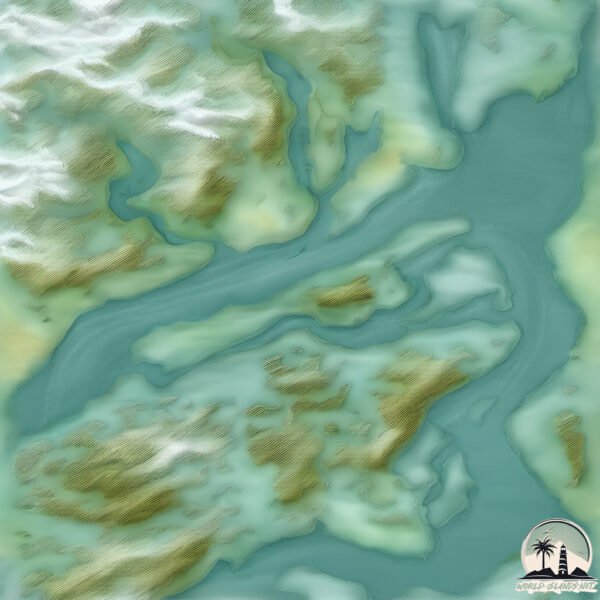
Geography and size of Maitland
Size: 41.2 km²
Coastline: 67.2 km
Ocean: Pacific Ocean
Sea: The Coastal Waters of Southeast Alaska and British Columbia
Continent: North America
Maitland is a Medium Island spanning 41 km² with a coastline of 67 km.
Archipel: –
Tectonic Plate: North America – Covers North America and parts of the Atlantic and Arctic Oceans, characterized by diverse geological features and varying levels of seismic activity.
The geographic heart of the island is pinpointed at these coordinates:
Latitude: 53.72465223 / Longitude: -128.97603145
Climate and weather of Maitland
Climate Zone: Continental
Climate Details: Warm-Summer Humid Continental Climate
Temperature: Warm Summer
Climate Characteristics: Features warm summers and cold winters with consistent precipitation, common in higher latitudes.
Topography and nature of Maitland
Timezone: UTC-08:00
Timezone places: America/Los_Angeles
Max. Elevation: 800 m
Mean Elevation: 277 m
Vegetation: Evergreen Needleleaf Forest
Tree Coverage: 80%
The mean elevation is 277 m. The highest elevation on the island reaches approximately 800 meters above sea level. The island is characterized by Plateau: Elevated flatlands rising sharply above the surrounding area, with a maximum elevation over 500 meters but a mean elevation less than 300 meters, forming unique highland areas on islands.
Dominating Vegetation: Evergreen Needleleaf Forest
Dominated by evergreen coniferous trees such as pines and firs, which retain their needle-like leaves throughout the year. These forests are often found in cooler climates. Maitland has a tree cover of 80 %.
Vegetation: 7 vegetation zones – Very Highly Diverse Island
Islands in this range are ecological powerhouses, showcasing a wide array of vegetation zones. Each zone, from lush rainforests to arid scrublands, coastal mangroves to mountainous regions, contributes to a complex and interdependent ecosystem. These islands are often hotspots of biodiversity, supporting numerous species and intricate ecological processes.
Infrastructure and Travelling to Maitland
Does the island have a public airport? no.
There is no public and scheduled airport on Maitland. The nearest airport is Northwest Regional Airport Terrace-Kitimat, located 83 km away.
Does the island have a major port? no.
There are no major ports on Maitland. The closest major port is KITIMAT, approximately 32 km away.
The mean population of Maitland is 0 per km². Maitland is Uninhabited. The island belongs to Canada.
Continuing your journey, Loretta is the next notable island, situated merely km away.
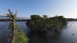
Exploring Dog Island on Lake Maitland


Canada is classified as Developed region: G7: Group of Seven – Major advanced economies, including Canada, France, Germany, Italy, Japan, the United Kingdom, and the United States. The level of income is High income: OECD.
News – Latest Updates and Headlines from Maitland
Stay informed with the most recent news and important headlines from Maitland. Here’s a roundup of the latest developments.
Please note: The data used here has been primarily extracted from satellite readings. Deviations from exact values may occur, particularly regarding the height of elevations and population density. Land area and coastline measurements refer to average values at mean high tide.