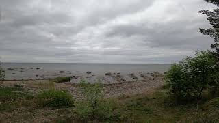
Welcome to Ruhnu Saar, a Continental island in the Gulf of Riga, part of the majestic Atlantic Ocean. This guide offers a comprehensive overview of what makes Ruhnu Saar unique – from its geography and climate to its population, infrastructure, and beyond. Dive into the details:
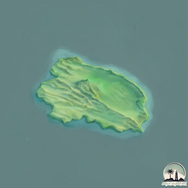
Geography and size of Ruhnu Saar
Size: 12.5 km²
Coastline: 17.7 km
Ocean: Atlantic Ocean
Sea: Gulf of Riga
Continent: Europe
Ruhnu Saar is a Medium Island spanning 12 km² with a coastline of 18 km.
Archipel: –
Tectonic Plate: Eurasia – One of the world’s largest tectonic plates, the Eurasian Plate covers a significant portion of Europe and Asia. It’s characterized by diverse geological features, including the Ural Mountains, the European Plain, and the Himalayas formed from its collision with the Indian Plate.
The geographic heart of the island is pinpointed at these coordinates:
Latitude: 57.80117456 / Longitude: 23.2431133
Climate and weather of Ruhnu Saar
Climate Zone: Continental
Climate Details: Warm-Summer Humid Continental Climate
Temperature: Warm Summer
Climate Characteristics: Features warm summers and cold winters with consistent precipitation, common in higher latitudes.
Topography and nature of Ruhnu Saar
Timezone: UTC+02:00
Timezone places: Europe/Helsinki
Max. Elevation: 24 m
Mean Elevation: 9 m
Vegetation: Mixed Forest
Tree Coverage: 79%
The mean elevation is 9 m. The highest elevation on the island reaches approximately 24 meters above sea level. The island is characterized by Plains: Flat, low-lying lands characterized by a maximum elevation of up to 200 meters. On islands, plains are typically coastal lowlands or central flat areas.
Dominating Vegetation: Mixed Forest
A combination of both deciduous and evergreen trees, often found in transitional zones between forest types. These forests offer a diverse habitat for various wildlife species. Ruhnu Saar has a tree cover of 79 %.
Vegetation: 9 vegetation zones – Very Highly Diverse Island
Islands in this range are ecological powerhouses, showcasing a wide array of vegetation zones. Each zone, from lush rainforests to arid scrublands, coastal mangroves to mountainous regions, contributes to a complex and interdependent ecosystem. These islands are often hotspots of biodiversity, supporting numerous species and intricate ecological processes.
Infrastructure and Travelling to Ruhnu Saar
Does the island have a public airport? yes.
Ruhnu Saar has a public and scheduled airport. The following airports are located on this island: Ruhnu Airfield.
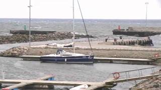
Does the island have a major port? no.
There are no major ports on Ruhnu Saar. The closest major port is LIELUPE, approximately 89 km away.
The mean population of Ruhnu Saar is 4 per km². Ruhnu Saar is Gently Populated. The island belongs to Estonia.
Continuing your journey, Muhu is the next notable island, situated merely km away.
Runö boat ride to Ruhnu island 50FPS 1080P
Departing from Munalaiu and arriving to Ringsu harbor during midsummer 23.06.2023.Runö boat ride to Ruhnu island 50FPS 1080P
Departing from Munalaiu and arriving to Ringsu harbor during midsummer ...
Departing from Munalaiu and arriving to Ringsu harbor during midsummer 23.06.2023.
Ruhnu Island Trip 2022 - Official Aftermovie
In January 2022, we went on an unforgettable trip to Ruhnu. A tiny ...
In January 2022, we went on an unforgettable trip to Ruhnu. A tiny Estonian island in the middle of the Baltic Sea. During the ...
Different fun moments and setting around Ruhnu island 50FPS 1080P
Including Ringsu harbor, renovating of airport, view from lighthouse ...
Including Ringsu harbor, renovating of airport, view from lighthouse and some comments in Estonian. 23.06.2023.
Ruhnu saar (island)
Pikkus 5,5 km ja laius 3,5 km. Elanikke umbes 300. Pärnu 96 km ...
Pikkus 5,5 km ja laius 3,5 km. Elanikke umbes 300. Pärnu 96 km kaugusel. Eesti.Estonia.Estland.
RUHNU The Island of Ruhnu HD 1080p
Ruhnu saar asub Liivi lahe keskel. Lähim koht mandril on 37 km ...
Ruhnu saar asub Liivi lahe keskel. Lähim koht mandril on 37 km kaugusel asuv Kolka neem Kuramaal Lätis. Kuressaarde on ...
ЭСТОНИЯ. Остров Рухну (Ruhnu)
Маленький остров в Рижском заливе, плошадью 12 км2. На нем проживает ...
Маленький остров в Рижском заливе, плошадью 12 км2. На нем проживает всего 55 человек. Но тем не менее на острове ...
Elementary school of Ruhnu island 50FPS 1080P
Built in 1875 studying was in Swedish language until year 1944. ...
Built in 1875 studying was in Swedish language until year 1944. Current building was renovated in 2017. 23.06.2023.
Ruhnu
Ruhnu saar, suvi 2022.
Ruhnu saar, suvi 2022.
Ferry "RUNO" route Parnu - island Ruhnu & Roomassaare - Ruhnu
Ferry "RUNO" route Parnu - island Ruhnu & Roomassaare - Ruhnu.Estonia ...
Ferry "RUNO" route Parnu - island Ruhnu & Roomassaare - Ruhnu.Estonia Оverview video- saloon, wheelhouse, engine room.
(2023-07-23) Ethel`s Estonia & Liina´s Itali || RUHNU & MILANO
In this chapter we are travelling again. Ethel is travelling to ...
In this chapter we are travelling again. Ethel is travelling to Estonia through Finland and visiting the timy tiny island Ruhnu. Liina is ...
Expedition to Ruhnu (September of 2021) - Sounds and Stories from Ruhnu Island
Sounds and Stories from Ruhnu Island visiting Ellen Jäger in Ruhnu. ...
Sounds and Stories from Ruhnu Island visiting Ellen Jäger in Ruhnu. Ellen was only four years old when she and her family ...
The island of Ruhnu. Estonia
July 2017.
July 2017.
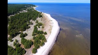
Ruhnu island from bird's-eye
Ruhnu island filmed on Dji mini 2 from bird's-eye. Ruhnu marina and ...
Ruhnu island filmed on Dji mini 2 from bird's-eye. Ruhnu marina and Ruhnu 17-age wooden church are the main POI on the ...
ruhnu arrival
Arriving at harbour of Ringsu on the island of Ruhnu, in Riga Bay.
Arriving at harbour of Ringsu on the island of Ruhnu, in Riga Bay.
Amazing August - Vaindloo _ Ruhnu
Promo of Estonian islands.
Promo of Estonian islands.
Ruhnu saarel juulis 2012
Seltskond insenere ja kultuuriloolasi Ruhnu inimeste ja hoonestusega ...
Seltskond insenere ja kultuuriloolasi Ruhnu inimeste ja hoonestusega tutvumas. Loodus on samuti väga ilus.
Ruhnu Ruhnö visit to the northern part of the island , seal watching at Kuunsi
2 sæler ud for nordspidsen af Ruhnu Ruhnö i Kuunsi.
2 sæler ud for nordspidsen af Ruhnu Ruhnö i Kuunsi.
Ruhnu saar
Этим летом Tallinn Guide club вместе с путешественниками, совершил ...
Этим летом Tallinn Guide club вместе с путешественниками, совершил поездку на самый дальний остров Рухну.
Ruhnu island, Estonia
The island of Ruhnu is considered the most remote from mainland ...
The island of Ruhnu is considered the most remote from mainland Estonia. It is located in the Gulf of Riga in the Baltic Sea and ...
Solo Eastern European Island trip...gone wrong! 🇸🇪🇪🇪
I visited the small Estonian island of Ruhnu, close to Latvia. Ruhnu ...
I visited the small Estonian island of Ruhnu, close to Latvia. Ruhnu is a small charming island that used to be home to a Swedish ...
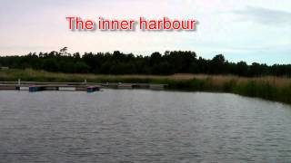
ruhnu.mp4
The harbour of Ringsu on the island of Ruhnu in Riga Bay.
The harbour of Ringsu on the island of Ruhnu in Riga Bay.
Sirmiku Ruhnu Island, Baltic Sea
Putting Sirmiku into context! 🙂
Putting Sirmiku into context! 🙂
Ruhnu island (Estonia)
This is a collection of pics from my visit to Ruhnu island, Estonia ...
This is a collection of pics from my visit to Ruhnu island, Estonia (part of my Baltic Coastal Hiking adventure in 2020). Indeed ...
Estonia is classified as Developed region: nonG7: Developed economies outside of the Group of Seven, characterized by high income and advanced economic structures. The level of income is High income: OECD.
News – Latest Updates and Headlines from Ruhnu Saar
Stay informed with the most recent news and important headlines from Ruhnu Saar. Here’s a roundup of the latest developments.
Loading...
Please note: The data used here has been primarily extracted from satellite readings. Deviations from exact values may occur, particularly regarding the height of elevations and population density. Land area and coastline measurements refer to average values at mean high tide.