
Sakar
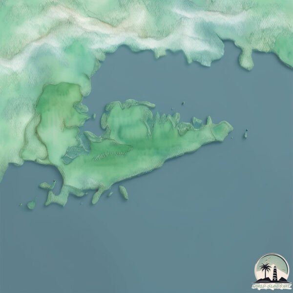
Welcome to Sakar, a Tropical island in the Celebes Sea, part of the majestic Pacific Ocean. This guide offers a comprehensive overview of what makes Sakar unique – from its geography and climate to its population, infrastructure, and beyond. Dive into the details:
- Geography and Size: Explore the island’s size and location.
- Climate and Weather: Weather patterns and temperature.
- Topography and Nature: Uncover the natural wonders of the island.
- Infrastructure and Travelling: Insights on reaching, staying, and making the most of your visit.
- News and Headlines: Latest News.
Geography and size of Sakar
Size: 18.2 km²
Coastline: 39.5 km
Ocean: Pacific Ocean
Sea: Celebes Sea
Continent: Asia
Sakar is a Medium Island spanning 18 km² with a coastline of 39 km.
Archipel: Greater Sunda Islands – A group of large islands in Southeast Asia, including Borneo, Sumatra, Java, and Sulawesi, known for their rich biodiversity and cultural diversity.
Tectonic Plate: Sunda – Extends across Southeast Asia, encompassing parts of the Sunda Shelf, known for its interaction with the Australian Plate, contributing to volcanic activity in Indonesia.
The geographic heart of the island is pinpointed at these coordinates:
Latitude: 4.97013093 / Longitude: 118.33930625
Climate and weather of Sakar
Climate Zone: Tropical
Climate Details: Tropical Rainforest Climate
Temperature: Hot
Climate Characteristics: This climate is typified by heavy rainfall throughout the year, high humidity, and consistently high temperatures, leading to lush rainforests and rich biodiversity. Seasonal temperature variations are minimal.
Topography and nature of Sakar
Timezone: UTC+08:00
Timezone places: Australia/Perth
Max. Elevation: 92 m
Mean Elevation: 42 m
Vegetation: Evergreen Broadleaf Forest
Tree Coverage: 80%
The mean elevation is 42 m. The highest elevation on the island reaches approximately 92 meters above sea level. The island is characterized by Plains: Flat, low-lying lands characterized by a maximum elevation of up to 200 meters. On islands, plains are typically coastal lowlands or central flat areas.
Dominating Vegetation: Evergreen Broadleaf Forest
Characterized by dense, lush canopies of broadleaf trees that retain their leaves year-round. These forests are typically found in tropical and subtropical regions and are known for their high biodiversity. Sakar has a tree cover of 80 %.
Vegetation: 7 vegetation zones – Very Highly Diverse Island
Islands in this range are ecological powerhouses, showcasing a wide array of vegetation zones. Each zone, from lush rainforests to arid scrublands, coastal mangroves to mountainous regions, contributes to a complex and interdependent ecosystem. These islands are often hotspots of biodiversity, supporting numerous species and intricate ecological processes.
Infrastructure and Travelling to Sakar
Does the island have a public airport? no.
There is no public and scheduled airport on Sakar. The nearest airport is Lahad Datu Airport, located 5 km away.
Does the island have a major port? no.
There are no major ports on Sakar. The closest major port is LAHAD DATU, approximately 3 km away.
The mean population of Sakar is 37 per km². Sakar is Gently Populated. The island belongs to Malaysia.
Continuing your journey, Timbun Mata is the next notable island, situated merely km away.
Malaysia is classified as Developing region: Regions characterized by lower income levels, with economies in the process of industrialization and modernization. The level of income is Upper middle income.
News – Latest Updates and Headlines from Sakar
Stay informed with the most recent news and important headlines from Sakar. Here’s a roundup of the latest developments.
- Moderate mag. 4.4 earthquake - West New Britain Province, 192 km northeast of Lae, Papua New Guinea, on Saturday, Oct 3, 2026, at 09:05 pm (Port Moresby time) - Volcano Discoveryon 3 October 2026
Moderate mag. 4.4 earthquake - West New Britain Province, 192 km northeast of Lae, Papua New Guinea, on Saturday, Oct 3, 2026, at 09:05 pm (Port Moresby time) Volcano Discovery
- Moderate mag. 4.3 earthquake - Bismarck Sea, 56 km north of Sakar Island, Morobe Province, Papua New Guinea, on Thursday, Aug 27, 2026, at 02:49 pm (GMT +10) - Volcano Discoveryon 27 August 2026
Moderate mag. 4.3 earthquake - Bismarck Sea, 56 km north of Sakar Island, Morobe Province, Papua New Guinea, on Thursday, Aug 27, 2026, at 02:49 pm (GMT +10) Volcano Discovery
- Moderate mag. 4.7 earthquake - Solomon Sea, 40 km southwest of Kandrian, Papua New Guinea, on Monday, Jun 29, 2026, at 04:45 am (GMT +10) - Volcano Discoveryon 28 June 2026
Moderate mag. 4.7 earthquake - Solomon Sea, 40 km southwest of Kandrian, Papua New Guinea, on Monday, Jun 29, 2026, at 04:45 am (GMT +10) Volcano Discovery
- German tourist dies after losing consciousness while snorkelling off Sabah island - The Staron 17 June 2026
German tourist dies after losing consciousness while snorkelling off Sabah island The Star
- German tourist dies while snorkelling off Lahad Datu - NST Onlineon 17 June 2026
German tourist dies while snorkelling off Lahad Datu NST Online
- Moderate mag. 4.4 earthquake - Solomon Sea, 105 km southeast of Sakar Island, Morobe Province, Papua New Guinea, on Sunday, Jun 7, 2026, at 05:04 am (Port Moresby time) - Volcano Discoveryon 6 June 2026
Moderate mag. 4.4 earthquake - Solomon Sea, 105 km southeast of Sakar Island, Morobe Province, Papua New Guinea, on Sunday, Jun 7, 2026, at 05:04 am (Port Moresby time) Volcano Discovery
- Inside the Kitchen: Seven Questions with Chef Sujan Sarkar of Indienne - Fine Dining Loverson 23 July 2025
Inside the Kitchen: Seven Questions with Chef Sujan Sarkar of Indienne Fine Dining Lovers
- Healthcare Group Refutes Claims That CEO Misused Confidential RI Patient Data for Work at Brown - Go Local Provon 18 February 2025
Healthcare Group Refutes Claims That CEO Misused Confidential RI Patient Data for Work at Brown Go Local Prov
- Aronaimutu Island, Morobe Province, Papua New Guinea, Earthquakes: Latest Quakes - Volcano Discoveryon 31 March 2024
Aronaimutu Island, Morobe Province, Papua New Guinea, Earthquakes: Latest Quakes Volcano Discovery
- Earthquakes in or near Madang Province, Papua New Guinea, This Month: List, Stats, & Map - Volcano Discoveryon 25 March 2024
Earthquakes in or near Madang Province, Papua New Guinea, This Month: List, Stats, & Map Volcano Discovery
Please note: The data used here has been primarily extracted from satellite readings. Deviations from exact values may occur, particularly regarding the height of elevations and population density. Land area and coastline measurements refer to average values at mean high tide.