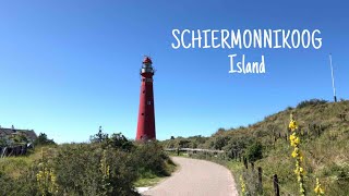
Schiermonnikoog
Welcome to Schiermonnikoog, a Temperate island in the North Sea, part of the majestic Atlantic Ocean. This guide offers a comprehensive overview of what makes Schiermonnikoog unique – from its geography and climate to its population, infrastructure, and beyond. Dive into the details:
- Geography and Size: Explore the island’s size and location.
- Climate and Weather: Weather patterns and temperature.
- Topography and Nature: Uncover the natural wonders of the island.
- Infrastructure and Travelling: Insights on reaching, staying, and making the most of your visit.
- News and Headlines: Latest News.
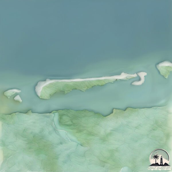
Geography and size of Schiermonnikoog
Size: 44.1 km²
Coastline: 79.7 km
Ocean: Atlantic Ocean
Sea: North Sea
Continent: Europe
Schiermonnikoog is a Medium Island spanning 44 km² with a coastline of 80 km.
Archipel: Frisian Islands – A chain of islands in the North Sea, off the coasts of the Netherlands, Germany, and Denmark, known for their distinctive culture and natural beauty.
Tectonic Plate: Eurasia – One of the world’s largest tectonic plates, the Eurasian Plate covers a significant portion of Europe and Asia. It’s characterized by diverse geological features, including the Ural Mountains, the European Plain, and the Himalayas formed from its collision with the Indian Plate.
The geographic heart of the island is pinpointed at these coordinates:
Latitude: 53.49032712 / Longitude: 6.22231166
Climate and weather of Schiermonnikoog
Climate Zone: Temperate
Climate Details: Temperate Oceanic Climate
Temperature: Warm Summer
Climate Characteristics: Known for its moderate year-round temperatures with ample rainfall and no dry season. Warm summers are characteristic.
Topography and nature of Schiermonnikoog
Timezone: UTC+01:00
Timezone places: Europe/Paris
Max. Elevation: 6 m
Mean Elevation: 0 m
Vegetation: Agricultural Mosaic
Tree Coverage: 57%
The mean elevation is 0 m. The highest elevation on the island reaches approximately 6 meters above sea level. The island is characterized by Plains: Flat, low-lying lands characterized by a maximum elevation of up to 200 meters. On islands, plains are typically coastal lowlands or central flat areas.
Dominating Vegetation: Agricultural Mosaic
A mix of cropland and natural vegetation, often seen in rural landscapes where agricultural fields are interspersed with patches of natural habitats. Schiermonnikoog has a tree cover of 57 %.
Vegetation: 11 vegetation zones – Exceptionally Diverse Island
Islands with more than ten vegetation zones are among the most ecologically rich and varied in the world. These islands are akin to miniature continents, boasting an incredible array of ecosystems. The sheer range of habitats, from high peaks to deep valleys, rainforests to deserts, creates a mosaic of life that is unparalleled. They are crucial for conservation and ecological studies.
Infrastructure and Travelling to Schiermonnikoog
Does the island have a public airport? no.
There is no public and scheduled airport on Schiermonnikoog. The nearest airport is Borkum Airport, located 36 km away.
Does the island have a major port? no.
There are no major ports on Schiermonnikoog. The closest major port is EEMSHAVEN, approximately 49 km away.
The mean population of Schiermonnikoog is 23 per km². Schiermonnikoog is Gently Populated. The island belongs to Netherlands.
Continuing your journey, Rottumerplaat is the next notable island, situated merely km away.
Schiermonnikoog Island Small Island In Netherlands


Netherlands is classified as Developed region: nonG7: Developed economies outside of the Group of Seven, characterized by high income and advanced economic structures. The level of income is High income: OECD.
News – Latest Updates and Headlines from Schiermonnikoog
Stay informed with the most recent news and important headlines from Schiermonnikoog. Here’s a roundup of the latest developments.
Please note: The data used here has been primarily extracted from satellite readings. Deviations from exact values may occur, particularly regarding the height of elevations and population density. Land area and coastline measurements refer to average values at mean high tide.