Sharqi
Welcome to Sharqi, a Dry island in the Mediterranean Sea – Eastern Basin, part of the majestic Atlantic Ocean. This guide offers a comprehensive overview of what makes Sharqi unique – from its geography and climate to its population, infrastructure, and beyond. Dive into the details:
- Geography and Size: Explore the island’s size and location.
- Climate and Weather: Weather patterns and temperature.
- Topography and Nature: Uncover the natural wonders of the island.
- Infrastructure and Travelling: Insights on reaching, staying, and making the most of your visit.
- News and Headlines: Latest News.
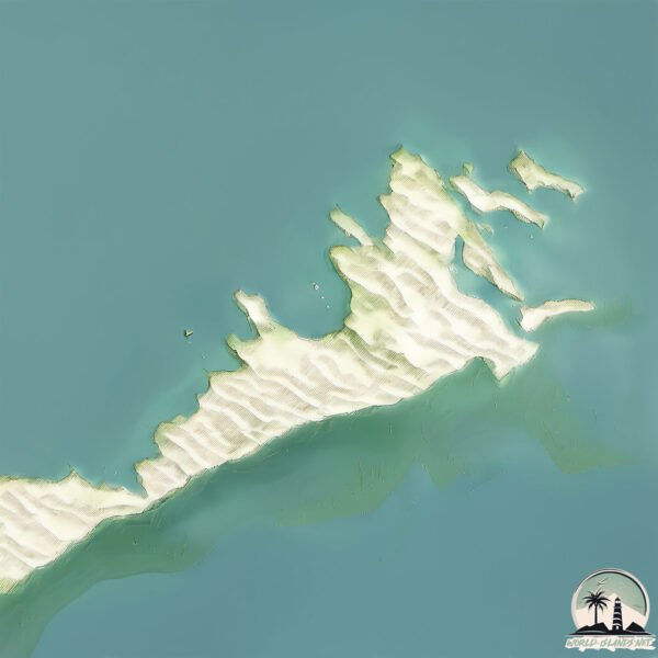
Geography and size of Sharqi
Size: 89.7 km²
Coastline: 107.3 km
Ocean: Atlantic Ocean
Sea: Mediterranean Sea – Eastern Basin
Continent: Africa
Sharqi is a Medium Island spanning 90 km² with a coastline of 107 km.
Archipel: –
Tectonic Plate: Aegean Sea – Located in the eastern Mediterranean, this microplate is characterized by seismic and volcanic activity due to its interaction with the Eurasian and African Plates.
The geographic heart of the island is pinpointed at these coordinates:
Latitude: 34.7378344 / Longitude: 11.22194219
Climate and weather of Sharqi
Climate Zone: Dry
Climate Details: Hot Semi-Arid (Steppe) Climate
Temperature: Hot
Climate Characteristics: Features hot summers and mild to warm winters. Receives more rainfall than hot deserts but less than tropical savannas, leading to a somewhat more varied landscape.
Topography and nature of Sharqi
Timezone: UTC+01:00
Timezone places: Europe/Paris
Max. Elevation: 11 m
Mean Elevation: 1 m
Vegetation: Sparse Vegetation
Tree Coverage: 14%
The mean elevation is 1 m. The highest elevation on the island reaches approximately 11 meters above sea level. The island is characterized by Plains: Flat, low-lying lands characterized by a maximum elevation of up to 200 meters. On islands, plains are typically coastal lowlands or central flat areas.
Dominating Vegetation: Sparse Vegetation
These regions have limited plant growth, typically due to extreme conditions like aridity or poor soils. Vegetation is scattered and consists of hardy plant species. Sharqi has a tree cover of 14 %.
Vegetation: 11 vegetation zones – Exceptionally Diverse Island
Islands with more than ten vegetation zones are among the most ecologically rich and varied in the world. These islands are akin to miniature continents, boasting an incredible array of ecosystems. The sheer range of habitats, from high peaks to deep valleys, rainforests to deserts, creates a mosaic of life that is unparalleled. They are crucial for conservation and ecological studies.
Infrastructure and Travelling to Sharqi
Does the island have a public airport? no.
There is no public and scheduled airport on Sharqi. The nearest airport is Sfax Thyna International Airport, located 48 km away.
Does the island have a major port? no.
There are no major ports on Sharqi. The closest major port is MERSA SFAX, approximately 40 km away.
The mean population of Sharqi is 103 per km². Sharqi is Moderately Inhabited. The island belongs to Tunisia.
Continuing your journey, Melitta is the next notable island, situated merely km away.
I Almost Ran the Boat Aground... again | Sharqi Island, Tunisia


Tunisia is classified as Developing region: Regions characterized by lower income levels, with economies in the process of industrialization and modernization. The level of income is Upper middle income.
News – Latest Updates and Headlines from Sharqi
Stay informed with the most recent news and important headlines from Sharqi. Here’s a roundup of the latest developments.
Please note: The data used here has been primarily extracted from satellite readings. Deviations from exact values may occur, particularly regarding the height of elevations and population density. Land area and coastline measurements refer to average values at mean high tide.