Welcome to Sudest, a Tropical island in the Coral Sea, part of the majestic Pacific Ocean. This guide offers a comprehensive overview of what makes Sudest unique – from its geography and climate to its population, infrastructure, and beyond. Dive into the details:
Geography and size of Sudest
Size: 812.9 km²
Coastline: 240.4 km
Ocean: Pacific Ocean
Sea: Coral Sea
Continent: Oceania
Sudest is a Large Island spanning 813 km² with a coastline of 240 km.
Archipel: Melanesia – A subregion of Oceania in the southwestern Pacific Ocean, including countries like Fiji, Solomon Islands, and Vanuatu, known for their diverse cultures and languages.
Tectonic Plate: Australia – A major tectonic plate covering Australia, New Zealand, and parts of the Indian and Pacific Oceans, known for its relative stability and occasional seismic activity.
The geographic heart of the island is pinpointed at these coordinates:
Latitude: -11.505817 / Longitude: 153.47416291
Climate and weather of Sudest
Climate Zone: Tropical
Climate Details: Tropical Rainforest Climate
Temperature: Hot
Climate Characteristics: This climate is typified by heavy rainfall throughout the year, high humidity, and consistently high temperatures, leading to lush rainforests and rich biodiversity. Seasonal temperature variations are minimal.
Topography and nature of Sudest
Timezone: UTC+10:00
Timezone places: Australia/Sydney
Max. Elevation: 541 m
Mean Elevation: 103 m
Vegetation: Evergreen Broadleaf Forest
Tree Coverage: 81%
The mean elevation is 103 m. The highest elevation on the island reaches approximately 541 meters above sea level. The island is characterized by Plateau: Elevated flatlands rising sharply above the surrounding area, with a maximum elevation over 500 meters but a mean elevation less than 300 meters, forming unique highland areas on islands.
Dominating Vegetation: Evergreen Broadleaf Forest
Characterized by dense, lush canopies of broadleaf trees that retain their leaves year-round. These forests are typically found in tropical and subtropical regions and are known for their high biodiversity. Sudest has a tree cover of 81 %.
Vegetation: 9 vegetation zones – Very Highly Diverse Island
Islands in this range are ecological powerhouses, showcasing a wide array of vegetation zones. Each zone, from lush rainforests to arid scrublands, coastal mangroves to mountainous regions, contributes to a complex and interdependent ecosystem. These islands are often hotspots of biodiversity, supporting numerous species and intricate ecological processes.
Infrastructure and Travelling to Sudest
Does the island have a public airport? no.
There is no public and scheduled airport on Sudest. The nearest airport is Misima Island Airport, located 81 km away.
Does the island have a major port? no.
There are no major ports on Sudest. The closest major port is SULOGA HARBOR, approximately 239 km away.
The mean population of Sudest is 23 per km². Sudest is Gently Populated. The island belongs to Papua New Guinea.
Continuing your journey, Panatinance is the next notable island, situated merely km away.
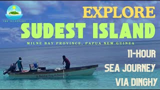
Explore Sudest Island, Milne Bay Province, Papua New Guinea
Welcome to our adventure to the Southeastern most part of Papua New ...
Welcome to our adventure to the Southeastern most part of Papua New Guinea! Setting sail from St. Joseph Parish Basilaki at ...
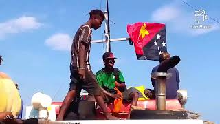
Sudest Island, Gelewaga,Milne bay Province 🥰🙏 #culture #cultureshock
Island Sudest 2024 AJ ft JOBO
PRODUCE BY SSP 2024.
PRODUCE BY SSP 2024.
A trip to sudest island the second last island of PNG.
Alluvial Mining on Sudest Island - Man-Power
The Funniest Custom We’ve Heard on These Remote Islands 😂
Remote islands hold some wild beliefs and customs… and this one might ...
Remote islands hold some wild beliefs and customs… and this one might be the funniest we've heard. Places: Sudest Island ...
Little Island in Sudest
Heading towards tiny island for few minutes rest before continuing on ...
Heading towards tiny island for few minutes rest before continuing on the journey. Beautiful crystal blue seas.
Nimoa Island, Sudest, Milne Bay Province, Papua New Guinea
Nimoa Island is an Island in the Sudest group of Islands in the ...
Nimoa Island is an Island in the Sudest group of Islands in the Samarai Murua district of Milne Bay Province in Papua New Guinea ...
A Brief Tour of the Rambuso Primary School - Sudest Island - Samarai Murua District. MBP.
Find here is the brief tour of the Rambuso Primary School, a school ...
Find here is the brief tour of the Rambuso Primary School, a school whose name that I became too familiar with during my ...
Welcome to Sudest Island - Badia & Tagula Wharf - Yeleyamba Rural LLG - Samarai Murua District
This is the part 2 to my boat trip to Sudest Island in the Yeleyamba ...
This is the part 2 to my boat trip to Sudest Island in the Yeleyamba Rural LLG of the Samarai Murua District of Milne Bay Province ...
Children from Sudest island Papua New Guinea
Normal Rain & Wind on Sudest Island
A normal rain and wind on Sudest Island is like a strong wind! #Vuwovill.
A normal rain and wind on Sudest Island is like a strong wind! #Vuwovill.
How missionaries changed these remote islands in Papua New Guinea.
In this video, we explore a powerful cultural crossroads as Poppy ...
In this video, we explore a powerful cultural crossroads as Poppy joins the villagers of Papua New Guinea in singing Christian ...
Badia Wharf & Tagula Govt Patrol Post - Yeleyamba LLG - Sudest Island - Samarai Murua District. MBP.
Guys, wanna welcome you all to the Badia Wharf area which houses the ...
Guys, wanna welcome you all to the Badia Wharf area which houses the current Business Houses and as well as the Tagula ...
Wanim Island Passage, Sudest Island. Calvados Chain of Islands Lousiade Archipelago| Milne Bay.
Jisas Mesaiya Tagula Island Milne Bay Province Papua New Guinea Tagula Sudest
Ne i ghamba ŋgama ghɨmoru na ne u uno idae Jisas, kaiwae ne i ...
Ne i ghamba ŋgama ghɨmoru na ne u uno idae Jisas, kaiwae ne i vamoruŋgiya le gharɨgharɨ lenji tharɨ e tɨne.” “Ghemi hu ...
A beautiful boat leaves the wharf @simonpiyuwes3407 #adventure #sailor #travel #beach #island
A boats leaves rural Sudest Wharf, Samarai Murua, Milne Bay Province, ...
A boats leaves rural Sudest Wharf, Samarai Murua, Milne Bay Province, Papua New Guinea @simonpiyuwes3407 ...
Oops 😂 #Rugby #Shorts #Sevens
Jorja Miller made an uncharacteristic mistake at the Singapore 7s, the ...
Jorja Miller made an uncharacteristic mistake at the Singapore 7s, the New Zealand 7s star accidentally kicked the ball out early ...
Early morning leaving Gesira waterfalls, Sudest. Virgin forest, crocodile infested river.
The dinghy leaving Gesira waterfalls. Beautiful morning in the ...
The dinghy leaving Gesira waterfalls. Beautiful morning in the hinterlands of Sudest, Milne Bay Province, Papua New Guinea.
The Most Remote Uninhabited Island in the World 📍 Bouvet Island 🏝️#map #geography #explanation
Did you know where is the most remote uninhibited island in the world? ...
Did you know where is the most remote uninhibited island in the world? Where is Bouvet Island? Transcription: What if you want to ...
Traveling from Sudest,Tagula down to Misima Bwagaoya. #nature #naturelovers #naturephotography
What Happens When Poppy Plays Men’s A-Grade Soccer in Papua New Guinea
Poppy makes history on Sudest Island, becoming the first woman to play ...
Poppy makes history on Sudest Island, becoming the first woman to play A-grade soccer—and she scores twice! Places: Sudest ...
No Scourer No Problem
When you live in such remote locations with little to no access to ...
When you live in such remote locations with little to no access to shops it is essential to know techniques that are available from ...
Papua New Guinea is classified as Developing region: Regions characterized by lower income levels, with economies in the process of industrialization and modernization. The level of income is Lower middle income.
News – Latest Updates and Headlines from Sudest
Stay informed with the most recent news and important headlines from Sudest. Here’s a roundup of the latest developments.
Loading...
Please note: The data used here has been primarily extracted from satellite readings. Deviations from exact values may occur, particularly regarding the height of elevations and population density. Land area and coastline measurements refer to average values at mean high tide.