Welcome to Tromoy, a Temperate island in the Skagerrak, part of the majestic Atlantic Ocean. This guide offers a comprehensive overview of what makes Tromoy unique – from its geography and climate to its population, infrastructure, and beyond. Dive into the details:
Geography and size of Tromoy
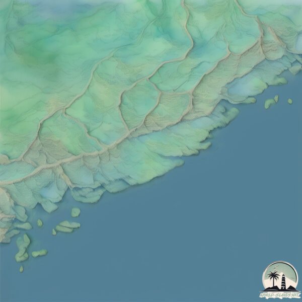
Size: 30 km²
Coastline: 56.7 km
Ocean: Atlantic Ocean
Sea: Skagerrak
Continent: Europe
Tromoy is a Medium Island spanning 30 km² with a coastline of 57 km.
Archipel: –
Tectonic Plate: Eurasia – One of the world’s largest tectonic plates, the Eurasian Plate covers a significant portion of Europe and Asia. It’s characterized by diverse geological features, including the Ural Mountains, the European Plain, and the Himalayas formed from its collision with the Indian Plate.
The geographic heart of the island is pinpointed at these coordinates:
Latitude: 58.46815946 / Longitude: 8.86077927
Climate and weather of Tromoy
Climate Zone: Temperate
Climate Details: Temperate Oceanic Climate
Temperature: Warm Summer
Climate Characteristics: Known for its moderate year-round temperatures with ample rainfall and no dry season. Warm summers are characteristic.
Topography and nature of Tromoy
Timezone: UTC+01:00
Timezone places: Europe/Paris
Max. Elevation: 50 m
Mean Elevation: 22 m
Vegetation: Mixed Forest
Tree Coverage: 92%
The mean elevation is 22 m. The highest elevation on the island reaches approximately 50 meters above sea level. The island is characterized by Plains: Flat, low-lying lands characterized by a maximum elevation of up to 200 meters. On islands, plains are typically coastal lowlands or central flat areas.
Dominating Vegetation: Mixed Forest
A combination of both deciduous and evergreen trees, often found in transitional zones between forest types. These forests offer a diverse habitat for various wildlife species. Tromoy has a tree cover of 92 %.
Vegetation: 7 vegetation zones – Very Highly Diverse Island
Islands in this range are ecological powerhouses, showcasing a wide array of vegetation zones. Each zone, from lush rainforests to arid scrublands, coastal mangroves to mountainous regions, contributes to a complex and interdependent ecosystem. These islands are often hotspots of biodiversity, supporting numerous species and intricate ecological processes.
Infrastructure and Travelling to Tromoy
Does the island have a public airport? no.
There is no public and scheduled airport on Tromoy. The nearest airport is Kristiansand Airport, Kjevik, located 82 km away.
Does the island have a major port? no.
There are no major ports on Tromoy. The closest major port is ARENDAL, approximately 2 km away.
The mean population of Tromoy is 162 per km². Tromoy is Moderately Inhabited. The island belongs to Norway.
Continuing your journey, North Jutlandic is the next notable island, situated merely km away.
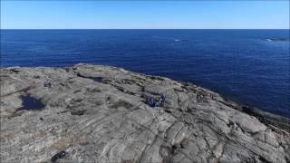
Take a second - Spornes on Tromøy Island in Arendal Norway
Take a second. Let your shoulders drop and the noise fade. There's no rush, just feel the moment and enjoy. The location is at ...Take a second - Spornes on Tromøy Island in Arendal Norway
Take a second. Let your shoulders drop and the noise fade. There's no ...
Take a second. Let your shoulders drop and the noise fade. There's no rush, just feel the moment and enjoy. The location is at ...
WELCOME TO THE HAPPY PLACE☀️🌊 - Hove on Tromøy Island, Arendal, Norway
Escape to a serene happy place with this relaxing journey to Hove on ...
Escape to a serene happy place with this relaxing journey to Hove on Tromøy Island, Arendal, Norway - one of my favorite spots to ...
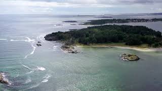
Tromøya - Summer 2022
Beautiful Tromøya in Arendal. Tromøya or Tromøy is the largest island ...
Beautiful Tromøya in Arendal. Tromøya or Tromøy is the largest island in Southern Norway. The 28.6-square-kilometre island is ...
Tourist island Tromøya which is not far from the city of Arendal
Please subscribe to my channel and follow me on Instagram: ...
A trip to Tromøya island near #Arendal , #norway . #thegreatoutdoors #hiking #inthewoods
Tourist island Tromøya which is not far from the city of Arendal
Tourist island Tromøya which is not far from the city of Arendal
Please subscribe to my channel and follow me on Instagram: ...
Daily weather Bottstangen, Blåmannen, Tromøy, Arendal, Norway
09.12.2020.
09.12.2020.
Tourist island Tromøya which is not far from the city of Arendal
Hove, Tromøy, Arendal - video 2011 11 30 12 37 05
Hove.
Hove.
Dji Mavic Pro 2 TROMØYA ARENDAL NORWAY 1 JULY 2020 4K Film!
Is on holiday in Southern Norway. Takes the car to drive to Tromøya, ...
Is on holiday in Southern Norway. Takes the car to drive to Tromøya, located in Arendal. Beautiful. The sun was shining. I had the ...
Arendal, Tur til Øyna og Gitmertangen Fyrlykt, Tromøya #44
Tromøya byr på mange perler. denne lille turen, ( ca 2,5km) helt på ...
Tromøya byr på mange perler. denne lille turen, ( ca 2,5km) helt på østspissen av Tromøya er heller intet unntak. En riktig flott tur ...
Hisøy,Tromøya islas en Arendal Noruega 🇸🇯🇨🇱, vedeo 151
Hola familia viajera,hoy recorreremos y conoceremos ,nuevas islas ...
Hola familia viajera,hoy recorreremos y conoceremos ,nuevas islas stituada en Arendal,al sur de Noruega.
Tromøya påska 2016
Mellom Spornes og Bjellandstrand i påskesol med dronen i sekken.
Mellom Spornes og Bjellandstrand i påskesol med dronen i sekken.
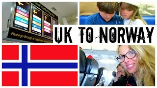
FLYING TO NORWAY - SUMMER HOLIDAY FUN - Tromøy day one | twoplustwocrew
We're off to Norway again for some summer adventures! We flew from ...
We're off to Norway again for some summer adventures! We flew from Gatwick on Norwegian Airlines to Torp Sandiford in ...
Ut på tur, Aldri sur. Hove, Tromøy, Arendal, Norway. Evening Walk.
Strait between Arendal and Tromøya / Norway
HOLIDAY VLOG 2 - Fishing Tromoy | twoplustwocrew
Fishing Tromoy | twoplustwocrew Fun afternoon chasing Mackerel on our ...
Fishing Tromoy | twoplustwocrew Fun afternoon chasing Mackerel on our half term southern Norway holiday. Great fun but we put ...
SOUTHERN NORWAY HOLIDAY VLOG 3 | Twoplustwocrew
SOUTHERN NORWAY HOLIDAY VLOG 3 | Twoplustwocrew Another beautiful day ...
SOUTHERN NORWAY HOLIDAY VLOG 3 | Twoplustwocrew Another beautiful day in Norway... Bike rides, BBQ, and some ...
Arendal. Tur rundt Gjerstadvannet, Tromøya #64
Tromøya er mer enn bare Hove og denne turen er vel verd å få med seg. ...
Tromøya er mer enn bare Hove og denne turen er vel verd å få med seg. Gjerstadvannet ligger midt på Tromøya. Det skifter ...
17 Mai på Tromøy 2020
Av smittevernhensyn ble også innbyggerne på Tromøy, Sørlandets største ...
Av smittevernhensyn ble også innbyggerne på Tromøy, Sørlandets største øy tvunget til å feire nasjonaldagen litt på avstand.
Norway, Arendal, The bridge
HOLIDAY COTTAGE ON AN ISLAND - NORWAY | twoplustwocrew
HOLIDAY COTTAGE ON AN ISLAND - NORWAY | twoplustwocrew We stayed at ...
HOLIDAY COTTAGE ON AN ISLAND - NORWAY | twoplustwocrew We stayed at our friends cottage in Tromoy about an hour from ...
Episode #34 Grimstad til Hove på Tromøya
Vi drar fra Grimstad og kommer til Hoveodden på Tromøya. Dette er også ...
Vi drar fra Grimstad og kommer til Hoveodden på Tromøya. Dette er også et fint stolpejaktsted 🙂 00:00 Avgang fra Grimstad 00:36 ...
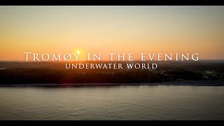
Underwater world Tromøy
diving, snorkeling, freediving, spearfishing, Arendal , Tromøy, Norway.
diving, snorkeling, freediving, spearfishing, Arendal , Tromøy, Norway.
Norway is classified as Developed region: nonG7: Developed economies outside of the Group of Seven, characterized by high income and advanced economic structures. The level of income is High income: OECD.
News – Latest Updates and Headlines from Tromoy
Stay informed with the most recent news and important headlines from Tromoy. Here’s a roundup of the latest developments.
Loading...
Please note: The data used here has been primarily extracted from satellite readings. Deviations from exact values may occur, particularly regarding the height of elevations and population density. Land area and coastline measurements refer to average values at mean high tide.