Welcome to Vatersay Island, a Temperate island in the Inner Seas off the West Coast of Scotland, part of the majestic Atlantic Ocean. This guide offers a comprehensive overview of what makes Vatersay Island unique – from its geography and climate to its population, infrastructure, and beyond. Dive into the details:
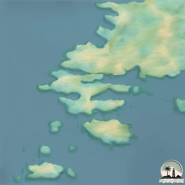
Geography and size of Vatersay Island
Size: 10.1 km²
Coastline: 35.5 km
Ocean: Atlantic Ocean
Sea: Inner Seas off the West Coast of Scotland
Continent: Europe
Vatersay Island is a Medium Island spanning 10 km² with a coastline of 36 km.
Archipel: Outer Hebrides – A chain of islands off the west coast of mainland Scotland, known for their rugged beauty, Gaelic culture, and traditional way of life.
Tectonic Plate: Eurasia – One of the world’s largest tectonic plates, the Eurasian Plate covers a significant portion of Europe and Asia. It’s characterized by diverse geological features, including the Ural Mountains, the European Plain, and the Himalayas formed from its collision with the Indian Plate.
The geographic heart of the island is pinpointed at these coordinates:
Latitude: 56.92930209 / Longitude: -7.53798538
Climate and weather of Vatersay Island
Climate Zone: Temperate
Climate Details: Temperate Oceanic Climate
Temperature: Warm Summer
Climate Characteristics: Known for its moderate year-round temperatures with ample rainfall and no dry season. Warm summers are characteristic.
Topography and nature of Vatersay Island
Timezone: UTC±00:00
Timezone places: Europe/London
Max. Elevation: 91 m
Mean Elevation: 33 m
Vegetation: Open Woodland
Tree Coverage: 41%
The mean elevation is 33 m. The highest elevation on the island reaches approximately 91 meters above sea level. The island is characterized by Plains: Flat, low-lying lands characterized by a maximum elevation of up to 200 meters. On islands, plains are typically coastal lowlands or central flat areas.
Dominating Vegetation: Open Woodland
Characterized by sparsely distributed trees with open canopy allowing sunlight to penetrate, supporting grasses and shrubs underneath. Often found in drier or transitional environments. Vatersay Island has a tree cover of 41 %.
Vegetation: 10 vegetation zones – Very Highly Diverse Island
Islands in this range are ecological powerhouses, showcasing a wide array of vegetation zones. Each zone, from lush rainforests to arid scrublands, coastal mangroves to mountainous regions, contributes to a complex and interdependent ecosystem. These islands are often hotspots of biodiversity, supporting numerous species and intricate ecological processes.
Infrastructure and Travelling to Vatersay Island
Does the island have a public airport? no.
There is no public and scheduled airport on Vatersay Island. The nearest airport is Barra Airport, located 11 km away.
Does the island have a major port? no.
There are no major ports on Vatersay Island. The closest major port is CASTLE BAY, approximately 2 km away.
The mean population of Vatersay Island is 4 per km². Vatersay Island is Gently Populated. The island belongs to United Kingdom.
Continuing your journey, Isle of Barra is the next notable island, situated merely km away.
Barra's Bin Man | Island Crossings | BBC Scotland
Donnie loves working as a bin man, but he has another passion - playing drums in The Vatersay Boys! Watch more: ...Barra's Bin Man | Island Crossings | BBC Scotland
Donnie loves working as a bin man, but he has another passion - ...
Donnie loves working as a bin man, but he has another passion - playing drums in The Vatersay Boys! Watch more: ...
Scotland's Outer Hebrides | Barra, Vatersay & Mingulay (film + guide)
BARRA TRAVEL GUIDE ...
Bodies In The Dunes (Full Episode) | S15 EP3 | Time Team (Barra, Outer Hebrides)
Some burials have been exposed by the wind in the dunes on western ...
Some burials have been exposed by the wind in the dunes on western Barra, dated to the Middle Bronze age. An Iron age ...
Touring the Outer Hebrides, Isles of Barra and Vatersay - Part 1
This video is filmed in 4K and is part of a series touring the ...
This video is filmed in 4K and is part of a series touring the beautiful Outer Hebrides, Scotland in our little white motorhome. In Part ...
FOUR DAYS ON THE SCOTTISH ISLANDS OF BARRA, VATERSAY AND ERISKAY
In March 2022, the photographer Ema Skeldon and her husband Eric ...
In March 2022, the photographer Ema Skeldon and her husband Eric McGougan spent four days on the islands of Barra, Vatersay ...
The Isles of Barra & Vatersay in the Outer Hebrides, Scotland. You have to visit these Islands.
I decide to take a day trip over to the beautiful Islands of BARRA & ...
I decide to take a day trip over to the beautiful Islands of BARRA & VATERSAY…..and I wasn't disappointed!! I am a Professional ...
A day exploring the Isle of Barra & Vatersay, Outer Hebrides | Barra Airport | Kisimul Castle
I've covered the West coast of Barra and the Isle of Vatersay in this ...
I've covered the West coast of Barra and the Isle of Vatersay in this video, enjoying a boat ride out to the famous Kisimul Castle ...
Is This The Best Beach In Scotland? Traigh a Bhaig on the Isle of Vatersay!
Bodies In The Dunes (Full Episode) | S15 EP3 | Time Team (Barra, Outer Hebrides)
Some burials have been exposed by the wind in the dunes on western ...
Some burials have been exposed by the wind in the dunes on western Barra, dated to Middle Bronze age. An Iron age ...
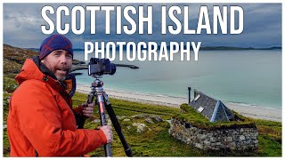
SCOTTISH ISLAND PHOTOGRAPHY: Barra and Vatersay
This week I travel to Barra And Vatersay for some Scottish Island ...
This week I travel to Barra And Vatersay for some Scottish Island Photography in the Outer Hebrides. The Scottish islands of the ...
ISLE OF BARRA AND VATERSAY #OUTER HEBRIDES SCOTLAND 2025
Barra is an island in the Outer Hebrides, Scotland, and the second ...
Barra is an island in the Outer Hebrides, Scotland, and the second southernmost inhabited island there, after the adjacent island ...
Scotsman Walking On Bagh A’Deas Beach On History Visit To Island Of Vatersay Scotland
Tour Scotland very short 4K travel video clip of a Scotsman wearing a ...
Tour Scotland very short 4K travel video clip of a Scotsman wearing a kilt and and Sporran and walking and talking on Bagh ...
Annie Jane - A Tale Without An Ending - Sept 2018 Barra and Vatersay, Western Isles, Scotland
This is a very short documentary on the wreck of the Annie Jane, which ...
This is a very short documentary on the wreck of the Annie Jane, which foundered off West Beach, Vatersay in 1853. It was made ...
Barra the Outer Hebrides BEST ISLAND? 🤩🏴🚐 #outerhebrides
A Place with No Roads: Barra Island, Scotland 🏝️✈️ #facts #history #traverseedudesert
A Place with No Roads: Barra Island, Scotland.
A Place with No Roads: Barra Island, Scotland.
Uncovering Barra's Hidden Gems - Outer Hebrides Road Trip!
OUTER HEBRIDES GUIDE BOOK ...
OUTER HEBRIDES GUIDE BOOK ...
Most beautiful beach in Scotland 🏴 Vatersay, Isle of Barra. Western Isles of Scotland
Quite possible the most beautiful beach in Scotland Vatersay ...
Quite possible the most beautiful beach in Scotland Vatersay beach on the island of Vatersay south of the island ...
Vatersay island, Outer Hebrides, Scotland
Vatersay island, Outer Hebrides, Scotland. Stunning landscape.
Vatersay island, Outer Hebrides, Scotland. Stunning landscape.
Vatersay, Barra, Outer Hebrides.
Vatersay has been for decades the most southerly inhabited island of ...
Vatersay has been for decades the most southerly inhabited island of the Western Isles. Following clearances in the 19th century, ...
Scotsman Walking On Traigh Hamara Beach On History Visit To Island Of Vatersay Scotland
Tour Scotland very short 4K travel video clip of a Scotsman wearing a ...
Tour Scotland very short 4K travel video clip of a Scotsman wearing a kilt and and Sporran and walking on Traigh Hamara Beach ...
Scotland’s Isle of Barra...Where Planes Land on the Sand! ✈️💙
Did YOU know that Scotland is home to the only beach in the WORLD with ...
Did YOU know that Scotland is home to the only beach in the WORLD with scheduled flights?! ✈️ Part of the Outer Hebrides, the ...
The Isles of Barra & Vatersay, Outer Hebrides -Scotland
This lovely island with castle and a beach landing strip, the only ...
This lovely island with castle and a beach landing strip, the only scheduled flight to land on a beach in the world. It is a must for ...
The way to Vatersay - Barra Island -Scotland
Isle of Barra, Western Isles of Scotland 🏴
Barra & Vatersay Island Youth Voices 1
United Kingdom is classified as Developed region: G7: Group of Seven – Major advanced economies, including Canada, France, Germany, Italy, Japan, the United Kingdom, and the United States. The level of income is High income: OECD.
News – Latest Updates and Headlines from Vatersay Island
Stay informed with the most recent news and important headlines from Vatersay Island. Here’s a roundup of the latest developments.
Loading...
Please note: The data used here has been primarily extracted from satellite readings. Deviations from exact values may occur, particularly regarding the height of elevations and population density. Land area and coastline measurements refer to average values at mean high tide.