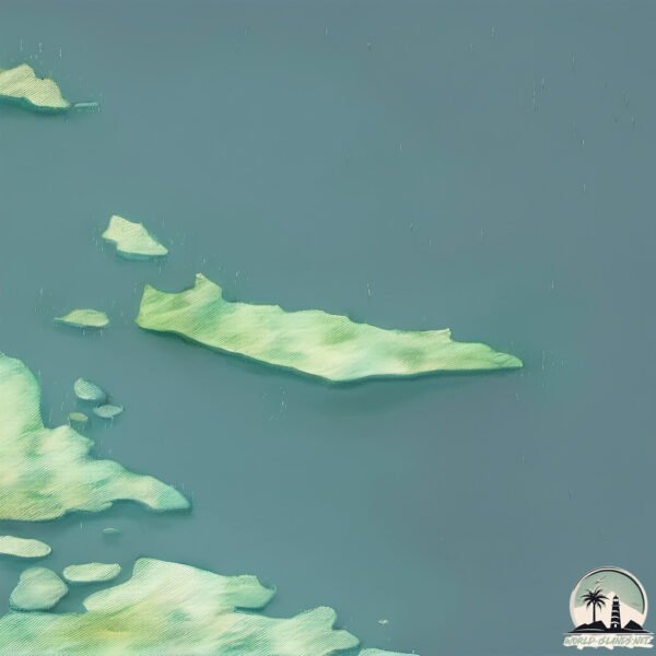
Welcome to Wales Island, a Polar island in the Hudson Strait, part of the majestic Arctic Ocean. This guide offers a comprehensive overview of what makes Wales Island unique – from its geography and climate to its population, infrastructure, and beyond. Dive into the details:
Geography and size of Wales Island
Size: 19 km²
Coastline: 29.4 km
Ocean: Arctic Ocean
Sea: Hudson Strait
Continent: North America
Wales Island is a Medium Island spanning 19 km² with a coastline of 29 km.
Archipel: –
Tectonic Plate: North America – Covers North America and parts of the Atlantic and Arctic Oceans, characterized by diverse geological features and varying levels of seismic activity.
The geographic heart of the island is pinpointed at these coordinates:
Latitude: 61.87161015 / Longitude: -72.05563211
Climate and weather of Wales Island
Climate Zone: Polar
Climate Details: Tundra
Temperature: Cold
Climate Characteristics: The tundra climate features long, extremely cold winters and short, cool summers. Vegetation is limited to mosses, lichens, and small shrubs due to the low temperatures and short growing seasons. Biodiversity is low, but some specialized species thrive.
Topography and nature of Wales Island
Timezone: UTC-05:00
Timezone places: America/New_York
Max. Elevation: 196 m
Mean Elevation: 97 m
Vegetation: Herbaceous Cover
Tree Coverage: 24%
The mean elevation is 97 m. The highest elevation on the island reaches approximately 196 meters above sea level. The island is characterized by Plains: Flat, low-lying lands characterized by a maximum elevation of up to 200 meters. On islands, plains are typically coastal lowlands or central flat areas.
Dominating Vegetation: Herbaceous Cover
Comprising mainly of grasses, herbs, and ferns, these areas are common in prairies, meadows, and savannas, and can vary widely in species composition. Wales Island has a tree cover of 24 %.
Vegetation: 5 vegetation zones – Highly Diverse Island
With five different vegetation zones, these islands offer a rich tapestry of ecosystems. The variety could include dense forests, open meadows, wetlands, coastal zones, and more. This level of diversity supports an intricate web of life, with each zone playing a vital role in the overall ecological health and balance of the island.
Infrastructure and Travelling to Wales Island
Does the island have a public airport? no.
There is no public and scheduled airport on Wales Island. The nearest airport is Kangiqsujuaq (Wakeham Bay) Airport, located 30 km away.
Does the island have a major port? no.
There are no major ports on Wales Island. The closest major port is PANGNIRTUNG, approximately 838 km away.
The mean population of Wales Island is 0 per km². Wales Island is Uninhabited. The island belongs to Canada.
Continuing your journey, Maiden Island is the next notable island, situated merely km away.
Joe Rogan on Visiting Wales Island
Subscribe! #rogandose #roganshorts #roganmoments #stories #wildlife #joeroganpodcast.Joe Rogan on Visiting Wales Island
Subscribe! #rogandose #roganshorts #roganmoments #stories #wildlife ...
Subscribe! #rogandose #roganshorts #roganmoments #stories #wildlife #joeroganpodcast.
Discover the Hidden Gem: Prince of Wales Island, Alaska
Join us as we uncover the breathtaking beauty of Prince of Wales ...
Join us as we uncover the breathtaking beauty of Prince of Wales Island, Alaska, a true hidden gem that promises unforgettable ...
I Found An Abandoned Island in Wales Nobody Will Live On
abandoned #abandonedhouse #abandonedplaces Today we explore an ...
abandoned #abandonedhouse #abandonedplaces Today we explore an Abandoned Island In Wales, Hidden in the Dwyryd ...
Inside Britain's Least Populated Island: Bardsey, Wales | Our Tiny Islands | Channel 4
From exceptional enclaves and secluded sanctuaries to awe-inspiring ...
From exceptional enclaves and secluded sanctuaries to awe-inspiring archipelagos and hidden havens, what's it like to live on ...
Alaska Adventures Prince Of Wales Island
Follow Me On Instagram @noah.network.
Follow Me On Instagram @noah.network.
They Own That Island! | Prince of Wales Island | Alaska | Bigfoot Society 676
In this episode of Bigfoot Society, join us as Larry shares his true ...
In this episode of Bigfoot Society, join us as Larry shares his true encounter with Bigfoot in the remote wilderness of Prince of ...
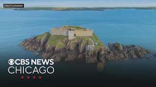
Private Welsh island with 19th century fort goes on the market.
Joe Rogan's Survival In The Prince Wales Island. #jre #podcast #wildlife
Unexplained Encounter in Alaska's Prince of Wales Island #shorts
Deep in Alaska's Tongass National Forest, a chilling encounter unfolds ...
Deep in Alaska's Tongass National Forest, a chilling encounter unfolds on Prince of Wales Island. Jan and her daughter ...
Private island for sale for $4 million off the coast of Wales
Thorne Island, a private island a few miles off the coast of ...
Thorne Island, a private island a few miles off the coast of Pembrokeshire in West Wales, United Kingdom, is for sale.
Craig, Ak Prince of Wales island
Drone footage.
Drone footage.
Welsh island named first 'Dark Sky Sanctuary' in Europe - BBC News
An island in north Wales has been officially recognised for having one ...
An island in north Wales has been officially recognised for having one of the best night skies in the world. Ynys Enlli (Bardsey ...
The "Locals Only" Guide to Thorne Bay, AK: Prince of Wales Island Secrets Revealed
Explore the uncharted territories of Alaska's Thorne Bay Wilderness, a ...
Explore the uncharted territories of Alaska's Thorne Bay Wilderness, a hidden gem for overlanding enthusiasts! Join us on an epic ...
Discovering Labouchere Bay: A Prince of Wales Island, Alaskan Overland Adventure
Join me on an unforgettable overland adventure to Labouchere Bay, a ...
Join me on an unforgettable overland adventure to Labouchere Bay, a hidden gem on Alaska's Prince of Wales Island!
Alaska's Gem: A Tour of Prince of Wales Island's Goblin Inn
This has become one of my favorite places to camp on the island.
This has become one of my favorite places to camp on the island.
Inverted Trees at Prince Of Wales Island BIGFOOT SASQUATCH
Inverted Trees at Prince Of Wales Island, Alaska BIGFOOT SASQUATCH ...
Inverted Trees at Prince Of Wales Island, Alaska BIGFOOT SASQUATCH Clip taken from the 2010 documentary Monsters and ...
Northern Expedition: Exploring Prince of Wales Island, Alaska
I swam with puffins - while disguised as one | Telegraph Travel
Skomer Island nature reserve is home to the largest puffin colony in ...
Skomer Island nature reserve is home to the largest puffin colony in southern Britain. In late-May The Wildlife Trust of South and ...
Fly Fishing Prince of Wales Island
The Karta River Wilderness and Karta River on Prince of Wales Island ...
The Karta River Wilderness and Karta River on Prince of Wales Island is an amazing Fly Fishing destination with opportunity for ...
4k Aerial Footage of Prince of Wales Island in Alaska
Footage I shot of Prince of Wales Island in Alaska with my Mavic Air ...
Footage I shot of Prince of Wales Island in Alaska with my Mavic Air 2S in 4k. I am an aerial drone operator with a part 107 license.
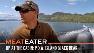
Up at the Cabin: Prince of Wales Island Black Bear | S5E16 | MeatEater
Last spring, Steve decided to pass up an opportunity to kill a black ...
Last spring, Steve decided to pass up an opportunity to kill a black bear in favor of an extended up close and personal experience.
The Upside Down Trees of Prince of Wales Island Alaska | Proof of Bigfoot?
Chuke discusses his trip to Prince of Wales Island and his ...
Chuke discusses his trip to Prince of Wales Island and his investigations into the upside down trees! Artwork in video by Rob Roy ...
Puffin Paradise? Exploring Wales’ Cutest Wildlife Spot 🐧 (Skomer Travel Guide)
Skomer Island is a tiny uninhabited isle off the coast of ...
Skomer Island is a tiny uninhabited isle off the coast of Pembrokeshire in western Wales. Although it's just ten minutes from the ...
Klawock, Ak prince of Wales island
Drone footage of prince of Wales island.
Drone footage of prince of Wales island.
Canada is classified as Developed region: G7: Group of Seven – Major advanced economies, including Canada, France, Germany, Italy, Japan, the United Kingdom, and the United States. The level of income is High income: OECD.
News – Latest Updates and Headlines from Wales Island
Stay informed with the most recent news and important headlines from Wales Island. Here’s a roundup of the latest developments.
Loading...
Please note: The data used here has been primarily extracted from satellite readings. Deviations from exact values may occur, particularly regarding the height of elevations and population density. Land area and coastline measurements refer to average values at mean high tide.