Ward Hunt
Welcome to Ward Hunt, a Polar island in the Arctic Ocean, part of the majestic Arctic Ocean. This guide offers a comprehensive overview of what makes Ward Hunt unique – from its geography and climate to its population, infrastructure, and beyond. Dive into the details:
- Geography and Size: Explore the island’s size and location.
- Climate and Weather: Weather patterns and temperature.
- Topography and Nature: Uncover the natural wonders of the island.
- Infrastructure and Travelling: Insights on reaching, staying, and making the most of your visit.
- News and Headlines: Latest News.
Geography and size of Ward Hunt
Size: 13.4 km²
Coastline: 23.4 km
Ocean: Arctic Ocean
Sea: Arctic Ocean
Continent: North America
Ward Hunt is a Medium Island spanning 13 km² with a coastline of 23 km.
Archipel: Queen Elizabeth Islands – The northernmost part of the Canadian Arctic Archipelago, the Queen Elizabeth Islands are a collection of about 35 major islands. This remote and sparsely populated region is characterized by its polar climate, ice caps, and glaciers. The islands are named in honor of Queen Elizabeth II and are home to diverse Arctic wildlife, including polar bears and seals, and are important for climate research.
Tectonic Plate: North America – Covers North America and parts of the Atlantic and Arctic Oceans, characterized by diverse geological features and varying levels of seismic activity.
The geographic heart of the island is pinpointed at these coordinates:
Latitude: 83.08228221 / Longitude: -74.15708282
Climate and weather of Ward Hunt
Climate Zone: Polar
Climate Details: Tundra
Temperature: Cold
Climate Characteristics: The tundra climate features long, extremely cold winters and short, cool summers. Vegetation is limited to mosses, lichens, and small shrubs due to the low temperatures and short growing seasons. Biodiversity is low, but some specialized species thrive.
Topography and nature of Ward Hunt
Timezone: UTC-05:00
Timezone places: America/New_York
Max. Elevation: 350 m
Mean Elevation: 105 m
Vegetation: Snow and Ice Covered
Tree Coverage: 55%
The mean elevation is 105 m. The highest elevation on the island reaches approximately 350 meters above sea level. The island is characterized by Hills: Gently sloping landforms with rounded tops, having a maximum elevation between 200 and 500 meters. Hills contribute to a varied landscape on islands.
Dominating Vegetation: Snow and Ice Covered
These areas are permanently or seasonally covered in snow and ice, with little to no vegetation, such as polar regions and high mountains. Ward Hunt has a tree cover of 55 %.
Vegetation: 2 vegetation zones – Low Diversity Island
Islands with two distinct vegetation zones offer slightly more ecological variety. These zones could be due to differences in elevation, moisture, or other environmental factors. While still limited in biodiversity, these islands may offer a contrast between the two zones, such as a coastline with mangroves and an inland area with grassland.
Infrastructure and Travelling to Ward Hunt
Does the island have a public airport? no.
There is no public and scheduled airport on Ward Hunt. The nearest airport is Siorapaluk Heliport, located 694 km away.
Does the island have a major port? no.
There are no major ports on Ward Hunt. The closest major port is PITUFFIK (THULE AIR BASE), approximately 921 km away.
The mean population of Ward Hunt is 0 per km². Ward Hunt is Uninhabited. The island belongs to Canada.
Continuing your journey, Bromley Island is the next notable island, situated merely km away.
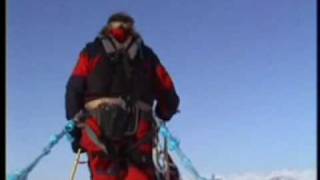
Ward Hunt Island: A Toddler's Last Stop Before The North Pole.


Canada is classified as Developed region: G7: Group of Seven – Major advanced economies, including Canada, France, Germany, Italy, Japan, the United Kingdom, and the United States. The level of income is High income: OECD.
News – Latest Updates and Headlines from Ward Hunt
Stay informed with the most recent news and important headlines from Ward Hunt. Here’s a roundup of the latest developments.
Please note: The data used here has been primarily extracted from satellite readings. Deviations from exact values may occur, particularly regarding the height of elevations and population density. Land area and coastline measurements refer to average values at mean high tide.