Ad Dissan
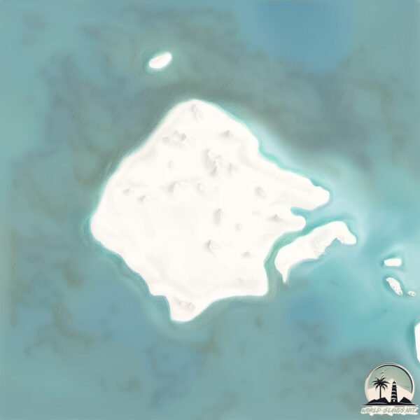
Welcome to Ad Dissan, a Dry island in the Red Sea, part of the majestic Indian Ocean. This guide offers a comprehensive overview of what makes Ad Dissan unique – from its geography and climate to its population, infrastructure, and beyond. Dive into the details:
- Geography and Size: Explore the island’s size and location.
- Climate and Weather: Weather patterns and temperature.
- Topography and Nature: Uncover the natural wonders of the island.
- Infrastructure and Travelling: Insights on reaching, staying, and making the most of your visit.
- News and Headlines: Latest News.
Geography and size of Ad Dissan
Size: 37 km²
Coastline: 26.6 km
Ocean: Indian Ocean
Sea: Red Sea
Continent: Asia
Ad Dissan is a Medium Island spanning 37 km² with a coastline of 27 km.
Archipel: –
Tectonic Plate: Arabia – A major tectonic plate covering the Arabian Peninsula and parts of the Middle East. The plate is primarily continental and known for its collision with the Eurasian Plate, leading to the uplift of the Zagros Mountains.
The geographic heart of the island is pinpointed at these coordinates:
Latitude: 16.9268291 / Longitude: 41.68617013
Climate and weather of Ad Dissan
Climate Zone: Dry
Climate Details: Hot Deserts Climate
Temperature: Hot
Climate Characteristics: Dominated by extremely hot temperatures, this climate is marked by minimal rainfall and barren landscapes. Nights often experience drastic temperature drops.
Topography and nature of Ad Dissan
Timezone: UTC+03:00
Timezone places: Asia/Riyadh
Max. Elevation: 24 m
Mean Elevation: 12 m
Vegetation: Rocky Terrain
Tree Coverage: 1%
The mean elevation is 12 m. The highest elevation on the island reaches approximately 24 meters above sea level. The island is characterized by Plains: Flat, low-lying lands characterized by a maximum elevation of up to 200 meters. On islands, plains are typically coastal lowlands or central flat areas.
Dominating Vegetation: Rocky Terrain
Landscapes dominated by gravel, rock, and stone, with little to no vegetation. These areas are often found in mountainous regions or deserts. Ad Dissan has a tree cover of 1 %.
Vegetation: 4 vegetation zones – Diverse Island
Four distinct vegetation zones mark these islands as ecologically diverse. They might feature varied landscapes such as forests, beaches, grasslands, and rocky areas. Such diversity reflects the island’s complex ecological interactions and varied habitats, which can support a rich array of wildlife and plant species.
Infrastructure and Travelling to Ad Dissan
Does the island have a public airport? no.
There is no public and scheduled airport on Ad Dissan. The nearest airport is Jizan Regional Airport / King Abdullah bin Abdulaziz Airport, located 95 km away.
Does the island have a major port? no.
There are no major ports on Ad Dissan. The closest major port is JIZAN, approximately 84 km away.
The mean population of Ad Dissan is 28 per km². Ad Dissan is Gently Populated. The island belongs to Saudi Arabia.
Continuing your journey, Sarad Sarso is the next notable island, situated merely km away.
Car meet canvey Island Nissan skyline #Nissan #Skyline #CallMe #CarSpotter #Event #EssexCarMate 


Saudi Arabia is classified as Developed region: nonG7: Developed economies outside of the Group of Seven, characterized by high income and advanced economic structures. The level of income is High income: nonOECD.
News – Latest Updates and Headlines from Ad Dissan
Stay informed with the most recent news and important headlines from Ad Dissan. Here’s a roundup of the latest developments.
Please note: The data used here has been primarily extracted from satellite readings. Deviations from exact values may occur, particularly regarding the height of elevations and population density. Land area and coastline measurements refer to average values at mean high tide.