Algodao
Welcome to Algodao, a Tropical island in the South Atlantic Ocean, part of the majestic Atlantic Ocean. This guide offers a comprehensive overview of what makes Algodao unique – from its geography and climate to its population, infrastructure, and beyond. Dive into the details:
- Geography and Size: Explore the island’s size and location.
- Climate and Weather: Weather patterns and temperature.
- Topography and Nature: Uncover the natural wonders of the island.
- Infrastructure and Travelling: Insights on reaching, staying, and making the most of your visit.
- News and Headlines: Latest News.
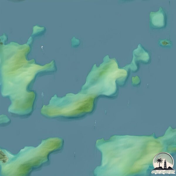
Geography and size of Algodao
Size: 3.194 km²
Coastline: 10.4 km
Ocean: Atlantic Ocean
Sea: South Atlantic Ocean
Continent: South America
Algodao is a Small Island spanning 3.2 km² with a coastline of 10.4 km.
Archipel: –
Tectonic Plate: South America – A major plate covering the South American continent and part of the Atlantic Ocean, known for the Andes mountain range and significant seismic and volcanic activity.
The geographic heart of the island is pinpointed at these coordinates:
Latitude: -23.21452065 / Longitude: -44.60203615
Climate and weather of Algodao
Climate Zone: Tropical
Climate Details: Tropical Monsoon Climate
Temperature: Hot
Climate Characteristics: Characterized by heavy rainfall, high humidity, and uniformly high temperatures, but with a distinct short dry season. It features a seasonal reversal of prevailing wind directions.
Topography and nature of Algodao
Timezone: UTC-03:00
Timezone places: America/Sao_Paulo
Max. Elevation: 103 m
Mean Elevation: 69 m
Vegetation: Evergreen Broadleaf Forest
Tree Coverage: 100%
The mean elevation is 69 m. The highest elevation on the island reaches approximately 103 meters above sea level. The island is characterized by Plains: Flat, low-lying lands characterized by a maximum elevation of up to 200 meters. On islands, plains are typically coastal lowlands or central flat areas.
Dominating Vegetation: Evergreen Broadleaf Forest
Characterized by dense, lush canopies of broadleaf trees that retain their leaves year-round. These forests are typically found in tropical and subtropical regions and are known for their high biodiversity. Algodao has a tree cover of 100 %.
Vegetation: 3 vegetation zones – Moderately Diverse Island
These islands start to show a broader range of ecological niches. With three vegetation zones, they may offer a mix of ecosystems like coastal areas, inland woods, and perhaps a distinct wetland or dry area. This diversity supports a wider range of flora and fauna, making these islands more ecologically complex than those with minimal diversity.
Infrastructure and Travelling to Algodao
Does the island have a public airport? no.
There is no public and scheduled airport on Algodao. The nearest airport is Paraty Airport, located 11 km away.
Does the island have a major port? no.
There are no major ports on Algodao. The closest major port is ANGRA DOS REIS, approximately 36 km away.
The mean population of Algodao is 22 per km². Algodao is Gently Populated. The island belongs to Brazil.
Continuing your journey, Ilha da Marambaia is the next notable island, situated merely km away.
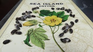
The MOST EXPENSIVE cotton in the world: Sea Island Cotton


Brazil is classified as Emerging region: BRIC: Brazil, Russia, India, and China – Economies noted for their rapid growth and increasing influence on global affairs. The level of income is Upper middle income.
News – Latest Updates and Headlines from Algodao
Stay informed with the most recent news and important headlines from Algodao. Here’s a roundup of the latest developments.
Please note: The data used here has been primarily extracted from satellite readings. Deviations from exact values may occur, particularly regarding the height of elevations and population density. Land area and coastline measurements refer to average values at mean high tide.