Welcome to Alsta, a Continental island in the Norwegian Sea, part of the majestic Arctic Ocean. This guide offers a comprehensive overview of what makes Alsta unique – from its geography and climate to its population, infrastructure, and beyond. Dive into the details:
Geography and size of Alsta
Size: 170.4 km²
Coastline: 219.8 km
Ocean: Arctic Ocean
Sea: Norwegian Sea
Continent: Europe
Alsta is a Large Island spanning 170 km² with a coastline of 220 km.
Archipel: –
Tectonic Plate: Eurasia – One of the world’s largest tectonic plates, the Eurasian Plate covers a significant portion of Europe and Asia. It’s characterized by diverse geological features, including the Ural Mountains, the European Plain, and the Himalayas formed from its collision with the Indian Plate.
The geographic heart of the island is pinpointed at these coordinates:
Latitude: 65.94987018 / Longitude: 12.60103664
Climate and weather of Alsta
Climate Zone: Continental
Climate Details: Warm-Summer Humid Continental Climate
Temperature: Warm Summer
Climate Characteristics: Features warm summers and cold winters with consistent precipitation, common in higher latitudes.
Topography and nature of Alsta
Timezone: UTC+01:00
Timezone places: Europe/Paris
Max. Elevation: 924 m
Mean Elevation: 232 m
Vegetation: Open Woodland
Tree Coverage: 39%
The mean elevation is 232 m. The highest elevation on the island reaches approximately 924 meters above sea level. The island is characterized by Plateau: Elevated flatlands rising sharply above the surrounding area, with a maximum elevation over 500 meters but a mean elevation less than 300 meters, forming unique highland areas on islands.
Dominating Vegetation: Open Woodland
Characterized by sparsely distributed trees with open canopy allowing sunlight to penetrate, supporting grasses and shrubs underneath. Often found in drier or transitional environments. Alsta has a tree cover of 39 %.
Vegetation: 9 vegetation zones – Very Highly Diverse Island
Islands in this range are ecological powerhouses, showcasing a wide array of vegetation zones. Each zone, from lush rainforests to arid scrublands, coastal mangroves to mountainous regions, contributes to a complex and interdependent ecosystem. These islands are often hotspots of biodiversity, supporting numerous species and intricate ecological processes.
Infrastructure and Travelling to Alsta
Does the island have a public airport? yes.
Alsta has a public and scheduled airport. The following airports are located on this island: Sandnessjøen Airport, Stokka.
Does the island have a major port? yes.
Alsta is home to a major port. The following ports are situated on the island: TJOTTA, SANDNESSJOEN.
The mean population of Alsta is 14 per km². Alsta is Gently Populated. The island belongs to Norway.
Continuing your journey, Minlandet is the next notable island, situated merely km away.
In The Incredibles (2004), Why was Elastigirl so damn Thicc🔥.
In The Incredibles (2004), Why was Elastigirl so damn Thicc. #theincredibles #movie #movies #elastigirl.In The Incredibles (2004), Why was Elastigirl so damn Thicc🔥.
In The Incredibles (2004), Why was Elastigirl so damn Thicc. ...
In The Incredibles (2004), Why was Elastigirl so damn Thicc. #theincredibles #movie #movies #elastigirl.
Alsta Watches Now on WatchGauge!
This is my most exciting brand partnership in a LONG Time! Alsta ...
This is my most exciting brand partnership in a LONG Time! Alsta Watches! Made famous in the movie Jaws as Richard Dryfus' ...
Ranking Asta Swords from Weakest to STRONGEST
Ranking Asta Swords from Weakest to STRONGEST Black Clover, Grimoires, ...
Ranking Asta Swords from Weakest to STRONGEST Black Clover, Grimoires, Magic Knights, Clover Kingdom, Asta, Yuno, Wizard ...
5 Watches You Should NEVER Buy!
CHECK OUT THE BEST OF ALIEXPRESS – PAGANI, SAN MARTIN AND SEA-GULL!* ...
How Elastigirl Gave Birth?! 🤯 #fyp #tiktokgemscontest #incredibles #incredibles2 #shorts
How I Caught Mackerel in Norway
mackerel in norway. bait weight 60 grams. coast of Norway, bay of the ...
mackerel in norway. bait weight 60 grams. coast of Norway, bay of the Atlantic Ocean, Alsta Island.
This was so funny! Happy birthday ALLEN! ❤️
The Five Watches You Should NEVER Buy!
Top 5 Summer Watches for 2021 on WatchGauge!
The warm weather is coming! Why not pick out my top 5 watches that are ...
The warm weather is coming! Why not pick out my top 5 watches that are offered on WatchGauge!?! (ok, I threw in a 6th) In no ...
"Never, Ever?" | Elastigirl Edit | The Incredibles 2 | Sabrina Carpenter - espresso
Movie: The Incredibles 2 Song Used : sabrina carpenter - espresso ...
Movie: The Incredibles 2 Song Used : sabrina carpenter - espresso (slowed + reverb) Program used : After Effects 2020/2024 ...
La collezione di orologi di lusso di Alessandro Borghese #orafix #alessandroborghese #orologi
watchcollection #CollezioneDiOrologi #RolexDaytona #ZenithElPrimero ...
watchcollection #CollezioneDiOrologi #RolexDaytona #ZenithElPrimero #CartierTank #TagHeuerMonaco ...
Cheer extreme, senior elite 2024-2025 🩵👑 #cheerleader #cheer
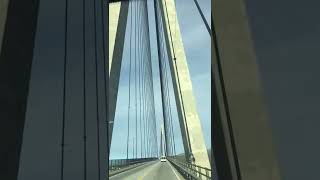
HELGELAND BRIDGE NORTH OF NORWAY 🇳🇴 Helgelandsbrua Nordland#europe
The Helgeland Bridge is a cable-stayed bridge that crosses the ...
The Helgeland Bridge is a cable-stayed bridge that crosses the Leirfjorden between the mainland and the island of Alsta in ...
The dreamlike Helgeland Bridge - Norway / Short film
The beautiful Helgeland Bridge at Sandnessjøen connects the island of ...
The beautiful Helgeland Bridge at Sandnessjøen connects the island of Alsta with the mainland and offers a fantastic view of its ...
Flight Simulator 2020 - POI's - Norway - Helgeland Bridge
In this video we will fly over the Helgeland Bridge. The Helgeland ...
In this video we will fly over the Helgeland Bridge. The Helgeland Bridge (Norwegian: Helgelandsbrua) is a cable-stayed bridge ...
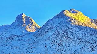
Seven Sisters - Slideshow
The "Seven Sisters" mountain range on the island of Alsta in Norway.
The "Seven Sisters" mountain range on the island of Alsta in Norway.
HELGELAND BRIDGE | SANDNESSJOEN | NORLAND | NORWAY
The Helgeland Bridge is a cable-stayed bridge that crosses the ...
The Helgeland Bridge is a cable-stayed bridge that crosses the Leirfjorden between the mainland and the island of Alsta in ...
Mike Alstott Greatest Runs
National Football League and NFL FOX own the rights to this video* ...
National Football League and NFL FOX own the rights to this video* Michael Joseph Alstott, is a former American football fullback ...
Ruger - WeWe (Official Lyric Video)
'WeWe' taken from Ruger's EP The Second Wave Deluxe, listen here; ...
Nabbit really is like this in New Super Mario Bros. U Deluxe 💀#supermario #mario #shorts
WHAT TO EXPECT WHEN DRIVING AT HELGELAND BRIDGE | NORTH NORWAY
Helgeland Bridge - Helgelandsbrua: The Helgeland Bridge is a ...
Helgeland Bridge - Helgelandsbrua: The Helgeland Bridge is a cable-stayed bridge that crosses the Leirfjorden between the ...
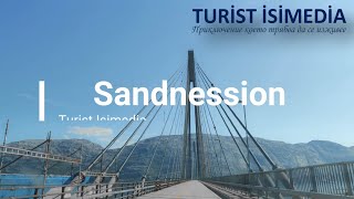
Sandnesson- Bodo- Turist Isimedia - tourist guide
Follow: Turist isimedia web:
http://turist.eks-bg.com Video: Norwegian / Видео: Норвегия - Sandnesson - Bodo Marvin Nikolov ...
ये समुद्र आपस में कभी नहीं मिलते||#sort #trending #facts #alaska #समुद्र
ये समुद्र आपस में कभी नहीं मिलते||#sort #trending #facts #alaska ...
ये समुद्र आपस में कभी नहीं मिलते||#sort #trending #facts #alaska #समुद्र ये समुद्र ...
Norway is classified as Developed region: nonG7: Developed economies outside of the Group of Seven, characterized by high income and advanced economic structures. The level of income is High income: OECD.
News – Latest Updates and Headlines from Alsta
Stay informed with the most recent news and important headlines from Alsta. Here’s a roundup of the latest developments.
Loading...
Please note: The data used here has been primarily extracted from satellite readings. Deviations from exact values may occur, particularly regarding the height of elevations and population density. Land area and coastline measurements refer to average values at mean high tide.