Welcome to Ameland, a Temperate island in the North Sea, part of the majestic Atlantic Ocean. This guide offers a comprehensive overview of what makes Ameland unique – from its geography and climate to its population, infrastructure, and beyond. Dive into the details:
Geography and size of Ameland
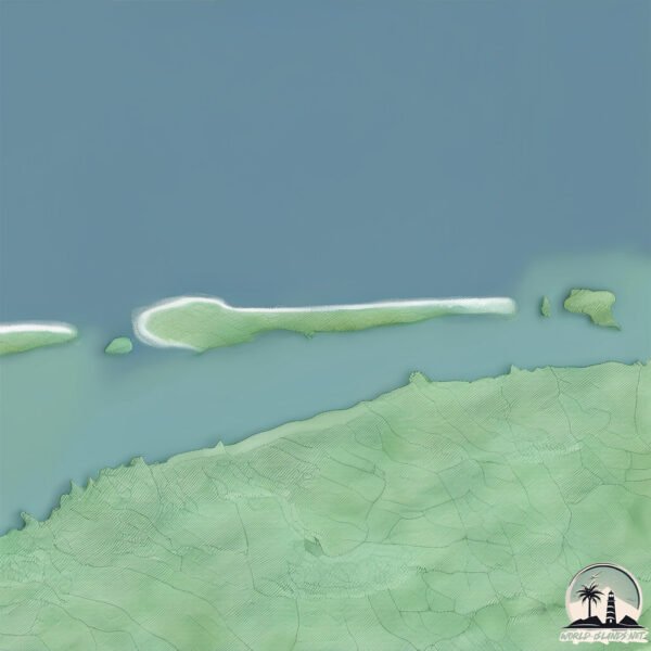
Size: 60.8 km²
Coastline: 78 km
Ocean: Atlantic Ocean
Sea: North Sea
Continent: Europe
Ameland is a Medium Island spanning 61 km² with a coastline of 78 km.
Archipel: Frisian Islands – A chain of islands in the North Sea, off the coasts of the Netherlands, Germany, and Denmark, known for their distinctive culture and natural beauty.
Tectonic Plate: Eurasia – One of the world’s largest tectonic plates, the Eurasian Plate covers a significant portion of Europe and Asia. It’s characterized by diverse geological features, including the Ural Mountains, the European Plain, and the Himalayas formed from its collision with the Indian Plate.
The geographic heart of the island is pinpointed at these coordinates:
Latitude: 53.45029381 / Longitude: 5.7546563
Climate and weather of Ameland
Climate Zone: Temperate
Climate Details: Temperate Oceanic Climate
Temperature: Warm Summer
Climate Characteristics: Known for its moderate year-round temperatures with ample rainfall and no dry season. Warm summers are characteristic.
Topography and nature of Ameland
Timezone: UTC+01:00
Timezone places: Europe/Paris
Max. Elevation: 8 m
Mean Elevation: 1 m
Vegetation: Agricultural Mosaic
Tree Coverage: 35%
The mean elevation is 1 m. The highest elevation on the island reaches approximately 8 meters above sea level. The island is characterized by Plains: Flat, low-lying lands characterized by a maximum elevation of up to 200 meters. On islands, plains are typically coastal lowlands or central flat areas.
Dominating Vegetation: Agricultural Mosaic
A mix of cropland and natural vegetation, often seen in rural landscapes where agricultural fields are interspersed with patches of natural habitats. Ameland has a tree cover of 35 %.
Vegetation: 13 vegetation zones – Exceptionally Diverse Island
Islands with more than ten vegetation zones are among the most ecologically rich and varied in the world. These islands are akin to miniature continents, boasting an incredible array of ecosystems. The sheer range of habitats, from high peaks to deep valleys, rainforests to deserts, creates a mosaic of life that is unparalleled. They are crucial for conservation and ecological studies.
Infrastructure and Travelling to Ameland
Does the island have a public airport? no.
There is no public and scheduled airport on Ameland. The nearest airport is Groningen Airport Eelde, located 78 km away.
Does the island have a major port? no.
There are no major ports on Ameland. The closest major port is HARLINGEN, approximately 36 km away.
The mean population of Ameland is 56 per km². Ameland is Gently Populated. The island belongs to Netherlands.
Continuing your journey, Schiermonnikoog is the next notable island, situated merely km away.
The Beauty of Ameland Island | Best of the Netherlands (Dutch Islands)
I spent a sweet and simple summer on Ameland, one of the pristine Frisian Islands in the Netherlands. Read the full story ...The Beauty of Ameland Island | Best of the Netherlands (Dutch Islands)
I spent a sweet and simple summer on Ameland, one of the pristine ...
I spent a sweet and simple summer on Ameland, one of the pristine Frisian Islands in the Netherlands. Read the full story ...
Ameland island - The Netherlands + Storm
Ameland one of the most beautiful wadden islands in the Netherlands. ...
Ameland one of the most beautiful wadden islands in the Netherlands. We visit this island every year with our family. And of ...
Hollum, Ameland, Island in Netherlands
Dutch Island North Sea Walking Tour 4K 🇳🇱| Ameland (Full Walk)
Experience a peaceful 4K walking tour along the North Sea coast of ...
Experience a peaceful 4K walking tour along the North Sea coast of Ameland, a Dutch island known for its wide beaches, dunes, ...
Ameland. A beautiful island with pretty beaches, fresh air, lots of restaurants and relaxed people.
Ameland | by Drone | 4K
Beautiful aerial images of Ameland - the lighthouse in Hollum in the ...
Beautiful aerial images of Ameland - the lighthouse in Hollum in the west - blowcarts, rafting, paragliding at Ameland Adventures ...
Ameland [Part IV] 4K - Amazing beach, Island nature, beautiful boats, sea sounds and more
I make videos where you will feel the different parts of the world ...
I make videos where you will feel the different parts of the world closely and capture the ambiance. I show you interesting places, ...
Ameland for the weekend! Quick impression of this Dutch Island!
We made a small and quick video about celebrating our second wedding ...
We made a small and quick video about celebrating our second wedding anniversary on the Dutch island Ameland. Hope you ...
A SECLUDED NUDIST BEACH IN AMELAND (friesland, the netherlands)
In this episode, Michelle and Alex explore the Dutch Frisian Island ...
In this episode, Michelle and Alex explore the Dutch Frisian Island that's known to have some of the best food (according to The ...
Ameland 2023 | Drone | 4K
Some aerial footage of Ameland captured by drone during my one-week ...
Some aerial footage of Ameland captured by drone during my one-week trip to this beautiful island located in the north coast of ...
AMELAND BEACH AND DUNES 2020 - Dutch Wadden Island Time Capsule
AMELAND BEACH AND DUNES 2020 - Dutch Wadden Island Time Capsule ...
AMELAND BEACH AND DUNES 2020 - Dutch Wadden Island Time Capsule Ameland island 2020: Pristine North Sea beaches, ...
Swinging into paradise at Ameland #BeachGolf #AmelandAdventures #PerfectDay #iamsterdam #ameland
islandlife #islandofnetherland #goldensands #golfshorts #golf ...
islandlife #islandofnetherland #goldensands #golfshorts #golf #westfrisianisland #friesland #amelander #duinenameland ...
Ameland Island
Ameland It is a municipality and one of the West Frisian Islands off ...
Ameland It is a municipality and one of the West Frisian Islands off the north coast of the Netherlands. It consists mostly of sand ...
Ameland 1von 3 Im Flug von Ost nach West - von Buren bis Hollum
Die Ferieninsel Ameland, für den Niederrhein und dem Münsterland seit ...
Die Ferieninsel Ameland, für den Niederrhein und dem Münsterland seit Jahrzehnten als Kinderferieninsel bekannt, ist in den ...
Hotel Ameland
Videopresentatie van hotel Ameland. Dit 3* hotel is gelegen in Nes. In ...
Videopresentatie van hotel Ameland. Dit 3* hotel is gelegen in Nes. In 2012 een Bib vermelding gekregen in de Michelin gids.
Island Ameland landuse change 1996 - 2017
Timelapse animation of land use change between 1996 - 2017 at the ...
Timelapse animation of land use change between 1996 - 2017 at the island of Ameland (one of the West Frisian Islands) ...
AMELAND, island The Netherlands
*WAIT FOR IT* Ameland, Netherlands | Wind surfing | Island life | Beach life | Desi Dutch Couple
Wait for it Loving the view from the islands in the north of the ...
Wait for it Loving the view from the islands in the north of the Netherlands! Dreaming to try this once • • • #desidutch ...
Ameland , island in Netherlands ♡♡☆ beautiful view
Ameland Island #The Netherlands
Netherland Trip - Ameland Island - A beautiful Place
Netherland Trip - Ameland Island - A beautiful island.
Netherland Trip - Ameland Island - A beautiful island.
Ameland 4K | Netherland | Ameland, the island for the entire family #VVVAmeland #Ameland#Netherlands
Ameland is a municipality and one of the West Frisian Islands off the ...
Ameland is a municipality and one of the West Frisian Islands off the north coast of the Netherlands. It consists mostly of sand ...
Ontdek het eiland Ameland!
Meer weten over de camping? Klik hier: ...
ameland island trip 2021
a weeks walkabout on dutch island........ soundtrack song......turn ...
a weeks walkabout on dutch island........ soundtrack song......turn that damn thing down.....all rights reserved james williams.
A Day on Ameland Island – Nature, Beaches & Dutch Charm | Telugu travel vlog | Nes | Ballum | Hollum
Join me as I explore the beautiful island of Ameland, one of the ...
Join me as I explore the beautiful island of Ameland, one of the best-kept secrets in the Netherlands! From sandy beaches and ...
Netherlands is classified as Developed region: nonG7: Developed economies outside of the Group of Seven, characterized by high income and advanced economic structures. The level of income is High income: OECD.
News – Latest Updates and Headlines from Ameland
Stay informed with the most recent news and important headlines from Ameland. Here’s a roundup of the latest developments.
Loading...
Please note: The data used here has been primarily extracted from satellite readings. Deviations from exact values may occur, particularly regarding the height of elevations and population density. Land area and coastline measurements refer to average values at mean high tide.


![Ameland [Part IV] 4K - Amazing beach, Island nature, beautiful boats, sea sounds and more](https://i.ytimg.com/vi/w5KcdZxz7Ww/mqdefault.jpg)


