Angamos
Welcome to Angamos, a Polar island in the South Pacific Ocean, part of the majestic Pacific Ocean. This guide offers a comprehensive overview of what makes Angamos unique – from its geography and climate to its population, infrastructure, and beyond. Dive into the details:
- Geography and Size: Explore the island’s size and location.
- Climate and Weather: Weather patterns and temperature.
- Topography and Nature: Uncover the natural wonders of the island.
- Infrastructure and Travelling: Insights on reaching, staying, and making the most of your visit.
- News and Headlines: Latest News.
Geography and size of Angamos
Size: 452.6 km²
Coastline: 285.4 km
Ocean: Pacific Ocean
Sea: South Pacific Ocean
Continent: South America
Angamos is a Large Island spanning 453 km² with a coastline of 285 km.
Archipel: Cordillera Patagónica Insular – A series of islands in the Patagonian region, known for their dramatic landscapes and part of the Andean mountain range.
Tectonic Plate: South America – A major plate covering the South American continent and part of the Atlantic Ocean, known for the Andes mountain range and significant seismic and volcanic activity.
The geographic heart of the island is pinpointed at these coordinates:
Latitude: -49.11099837 / Longitude: -74.98228987
Climate and weather of Angamos
Climate Zone: Polar
Climate Details: Tundra
Temperature: Cold
Climate Characteristics: The tundra climate features long, extremely cold winters and short, cool summers. Vegetation is limited to mosses, lichens, and small shrubs due to the low temperatures and short growing seasons. Biodiversity is low, but some specialized species thrive.
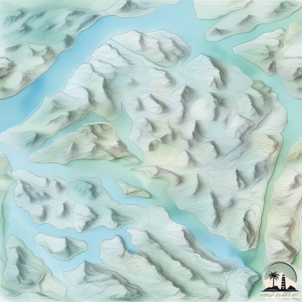
Topography and nature of Angamos
Timezone: UTC-04:00
Timezone places: America/La_Paz
Max. Elevation: 960 m
Mean Elevation: 355 m
Vegetation: Evergreen Broadleaf Forest
Tree Coverage: 40%
The mean elevation is 355 m. The highest elevation on the island reaches approximately 960 meters above sea level. The island is characterized by Mountains: High, steeply elevated landforms. Characterized by both a high maximum elevation (over 500 meters) and a high mean elevation, creating rugged, mountainous terrains on islands.
Dominating Vegetation: Evergreen Broadleaf Forest
Characterized by dense, lush canopies of broadleaf trees that retain their leaves year-round. These forests are typically found in tropical and subtropical regions and are known for their high biodiversity. Angamos has a tree cover of 40 %.
Vegetation: 11 vegetation zones – Exceptionally Diverse Island
Islands with more than ten vegetation zones are among the most ecologically rich and varied in the world. These islands are akin to miniature continents, boasting an incredible array of ecosystems. The sheer range of habitats, from high peaks to deep valleys, rainforests to deserts, creates a mosaic of life that is unparalleled. They are crucial for conservation and ecological studies.
Infrastructure and Travelling to Angamos
Does the island have a public airport? no.
There is no public and scheduled airport on Angamos. The nearest airport is El Calafate – Commander Armando Tola International Airport, located 332 km away.
Does the island have a major port? no.
There are no major ports on Angamos. The closest major port is PUERTO NATALES, approximately 372 km away.
The mean population of Angamos is 1 per km². Angamos is Uninhabited. The island belongs to Chile.
The name of the island resonates across different cultures and languages. Here is how it is known around the world: Arabic: جزيرة ويلينغتون; German: Wellington; Spanish: Isla Wellington; French: île Wellington; Portuguese: Ilha Wellington; Russian: Веллингтон; Chinese: 惠靈頓島
Continuing your journey, Lavinia is the next notable island, situated merely km away.
On Hire Bunker + Condition Survey at Angamos, Chile.


Chile is classified as Emerging region: G20: Group of Twenty – Major economies comprising both developed and emerging countries, representing the world’s largest economies. The level of income is Upper middle income.
News – Latest Updates and Headlines from Angamos
Stay informed with the most recent news and important headlines from Angamos. Here’s a roundup of the latest developments.
Please note: The data used here has been primarily extracted from satellite readings. Deviations from exact values may occur, particularly regarding the height of elevations and population density. Land area and coastline measurements refer to average values at mean high tide.