Austvagoy
Welcome to Austvagoy, a Continental island in the Norwegian Sea, part of the majestic Arctic Ocean. This guide offers a comprehensive overview of what makes Austvagoy unique – from its geography and climate to its population, infrastructure, and beyond. Dive into the details:
- Geography and Size: Explore the island’s size and location.
- Climate and Weather: Weather patterns and temperature.
- Topography and Nature: Uncover the natural wonders of the island.
- Infrastructure and Travelling: Insights on reaching, staying, and making the most of your visit.
- News and Headlines: Latest News.
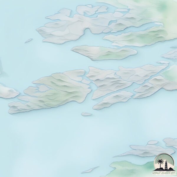
Geography and size of Austvagoy
Size: 536 km²
Coastline: 454.6 km
Ocean: Arctic Ocean
Sea: Norwegian Sea
Continent: Europe
Austvagoy is a Large Island spanning 536 km² with a coastline of 455 km.
Archipel: Lofoten – An archipelago in Norway, within the Arctic Circle, known for its dramatic scenery, fishing heritage, and as a popular tourist destination.
Tectonic Plate: Eurasia – One of the world’s largest tectonic plates, the Eurasian Plate covers a significant portion of Europe and Asia. It’s characterized by diverse geological features, including the Ural Mountains, the European Plain, and the Himalayas formed from its collision with the Indian Plate.
The geographic heart of the island is pinpointed at these coordinates:
Latitude: 68.33183175 / Longitude: 14.64974446
Climate and weather of Austvagoy
Climate Zone: Continental
Climate Details: Subarctic Climate
Temperature: Cold Summer
Climate Characteristics: Characterized by long, extremely cold winters and short, cool summers, often found in northern latitudes of North America and Eurasia.
Topography and nature of Austvagoy
Timezone: UTC+01:00
Timezone places: Europe/Paris
Max. Elevation: 937 m
Mean Elevation: 274 m
Vegetation: Open Woodland
Tree Coverage: 46%
The mean elevation is 274 m. The highest elevation on the island reaches approximately 937 meters above sea level. The island is characterized by Plateau: Elevated flatlands rising sharply above the surrounding area, with a maximum elevation over 500 meters but a mean elevation less than 300 meters, forming unique highland areas on islands.
Dominating Vegetation: Open Woodland
Characterized by sparsely distributed trees with open canopy allowing sunlight to penetrate, supporting grasses and shrubs underneath. Often found in drier or transitional environments. Austvagoy has a tree cover of 46 %.
Vegetation: 10 vegetation zones – Very Highly Diverse Island
Islands in this range are ecological powerhouses, showcasing a wide array of vegetation zones. Each zone, from lush rainforests to arid scrublands, coastal mangroves to mountainous regions, contributes to a complex and interdependent ecosystem. These islands are often hotspots of biodiversity, supporting numerous species and intricate ecological processes.
Infrastructure and Travelling to Austvagoy
Does the island have a public airport? yes.
Austvagoy has a public and scheduled airport. The following airports are located on this island: Svolvær Airport, Helle.
Does the island have a major port? no.
There are no major ports on Austvagoy. The closest major port is SVOLVAER, approximately 1 km away.
The mean population of Austvagoy is 17 per km². Austvagoy is Gently Populated. The island belongs to Norway.
The name of the island resonates across different cultures and languages. Here is how it is known around the world: Arabic: جزر لوفوتن; German: Lofoten; Spanish: Islas Lofoten; French: Îles Lofoten; Portuguese: Lofoten; Russian: Лофотенские острова; Chinese: 罗弗敦群岛
Continuing your journey, Stormolla is the next notable island, situated merely km away.
Sunnlandsfjorden, Austvågøy in Lofoten by drone 4k


Norway is classified as Developed region: nonG7: Developed economies outside of the Group of Seven, characterized by high income and advanced economic structures. The level of income is High income: OECD.
News – Latest Updates and Headlines from Austvagoy
Stay informed with the most recent news and important headlines from Austvagoy. Here’s a roundup of the latest developments.
Please note: The data used here has been primarily extracted from satellite readings. Deviations from exact values may occur, particularly regarding the height of elevations and population density. Land area and coastline measurements refer to average values at mean high tide.