Bai Sha
Welcome to Bai Sha, a Temperate island in the South China Sea, part of the majestic Pacific Ocean. This guide offers a comprehensive overview of what makes Bai Sha unique – from its geography and climate to its population, infrastructure, and beyond. Dive into the details:
- Geography and Size: Explore the island’s size and location.
- Climate and Weather: Weather patterns and temperature.
- Topography and Nature: Uncover the natural wonders of the island.
- Infrastructure and Travelling: Insights on reaching, staying, and making the most of your visit.
- News and Headlines: Latest News.
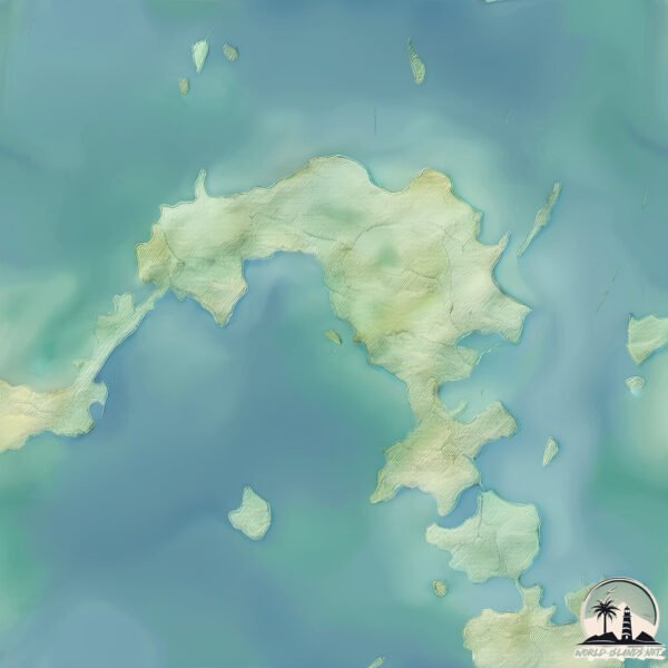
Geography and size of Bai Sha
Size: 14.9 km²
Coastline: 31 km
Ocean: Pacific Ocean
Sea: South China Sea
Continent: Asia
Bai Sha is a Medium Island spanning 15 km² with a coastline of 31 km.
Archipel: –
Tectonic Plate: Philippine Sea – An oceanic tectonic plate beneath the Philippine Sea, east of the Philippines. It’s involved in complex interactions with the surrounding Eurasian, Pacific, and Indo-Australian plates, leading to significant volcanic and seismic activity in the region.
The geographic heart of the island is pinpointed at these coordinates:
Latitude: 23.65619879 / Longitude: 119.58671437
Climate and weather of Bai Sha
Climate Zone: Temperate
Climate Details: Monsoon-Influenced Humid Subtropical Climate
Temperature: Hot Summer
Climate Characteristics: Known for hot, humid summers with significant monsoon rains, contrasted by mild, drier winters.
Topography and nature of Bai Sha
Timezone: UTC+08:00
Timezone places: Australia/Perth
Max. Elevation: 26 m
Mean Elevation: 13 m
Vegetation: Agricultural Mosaic
Tree Coverage: 25%
The mean elevation is 13 m. The highest elevation on the island reaches approximately 26 meters above sea level. The island is characterized by Plains: Flat, low-lying lands characterized by a maximum elevation of up to 200 meters. On islands, plains are typically coastal lowlands or central flat areas.
Dominating Vegetation: Agricultural Mosaic
A mix of cropland and natural vegetation, often seen in rural landscapes where agricultural fields are interspersed with patches of natural habitats. Bai Sha has a tree cover of 25 %.
Vegetation: 10 vegetation zones – Very Highly Diverse Island
Islands in this range are ecological powerhouses, showcasing a wide array of vegetation zones. Each zone, from lush rainforests to arid scrublands, coastal mangroves to mountainous regions, contributes to a complex and interdependent ecosystem. These islands are often hotspots of biodiversity, supporting numerous species and intricate ecological processes.
Infrastructure and Travelling to Bai Sha
Does the island have a public airport? no.
There is no public and scheduled airport on Bai Sha. The nearest airport is Penghu Magong Airport, located 7 km away.
Does the island have a major port? no.
There are no major ports on Bai Sha. The closest major port is PENG-HU KANG, approximately 8 km away.
The mean population of Bai Sha is 232 per km². Bai Sha is Moderately Inhabited. The island belongs to Taiwan.
Continuing your journey, Penghu is the next notable island, situated merely km away.
Hainan in 30 Seconds——Baisha Li Autonomous County

![[PENGHU] Xiyu and Baisha Islands (澎湖西嶼島白沙島)](https://i.ytimg.com/vi/BglyGnH8lSM/mqdefault.jpg)

Taiwan is classified as Developed region: nonG7: Developed economies outside of the Group of Seven, characterized by high income and advanced economic structures. The level of income is High income: nonOECD.
News – Latest Updates and Headlines from Bai Sha
Stay informed with the most recent news and important headlines from Bai Sha. Here’s a roundup of the latest developments.
Please note: The data used here has been primarily extracted from satellite readings. Deviations from exact values may occur, particularly regarding the height of elevations and population density. Land area and coastline measurements refer to average values at mean high tide.