Welcome to Ballalae, a Tropical island in the Solomon Sea, part of the majestic Pacific Ocean. This guide offers a comprehensive overview of what makes Ballalae unique – from its geography and climate to its population, infrastructure, and beyond. Dive into the details:
Geography and size of Ballalae
Size: 1.937 km²
Coastline: 6.5 km
Ocean: Pacific Ocean
Sea: Solomon Sea
Continent: Oceania
Ballalae is a Small Island spanning 1.9 km² with a coastline of 6.5 km.
Archipel: Melanesia – A subregion of Oceania in the southwestern Pacific Ocean, including countries like Fiji, Solomon Islands, and Vanuatu, known for their diverse cultures and languages.
Tectonic Plate: Sunda – Extends across Southeast Asia, encompassing parts of the Sunda Shelf, known for its interaction with the Australian Plate, contributing to volcanic activity in Indonesia.
The geographic heart of the island is pinpointed at these coordinates:
Latitude: -6.99169576 / Longitude: 155.88593715
Climate and weather of Ballalae
Climate Zone: Tropical
Climate Details: Tropical Rainforest Climate
Temperature: Hot
Climate Characteristics: This climate is typified by heavy rainfall throughout the year, high humidity, and consistently high temperatures, leading to lush rainforests and rich biodiversity. Seasonal temperature variations are minimal.
Topography and nature of Ballalae
Timezone: UTC+11:00
Timezone places: Pacific/Guadalcanal
Max. Elevation: 13 m
Mean Elevation: 8 m
Vegetation: Evergreen Broadleaf Forest
Tree Coverage: 66%
The mean elevation is 8 m. The highest elevation on the island reaches approximately 13 meters above sea level. The island is characterized by Plains: Flat, low-lying lands characterized by a maximum elevation of up to 200 meters. On islands, plains are typically coastal lowlands or central flat areas.
Dominating Vegetation: Evergreen Broadleaf Forest
Characterized by dense, lush canopies of broadleaf trees that retain their leaves year-round. These forests are typically found in tropical and subtropical regions and are known for their high biodiversity. Ballalae has a tree cover of 66 %.
Vegetation: 4 vegetation zones – Diverse Island
Four distinct vegetation zones mark these islands as ecologically diverse. They might feature varied landscapes such as forests, beaches, grasslands, and rocky areas. Such diversity reflects the island’s complex ecological interactions and varied habitats, which can support a rich array of wildlife and plant species.
Infrastructure and Travelling to Ballalae
Does the island have a public airport? yes.
Ballalae has a public and scheduled airport. The following airports are located on this island: Ballalae Airport.
Does the island have a major port? no.
There are no major ports on Ballalae. The closest major port is KIETA, approximately 90 km away.
The mean population of Ballalae is 13 per km². Ballalae is Gently Populated. The island belongs to Solomon Islands.
Continuing your journey, Shortland is the next notable island, situated merely km away.
WW2 Japanese Aircraft In Balalae Island
aircraft #abondoned #ww2 #balalae island Thank you for watching my video. Please subscribe my channel. and Thank you for ...WW2 Japanese Aircraft In Balalae Island
aircraft #abondoned #ww2 #balalae island Thank you for watching my ...
aircraft #abondoned #ww2 #balalae island Thank you for watching my video. Please subscribe my channel. and Thank you for ...
Balalae Island
Balalae Island (or Ballale/Ballali) is an island of the Shortland ...
Balalae Island (or Ballale/Ballali) is an island of the Shortland Islands Group in the Western Province of the Solomon Islands.
Ballalae Airfield - Wreckage
Video compilation of aircraft wreckage on Ballalae Airfield, Shortland ...
Video compilation of aircraft wreckage on Ballalae Airfield, Shortland Islands, Solomon Islands - December 2018. Aircraft being ...
Ballalae Island
Remains of Japanese aircraft from World War Two photographed in the ...
Remains of Japanese aircraft from World War Two photographed in the jungle on Ballalae Island, Solomon Islands.
Thank You! 🇸🇧 | WW2 GUADALCANAL 80th Anniversary Expedition to Solomon Islands 🇸🇧 | Oct/Nov 2022
We just completed VICTORY IN THE SOLOMONS, our Guadalcanal 80th ...
We just completed VICTORY IN THE SOLOMONS, our Guadalcanal 80th anniversary expedition to Solomon Islands (and ...
Landing at Ballalae Airport on Ballalae Island, Solomon Islands Microsoft Flight Simulator 2020
This is a simulation of landing at Ballalae Airport on Ballalae ...
This is a simulation of landing at Ballalae Airport on Ballalae Island, Solomon Islands Microsoft Flight Simulator 2020.
Shortland & Ballalae Aircraft Salvage
ONE NEWS First Aired: November 20, 2007 HOST Tina Lemazi: Solomon ...
ONE NEWS First Aired: November 20, 2007 HOST Tina Lemazi: Solomon Islands is known overseas for the role it played in the ...
Finding abandoned WW2 planes on Balalae Island in the Solomon Islands
balalae #solomonislands #ww2 #planes We visit a remote tropical island ...
balalae #solomonislands #ww2 #planes We visit a remote tropical island found Japanese WW2 planes / Balalae Island in the ...
Our quirentine In shortland islands (solomon island)
AA23 Flying Safari in Solomon Islands to Gizo, Ballalae & Mono Islands.
Comanche 5 Coral Sea Flying Safari from Gizo to WW 2 Japanese ...
Comanche 5 Coral Sea Flying Safari from Gizo to WW 2 Japanese aerodromes on Ballalae and Mono Islands in Solomon Islands.
Battle of Gavutu - Tanambogo Islands - 75 years later
Video of battlefield area of Gavutu and Tanambogo Islands, Solomon ...
Video of battlefield area of Gavutu and Tanambogo Islands, Solomon Islands the scene of fierce fighting by US and Japanese ...
Sailing the Solomon Islands, WW2 aircraft wreck dive.
In this video we scuba dive on an American WW2 Hellcat fighter ...
In this video we scuba dive on an American WW2 Hellcat fighter aircraft and also a Japanese ship wreck. We also enter a bat cave ...
WWII bomb disposal in The Solomons
NZDF personnel have recently returned from Operation Pukuarua in The ...
NZDF personnel have recently returned from Operation Pukuarua in The Solomon Islands. The Navy dive team and Army EOD ...
Movement of Japanese to Fauro Island
Japanese Marines and soldiers in the Buin area of South Bougainville ...
Japanese Marines and soldiers in the Buin area of South Bougainville were moved to concentration centres on the Fauro Island, ...
John Basilone - Battle site, Guadalcanal, Solomon Islands
Video of the area in which John Basilone fought and was recognised ...
Video of the area in which John Basilone fought and was recognised with a Medal of Honour during the battle for Guadalcanal, ...
Red Beach, Gudalcanal Province, Solomon Islands
Aerial footage of Red Beach, site of the USMC landings at guadalcanal ...
Aerial footage of Red Beach, site of the USMC landings at guadalcanal in the Solomon Islands during WW2 and the Battle of ...
HMAS Diamantina Destroys WWII Bombs in Solomon Islands
Courtesy: Australian Government Department of Defence This video has ...
Courtesy: Australian Government Department of Defence This video has been uploaded for use by Storyful's subscription clients ...
Wrecked airplanes and ships in Solomon Island during World War 2 HD Stock Footage
CriticalPast is an archive of historic footage. The vintage footage in ...
CriticalPast is an archive of historic footage. The vintage footage in this video has been uploaded for research purposes, and is ...
Part 1 Return to Vella Lavella
In 2012 Peter Sugden retraced his father's WW2 engagements with the ...
In 2012 Peter Sugden retraced his father's WW2 engagements with the Japanese remaining on the island of Vella Lavella in the ...
Operation Goodtime and the Battle of the Treasury Islands, 1943
Operation Goodtime and the Battle of the Treasury Islands, 1943 Part ...
Operation Goodtime and the Battle of the Treasury Islands, 1943 Part of New Zealand at War Week on WW2TV More Australian ...
Solomon Islands WW11 Museums and Sites
Solomon Islands WW11 artefacts, museums, sties. Tanks Planes Guns.
Solomon Islands WW11 artefacts, museums, sties. Tanks Planes Guns.
🤿 Sunken WW2 Fighter in Solomon Islands 🛩️ #Shorts
On September 16, 1943 a F6F-3 Hellcat fighter took off from Munda ...
On September 16, 1943 a F6F-3 Hellcat fighter took off from Munda Airfield at 1:15pm piloted by Lt. Richard W. Moore on an ...
Uninhabited South Pacific island turning into garbage dump
Henderson Island, part of the Pitcairn group, is polluted with the ...
Henderson Island, part of the Pitcairn group, is polluted with the highest density of plastic debris ever reported, with thousands of ...
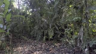
Found this old plane wreck in the jungle #adventure #planewreck #wwii #history #tropicallife
一式陸攻 ”Last Mitsubishi G4M" Shortland Islands Ballalae.
Last Mitsubishi G4M in Shortland Islands *Aerial shoot, picture ...
Last Mitsubishi G4M in Shortland Islands *Aerial shoot, picture editing Noriyuki Ichikawa ※ソロモン諸島政府とショートランド ...
Solomon Islands is classified as Least developed region: Countries that exhibit the lowest indicators of socioeconomic development, with the lowest Human Development Index ratings. The level of income is Lower middle income.
News – Latest Updates and Headlines from Ballalae
Stay informed with the most recent news and important headlines from Ballalae. Here’s a roundup of the latest developments.
Loading...
Please note: The data used here has been primarily extracted from satellite readings. Deviations from exact values may occur, particularly regarding the height of elevations and population density. Land area and coastline measurements refer to average values at mean high tide.