Bandaville
Welcome to Bandaville, a Tropical island in the Bay of Bengal, part of the majestic Indian Ocean. This guide offers a comprehensive overview of what makes Bandaville unique – from its geography and climate to its population, infrastructure, and beyond. Dive into the details:
- Geography and Size: Explore the island’s size and location.
- Climate and Weather: Weather patterns and temperature.
- Topography and Nature: Uncover the natural wonders of the island.
- Infrastructure and Travelling: Insights on reaching, staying, and making the most of your visit.
- News and Headlines: Latest News.
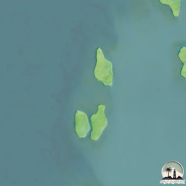
Geography and size of Bandaville
Size: 1.003 km²
Coastline: 8.2 km
Ocean: Indian Ocean
Sea: Bay of Bengal
Continent: Seven seas (open ocean)
Bandaville is a Small Island spanning 1 km² with a coastline of 8.2 km.
Archipel: Andaman Islands – Situated in the Bay of Bengal, the Andaman Islands are part of the Indian territory and are known for their picturesque beaches, clear waters, and lush forests. These islands are home to a variety of indigenous tribes and have a rich biodiversity, including unique flora and fauna. The Andamans also have a significant history, notably during the British colonial period.
Tectonic Plate: Burma – Also known as the Burma Plate, it’s a minor tectonic plate in Southeast Asia, largely covering Burma (Myanmar) and parts of the Indian Ocean. It’s involved in the subduction process under the Eurasian Plate, contributing to seismic activity in the region.
The geographic heart of the island is pinpointed at these coordinates:
Latitude: 12.89937738 / Longitude: 92.75432017
Climate and weather of Bandaville
Climate Zone: Tropical
Climate Details: Tropical Monsoon Climate
Temperature: Hot
Climate Characteristics: Characterized by heavy rainfall, high humidity, and uniformly high temperatures, but with a distinct short dry season. It features a seasonal reversal of prevailing wind directions.
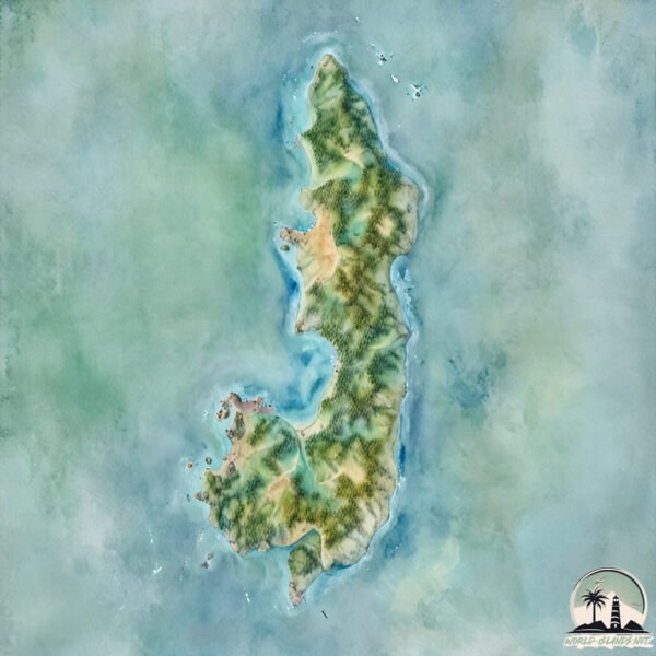
Topography and nature of Bandaville
Timezone: UTC+05:30
Timezone places:
Max. Elevation: -24 m
Mean Elevation: -28 m
Vegetation: Evergreen Needleleaf Forest
Tree Coverage: 40%
The mean elevation is -28 m. Remarkably, this unique island barely emerges above the sea level, showcasing nature’s fascinating interplay with the ocean. The island is characterized by Plains: Flat, low-lying lands characterized by a maximum elevation of up to 200 meters. On islands, plains are typically coastal lowlands or central flat areas.
Dominating Vegetation: Evergreen Needleleaf Forest
Dominated by evergreen coniferous trees such as pines and firs, which retain their needle-like leaves throughout the year. These forests are often found in cooler climates. Bandaville has a tree cover of 40 %.
Vegetation: 2 vegetation zones – Low Diversity Island
Islands with two distinct vegetation zones offer slightly more ecological variety. These zones could be due to differences in elevation, moisture, or other environmental factors. While still limited in biodiversity, these islands may offer a contrast between the two zones, such as a coastline with mangroves and an inland area with grassland.
Infrastructure and Travelling to Bandaville
Does the island have a public airport? no.
There is no public and scheduled airport on Bandaville. The nearest airport is Veer Savarkar International Airport / INS Utkrosh, located 139 km away.
Does the island have a major port? no.
There are no major ports on Bandaville. The closest major port is PORT BLAIR, approximately 134 km away.
The mean population of Bandaville is 40 per km². Bandaville is Gently Populated. The island belongs to India.
Continuing your journey, Interview Island is the next notable island, situated merely km away.
Yusuf / Cat Stevens – Lady D'Arbanville (Official Music Video)


India is classified as Emerging region: BRIC: Brazil, Russia, India, and China – Economies noted for their rapid growth and increasing influence on global affairs. The level of income is Lower middle income.
News – Latest Updates and Headlines from Bandaville
Stay informed with the most recent news and important headlines from Bandaville. Here’s a roundup of the latest developments.
Please note: The data used here has been primarily extracted from satellite readings. Deviations from exact values may occur, particularly regarding the height of elevations and population density. Land area and coastline measurements refer to average values at mean high tide.