Bei Xiaodao
Welcome to Bei Xiaodao, a Tropical island in the Eastern China Sea, part of the majestic Pacific Ocean. This guide offers a comprehensive overview of what makes Bei Xiaodao unique – from its geography and climate to its population, infrastructure, and beyond. Dive into the details:
- Geography and Size: Explore the island’s size and location.
- Climate and Weather: Weather patterns and temperature.
- Topography and Nature: Uncover the natural wonders of the island.
- Infrastructure and Travelling: Insights on reaching, staying, and making the most of your visit.
- News and Headlines: Latest News.
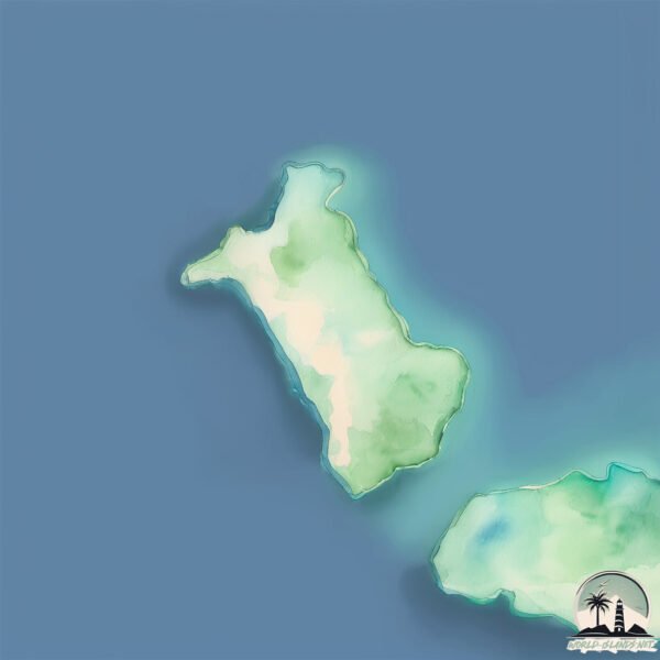
Geography and size of Bei Xiaodao
Size: 0.351 km²
Coastline: 3.6 km
Ocean: Pacific Ocean
Sea: Eastern China Sea
Continent: Asia
Bei Xiaodao is a Tiny Island spanning 0.351 km² with a coastline of 3.6 km.
Archipel: –
Tectonic Plate: Yangtze – A minor tectonic plate in East Asia, often considered a part of the Eurasian Plate. It’s primarily continental and covers the Yangtze River area in China, playing a significant role in the region’s geological stability.
The geographic heart of the island is pinpointed at these coordinates:
Latitude: 25.72985272 / Longitude: 123.54191279
Climate and weather of Bei Xiaodao
Climate Zone: Tropical
Climate Details: Tropical Rainforest Climate
Temperature: Hot
Climate Characteristics: This climate is typified by heavy rainfall throughout the year, high humidity, and consistently high temperatures, leading to lush rainforests and rich biodiversity. Seasonal temperature variations are minimal.
Topography and nature of Bei Xiaodao
Timezone: UTC+09:00
Timezone places: Asia/Tokyo
Max. Elevation: -10 m
Mean Elevation: -18 m
Vegetation: Herbaceous Cover
Tree Coverage: 0%
The mean elevation is -18 m. Remarkably, this unique island barely emerges above the sea level, showcasing nature’s fascinating interplay with the ocean. The island is characterized by Plains: Flat, low-lying lands characterized by a maximum elevation of up to 200 meters. On islands, plains are typically coastal lowlands or central flat areas.
Dominating Vegetation: Herbaceous Cover
Comprising mainly of grasses, herbs, and ferns, these areas are common in prairies, meadows, and savannas, and can vary widely in species composition. Bei Xiaodao has a tree cover of 0 %.
Vegetation: 2 vegetation zones – Low Diversity Island
Islands with two distinct vegetation zones offer slightly more ecological variety. These zones could be due to differences in elevation, moisture, or other environmental factors. While still limited in biodiversity, these islands may offer a contrast between the two zones, such as a coastline with mangroves and an inland area with grassland.
Infrastructure and Travelling to Bei Xiaodao
Does the island have a public airport? no.
There is no public and scheduled airport on Bei Xiaodao. The nearest airport is Yonaguni Airport, located 153 km away.
Does the island have a major port? no.
There are no major ports on Bei Xiaodao. The closest major port is ISHIGAKI, approximately 170 km away.
The mean population of Bei Xiaodao is 208 per km². Bei Xiaodao is Moderately Inhabited. The island belongs to Japan.
Continuing your journey, Yonaguni-jima is the next notable island, situated merely km away.
Japan is classified as Developed region: G7: Group of Seven – Major advanced economies, including Canada, France, Germany, Italy, Japan, the United Kingdom, and the United States. The level of income is High income: OECD.
News – Latest Updates and Headlines from Bei Xiaodao
Stay informed with the most recent news and important headlines from Bei Xiaodao. Here’s a roundup of the latest developments.
Please note: The data used here has been primarily extracted from satellite readings. Deviations from exact values may occur, particularly regarding the height of elevations and population density. Land area and coastline measurements refer to average values at mean high tide.