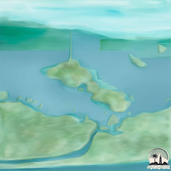
Welcome to Beringia Novaya, a Continental island in the Gulf of Alaska, part of the majestic Pacific Ocean. This guide offers a comprehensive overview of what makes Beringia Novaya unique – from its geography and climate to its population, infrastructure, and beyond. Dive into the details:
Geography and size of Beringia Novaya
Size: 4.586 km²
Coastline: 20.7 km
Ocean: Pacific Ocean
Sea: Gulf of Alaska
Continent: North America
Beringia Novaya is a Small Island spanning 4.6 km² with a coastline of 20.7 km.
Archipel: –
Tectonic Plate: North America – Covers North America and parts of the Atlantic and Arctic Oceans, characterized by diverse geological features and varying levels of seismic activity.
The geographic heart of the island is pinpointed at these coordinates:
Latitude: 60.10561329 / Longitude: -143.46336043
Climate and weather of Beringia Novaya
Climate Zone: Continental
Climate Details: Subarctic Climate
Temperature: Cold Summer
Climate Characteristics: Characterized by long, extremely cold winters and short, cool summers, often found in northern latitudes of North America and Eurasia.
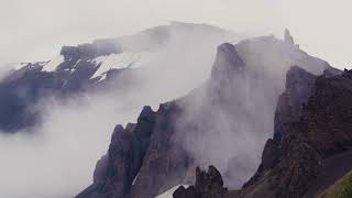
Topography and nature of Beringia Novaya
Timezone: UTC-09:00
Timezone places: America/Anchorage
Max. Elevation: 24 m
Mean Elevation: 16 m
Vegetation: Mixed Forest
Tree Coverage: 59%
The mean elevation is 16 m. The highest elevation on the island reaches approximately 24 meters above sea level. The island is characterized by Plains: Flat, low-lying lands characterized by a maximum elevation of up to 200 meters. On islands, plains are typically coastal lowlands or central flat areas.
Dominating Vegetation: Mixed Forest
A combination of both deciduous and evergreen trees, often found in transitional zones between forest types. These forests offer a diverse habitat for various wildlife species. Beringia Novaya has a tree cover of 59 %.
Vegetation: 5 vegetation zones – Highly Diverse Island
With five different vegetation zones, these islands offer a rich tapestry of ecosystems. The variety could include dense forests, open meadows, wetlands, coastal zones, and more. This level of diversity supports an intricate web of life, with each zone playing a vital role in the overall ecological health and balance of the island.
Infrastructure and Travelling to Beringia Novaya
Does the island have a public airport? no.
There is no public and scheduled airport on Beringia Novaya. The nearest airport is Yakataga Airport, located 104 km away.
Does the island have a major port? no.
There are no major ports on Beringia Novaya. The closest major port is KATALLA, approximately 116 km away.
The mean population of Beringia Novaya is 0 per km². Beringia Novaya is Uninhabited. The island belongs to United States of America.
Continuing your journey, Kayak is the next notable island, situated merely km away.
Why did Russia set up a human forbidden place in the Arctic Ocean?#map #world
Why did Russia set up a human forbidden place in the Arctic Ocean?#map #world
Russia's ‘New Land’ : Inside the Soviet Nuclear Test Land
In the New Russia Travel Documentary: heading to Novaya Zemlya ...
In the New Russia Travel Documentary: heading to Novaya Zemlya archipelago. What is there? What happened there after the ...
The Final Landmass Found On Earth: Severnaya Zemlya
Despite the widespread use of satellites, GPS, Google Earth, and ...
Despite the widespread use of satellites, GPS, Google Earth, and similar technologies, one might assume that every corner of our ...
Examining A Mysterious Building in the Remote Russian Arctic…
I came across this random structure when I was searching the coast of ...
I came across this random structure when I was searching the coast of Novaya Zemlya on Severny Island on Apple Maps. I wasn't ...
Novaya Zemlya: The Digital Black Hole on Google Maps (DOCUMENTARY)
Hit the like button if you enjoyed the video. ➜ If you didn't, feel ...
Hit the like button if you enjoyed the video. ➜ If you didn't, feel free to leave a dislike. ➜ Post a comment down below.
How Large Is Novaya Zemlya? - Polar Regions Uncovered
How Large Is Novaya Zemlya? In this engaging video, we will take a ...
How Large Is Novaya Zemlya? In this engaging video, we will take a closer look at Novaya Zemlya, a remarkable Arctic ...
Nuclear torpedo tested in Novaya Zemlya
Joe 17 (3.5 KTs), Novaya Zemlya, 1955. #ColdWar #USA #USSR ...
Joe 17 (3.5 KTs), Novaya Zemlya, 1955. #ColdWar #USA #USSR #NuclearTesting #Nuclear #Explosion #Detonation #Weapons ...
What Are The Main Settlements In Novaya Zemlya? - Polar Regions Uncovered
What Are The Main Settlements In Novaya Zemlya? Have you ever wondered ...
What Are The Main Settlements In Novaya Zemlya? Have you ever wondered about the main settlements in Novaya Zemlya and ...
Novaya Zemlya, Nassau coast
📍Severny island Russia 🇷🇺 Then & Now #russia #severnyisland #thenandnow #globalview
Did you know that NOVAYA ZEMLYA...
Did you know that NOVAYA ZEMLYA... Did you know that Novaya Zemlya ...
Did you know that NOVAYA ZEMLYA... Did you know that Novaya Zemlya (island in Russia), is the location where Tsar Bomba, ...
NOVAYA ZEMLYA THE SECRET ISLAND 🌴🌴🌴
3 Russian Islands Where No Human Is Welcome
3 Russian Islands Where No Human Is Welcome.
3 Russian Islands Where No Human Is Welcome.
Testing Site For The Most Powerful Nuclear Bomb Ever | Novaya Zemlya #facts #shorts #video
Novaya Zemlya HD The Amazing Story of Dutch explorer Willem Barents Novaya Zemlya Movie
Novaya Zemlya HD The Amazing Story of Dutch explorer Willem Barents ...
Novaya Zemlya HD The Amazing Story of Dutch explorer Willem Barents Novaya Zemlya Movie Novaya Zemlya recounts the ...
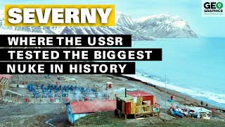
Severny: Where the USSR Tested the Biggest Nuke in History
Thanks to Dollar Shave Club for sponsoring. Go to ...
Traveling to Novaya Zemlya
Traveling to Novaya Zemlya offers a rare opportunity to explore one of ...
Traveling to Novaya Zemlya offers a rare opportunity to explore one of the most remote and pristine regions of the Arctic.
Novaya Zemlya
Some facts about the closed territory where there is the only ground ...
Some facts about the closed territory where there is the only ground in Russia for nuclear tests, learn in our infographics.
Visiting Novaya Zemyla be like 💀 (Explanation in comments) #russia #war #mutation
Jewels of the Russian Arctic: Franz Josef Land and Novaya Zemlya
On Jewels of the Russian Arctic: Franz Josef Land and Novaya Zemlya, ...
On Jewels of the Russian Arctic: Franz Josef Land and Novaya Zemlya, we follow the footsteps of early northern explorers to two ...
Polar bears invade Russian islands
Dozens of hungry polar bears have invaded the remote Artic region of ...
Dozens of hungry polar bears have invaded the remote Artic region of Novaya Zemlya, leading authorities to declare an ...
The Forbidden Russian Island That Hid the World's Biggest Bomb! #facts #geopolitics #education
There's a remote island in Russia so secretive, hardly anyone knows it ...
There's a remote island in Russia so secretive, hardly anyone knows it exists — and fewer have ever set foot on it. Welcome to ...
Novaya Zemlya Islands | Russia | Map in Short | Amrit Upadhyay | UPSC2024 | StudyIQ IAS Hindi
NovayaZemlya #Russia #UPSC2024 #MapInShort #amrit_upadhyay ...
NovayaZemlya #Russia #UPSC2024 #MapInShort #amrit_upadhyay #studyiqiashindi Dear Viewers, Novaya Zemlya means New ...
Satellite images suggest Russia is preparing to test a nuclear-powered missile in the Novaya Zemlya
Satellite images suggest Russia is preparing to test a nuclear-powered ...
Satellite images suggest Russia is preparing to test a nuclear-powered missile in the Novaya Zemlya#iran #donaldtrumpteam ...
United States of America is classified as Developed region: G7: Group of Seven – Major advanced economies, including Canada, France, Germany, Italy, Japan, the United Kingdom, and the United States. The level of income is High income: OECD.
News – Latest Updates and Headlines from Beringia Novaya
Stay informed with the most recent news and important headlines from Beringia Novaya. Here’s a roundup of the latest developments.
Loading...
Please note: The data used here has been primarily extracted from satellite readings. Deviations from exact values may occur, particularly regarding the height of elevations and population density. Land area and coastline measurements refer to average values at mean high tide.