Welcome to Big, a Polar island in the Hudson Strait, part of the majestic Atlantic Ocean. This guide offers a comprehensive overview of what makes Big unique – from its geography and climate to its population, infrastructure, and beyond. Dive into the details:
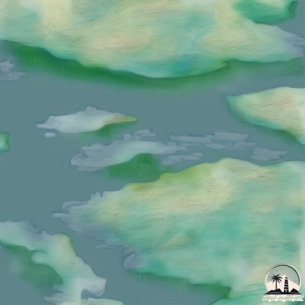
Geography and size of Big
Size: 1.884 km²
Coastline: 8.7 km
Ocean: Atlantic Ocean
Sea: Hudson Strait
Continent: North America
Big is a Small Island spanning 1.9 km² with a coastline of 8.7 km.
Archipel: Canadian Arctic Archipelago – A vast and remote region in northern Canada, consisting of a series of large and small islands known for their extreme Arctic environment and unique wildlife.
Tectonic Plate: North America – Covers North America and parts of the Atlantic and Arctic Oceans, characterized by diverse geological features and varying levels of seismic activity.
The geographic heart of the island is pinpointed at these coordinates:
Latitude: 62.50682329 / Longitude: -70.57566819
Climate and weather of Big
Climate Zone: Polar
Climate Details: Tundra
Temperature: Cold
Climate Characteristics: The tundra climate features long, extremely cold winters and short, cool summers. Vegetation is limited to mosses, lichens, and small shrubs due to the low temperatures and short growing seasons. Biodiversity is low, but some specialized species thrive.
Topography and nature of Big
Timezone: UTC-04:00
Timezone places: America/La_Paz
Max. Elevation: 334 m
Mean Elevation: 107 m
Vegetation: Herbaceous Cover
Tree Coverage: 15%
The mean elevation is 107 m. The highest elevation on the island reaches approximately 334 meters above sea level. The island is characterized by Hills: Gently sloping landforms with rounded tops, having a maximum elevation between 200 and 500 meters. Hills contribute to a varied landscape on islands.
Dominating Vegetation: Herbaceous Cover
Comprising mainly of grasses, herbs, and ferns, these areas are common in prairies, meadows, and savannas, and can vary widely in species composition. Big has a tree cover of 15 %.
Vegetation: 9 vegetation zones – Very Highly Diverse Island
Islands in this range are ecological powerhouses, showcasing a wide array of vegetation zones. Each zone, from lush rainforests to arid scrublands, coastal mangroves to mountainous regions, contributes to a complex and interdependent ecosystem. These islands are often hotspots of biodiversity, supporting numerous species and intricate ecological processes.
Infrastructure and Travelling to Big
Does the island have a public airport? no.
There is no public and scheduled airport on Big. The nearest airport is Makkovik Airport, located 3 km away.
Does the island have a major port? no.
There are no major ports on Big. The closest major port is MOBILE, approximately 18 km away.
The mean population of Big is 0 per km². Big is Uninhabited. The island belongs to Canada.
The name of the island resonates across different cultures and languages. Here is how it is known around the world: Arabic: لبرادور; German: Labrador; Spanish: Labrador; French: Labrador; Portuguese: Labrador; Russian: Лабрадор; Chinese: 拉布拉多
Continuing your journey, Emma Island is the next notable island, situated merely km away.
BIG ISLAND Hawaii Travel Guide 2025: 16 THINGS TO KNOW BEFORE YOU GO
Enjoy planning your trip to the Big Island! See our Big Island playlist for more information and open the Description for all the ...BIG ISLAND Hawaii Travel Guide 2025: 16 THINGS TO KNOW BEFORE YOU GO
Enjoy planning your trip to the Big Island! See our Big Island ...
Enjoy planning your trip to the Big Island! See our Big Island playlist for more information and open the Description for all the ...
21 Things to Do Around the Big Island, Hawaii | Two residents share their favorite things to do
Here are our favorite things to do in Big Island, Hawaii in 2022. This ...
Here are our favorite things to do in Big Island, Hawaii in 2022. This is your guided tour of what the Island of Hawaii has to offer ...
Hawaii's Big Island Vacation Travel Guide | Expedia
Hawaii's Big Island – The “Big Island” of Hawaii is (you guessed it) ...
Hawaii's Big Island – The “Big Island” of Hawaii is (you guessed it) the largest of the Hawaiian Islands and offers a stunning array ...
What To Do Big Island Hawaii 🌴 Ultimate Travel Guide
Dive into the Big Island Hawaii Unforgettable Adventures on the Big ...
Dive into the Big Island Hawaii Unforgettable Adventures on the Big Island: 10 Must-Do Experiences In this video, we'll embark on ...
❌Don't go to HAWAII without watching THIS... (5 things to do on the Big Island Hawaii)
Why You Need to Visit the Big Island - Hawaii 5 Day Travel Guide & Tips
Join us on our 5 day adventure through the incredible Big Island! ...
Join us on our 5 day adventure through the incredible Big Island! Hawaii, Hawaii (nicknamed "The Big Island" or "Kona" from the ...
The Big Island Ultimate Guide (w Maps) - Everything You Need to Know and More!!
Printable and Digital Guides Available... ...
BIG ISLAND of HAWAII Travel Guide: Everything to Know!
Watch this before you go to Hawaii's Big Island! This travel guide ...
Watch this before you go to Hawaii's Big Island! This travel guide breaks down everything you need to know: transportation, ...
ONE WEEK on the BIG ISLAND, HAWAII | BEST THINGS to DO, EAT & SEE | Travel Guide
ONE WEEK on the BIG ISLAND, HAWAII | BEST THINGS to DO, EAT & SEE | ...
ONE WEEK on the BIG ISLAND, HAWAII | BEST THINGS to DO, EAT & SEE | Travel Guide MANTA RAY SNORKEL TOUR: ...
Quick Tour of Hawaii Big Island’s Hidden Gems! 🌴✨
Quick Tour of Hawaii Big Island's Hidden Gems! ✨ #shorts #hawaii ...
Quick Tour of Hawaii Big Island's Hidden Gems! ✨ #shorts #hawaii #bigisland #usa hawaii big island hawaii hawaii travel ...
11 Things to Do on The Big Island That No One Else is Sharing
If you are heading to the Big Island of Hawaii, you've likely seen ...
If you are heading to the Big Island of Hawaii, you've likely seen list after list of the same things over and over. That's great - but ...
Our Big Island Hawaii Adventure: Food, Itinerary & Travel Tips (Plus Crazy Flight Deal!)
Aloha! In this visual, we embark on an unforgettable adventure across ...
Aloha! In this visual, we embark on an unforgettable adventure across the breathtaking Big Island (Hawai'i Island) of Hawaii!
Living on the Big Island: Our 2026 Predictions
Aloha! It's Eric & Julie with 365Hawaii We're out around the Big ...
Aloha! It's Eric & Julie with 365Hawaii We're out around the Big Island talking about what really happened this year and what we ...
15 Big Island things to do in just 3 days
This road map shows you where the must-see places are on the Big ...
This road map shows you where the must-see places are on the Big Island, how to get to them and what to expect when you arrive ...
4 things to do on Hawaii’s Big Island🌺🐚 #hawaii #konahawaii #hawaiiisland #bigislandhawaii #kona
Top 10 Best Things to Do on the Big Island, Hawaii - Travel Video 2024
Welcome to our ultimate guide on the Best Things to Do on the Big ...
Welcome to our ultimate guide on the Best Things to Do on the Big Island of Hawaii! Whether you're planning your dream vacation ...
7 Days on HAWAII's BIG ISLAND: What to See, Do & Eat
These are the best things to do & eat on the Big Island of Hawaii! ...
These are the best things to do & eat on the Big Island of Hawaii! Embark with us on a whirlwind 7-day family adventure across ...
Hawaii Big Island Travel Guide: 18 BEST Things To Do On Hawaii's Big Island
This Hawaii Big Island travel guide shares the best things to do in ...
This Hawaii Big Island travel guide shares the best things to do in Hawaii Big Island. -------------- How to travel more and visit your ...
5 Best Luxury Resorts on the Big Island, Hawaii | Four Seasons, Mauna Lani, Fairmont Orchid, Westin
Is a luxury Big Island resort in your future? These places are why ...
Is a luxury Big Island resort in your future? These places are why they call the Kohala Coast the Gold Coast. Links to learn more ...
5 REAL Hidden Food Gems on the Big Island of Hawaii
hawaii #bigislandhawaii #foodie Greetings, travelers. In this video, I ...
hawaii #bigislandhawaii #foodie Greetings, travelers. In this video, I am featuring 5 real food gems on the Big Island of Hawaii, ...
5 Days on the Big Island, Ultimate Hawaii Itinerary!
Grab our travel day shirts here! Please wake me for in-flight snacks: ...
Kīlauea Lava Fountains Erupt, Civil Defense Radio Message Issued (Feb. 15, 2026)
HAWAIʻI VOLCANOES NATIONAL PARK - Episode 42 in the ongoing summit ...
HAWAIʻI VOLCANOES NATIONAL PARK - Episode 42 in the ongoing summit eruption got underway at around 1:50 p.m. HST on ...
Big Island Of Hawaii Hidden Gems
Big Island Of Hawaii Hidden Gems Big Island Food Tour - ...
Kailua-Kona, Hawaii - 4K Walking Tour | Big Island USA 🇺🇸 | December 2024
Shooting date: December 18, 2024 - 12:25 PM Weather: Sunny ...
Shooting date: December 18, 2024 - 12:25 PM Weather: Sunny Temperature: 26°C / 78.8°F Camera: DJI OSMO POCKET3 00:00 ...
Why Hawaii’s Islands Aren’t Connected by Boats 🚢 Ocean Mystery 🌊
Hawaii travel hides a surprising fact, you can't move between the ...
Hawaii travel hides a surprising fact, you can't move between the islands by boat! The 8 main Hawaiian Islands, 6 open to ...
Canada is classified as Developed region: G7: Group of Seven – Major advanced economies, including Canada, France, Germany, Italy, Japan, the United Kingdom, and the United States. The level of income is High income: OECD.
News – Latest Updates and Headlines from Big
Stay informed with the most recent news and important headlines from Big. Here’s a roundup of the latest developments.
Loading...
Please note: The data used here has been primarily extracted from satellite readings. Deviations from exact values may occur, particularly regarding the height of elevations and population density. Land area and coastline measurements refer to average values at mean high tide.