Boa Vista
Welcome to Boa Vista, a Dry island in the North Atlantic Ocean, part of the majestic Atlantic Ocean. This guide offers a comprehensive overview of what makes Boa Vista unique – from its geography and climate to its population, infrastructure, and beyond. Dive into the details:
- Geography and Size: Explore the island’s size and location.
- Climate and Weather: Weather patterns and temperature.
- Topography and Nature: Uncover the natural wonders of the island.
- Infrastructure and Travelling: Insights on reaching, staying, and making the most of your visit.
- News and Headlines: Latest News.
Geography and size of Boa Vista
Size: 642.3 km²
Coastline: 134.3 km
Ocean: Atlantic Ocean
Sea: North Atlantic Ocean
Continent: Africa
Boa Vista is a Large Island spanning 642 km² with a coastline of 134 km.
Archipel: Cape Verde – An island country in the central Atlantic Ocean, known for its Creole Portuguese-African culture, music, and volcanic landscapes.
Tectonic Plate: Africa – One of the world’s largest tectonic plates, covering the African continent and parts of the surrounding oceans, known for its stability with some active rift zones.
The geographic heart of the island is pinpointed at these coordinates:
Latitude: 16.09772223 / Longitude: -22.8142955
Climate and weather of Boa Vista
Climate Zone: Dry
Climate Details: Hot Deserts Climate
Temperature: Hot
Climate Characteristics: Dominated by extremely hot temperatures, this climate is marked by minimal rainfall and barren landscapes. Nights often experience drastic temperature drops.
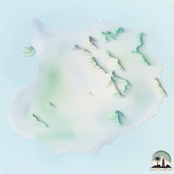
Topography and nature of Boa Vista
Timezone: UTC-01:00
Timezone places: Atlantic/Cape_Verde
Max. Elevation: 248 m
Mean Elevation: 55 m
Vegetation: Rocky Terrain
Tree Coverage: 3%
The mean elevation is 55 m. The highest elevation on the island reaches approximately 248 meters above sea level. The island is characterized by Hills: Gently sloping landforms with rounded tops, having a maximum elevation between 200 and 500 meters. Hills contribute to a varied landscape on islands.
Dominating Vegetation: Rocky Terrain
Landscapes dominated by gravel, rock, and stone, with little to no vegetation. These areas are often found in mountainous regions or deserts. Boa Vista has a tree cover of 3 %.
Vegetation: 8 vegetation zones – Very Highly Diverse Island
Islands in this range are ecological powerhouses, showcasing a wide array of vegetation zones. Each zone, from lush rainforests to arid scrublands, coastal mangroves to mountainous regions, contributes to a complex and interdependent ecosystem. These islands are often hotspots of biodiversity, supporting numerous species and intricate ecological processes.
Infrastructure and Travelling to Boa Vista
Does the island have a public airport? yes.
Boa Vista has a public and scheduled airport. The following airports are located on this island: Rabil Airport.
Does the island have a major port? no.
There are no major ports on Boa Vista. The closest major port is PORTO DA PRAIA, approximately 137 km away.
The mean population of Boa Vista is 31 per km². Boa Vista is Gently Populated. The island belongs to Cabo Verde.
The name of the island resonates across different cultures and languages. Here is how it is known around the world: Arabic: بوا فيستا; German: Boa Vista; Spanish: Isla de Boa Vista; French: Boa Vista; Portuguese: Ilha da Boa Vista; Russian: Боавишта; Chinese: 博阿維斯塔島
Continuing your journey, Sal is the next notable island, situated merely km away.
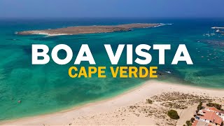
BOA VISTA, CAPE VERDE: Travel Guide to ALL top sights in 4K + DRONE


Cabo Verde is classified as Developing region: Regions characterized by lower income levels, with economies in the process of industrialization and modernization. The level of income is Lower middle income.
News – Latest Updates and Headlines from Boa Vista
Stay informed with the most recent news and important headlines from Boa Vista. Here’s a roundup of the latest developments.
Please note: The data used here has been primarily extracted from satellite readings. Deviations from exact values may occur, particularly regarding the height of elevations and population density. Land area and coastline measurements refer to average values at mean high tide.