Welcome to Bridgemarsh, a Temperate island in the North Sea, part of the majestic Atlantic Ocean. This guide offers a comprehensive overview of what makes Bridgemarsh unique – from its geography and climate to its population, infrastructure, and beyond. Dive into the details:
Geography and size of Bridgemarsh
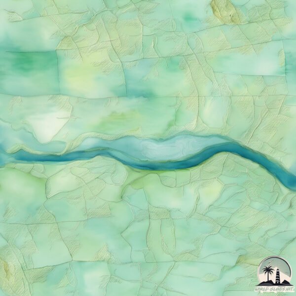
Size: 1.711 km²
Coastline: 9.2 km
Ocean: Atlantic Ocean
Sea: North Sea
Continent: Europe
Bridgemarsh is a Small Island spanning 1.7 km² with a coastline of 9.2 km.
Archipel: British Isles – A group of islands off the northwest coast of mainland Europe, including Great Britain, Ireland, and over 6,000 smaller islands, known for their rich history and cultural diversity.
Tectonic Plate: Eurasia – One of the world’s largest tectonic plates, the Eurasian Plate covers a significant portion of Europe and Asia. It’s characterized by diverse geological features, including the Ural Mountains, the European Plain, and the Himalayas formed from its collision with the Indian Plate.
The geographic heart of the island is pinpointed at these coordinates:
Latitude: 51.63870755 / Longitude: 0.73867073
Climate and weather of Bridgemarsh
Climate Zone: Temperate
Climate Details: Temperate Oceanic Climate
Temperature: Warm Summer
Climate Characteristics: Known for its moderate year-round temperatures with ample rainfall and no dry season. Warm summers are characteristic.
Topography and nature of Bridgemarsh
Timezone: UTC±00:00
Timezone places: Europe/London
Max. Elevation: 2 m
Mean Elevation: 1 m
Vegetation: Evergreen Needleleaf Forest
Tree Coverage: 10%
The mean elevation is 1 m. The highest elevation on the island reaches approximately 2 meters above sea level. The island is characterized by Plains: Flat, low-lying lands characterized by a maximum elevation of up to 200 meters. On islands, plains are typically coastal lowlands or central flat areas.
Dominating Vegetation: Evergreen Needleleaf Forest
Dominated by evergreen coniferous trees such as pines and firs, which retain their needle-like leaves throughout the year. These forests are often found in cooler climates. Bridgemarsh has a tree cover of 10 %.
Vegetation: 4 vegetation zones – Diverse Island
Four distinct vegetation zones mark these islands as ecologically diverse. They might feature varied landscapes such as forests, beaches, grasslands, and rocky areas. Such diversity reflects the island’s complex ecological interactions and varied habitats, which can support a rich array of wildlife and plant species.
Infrastructure and Travelling to Bridgemarsh
Does the island have a public airport? no.
There is no public and scheduled airport on Bridgemarsh. The nearest airport is Southend Airport, located 8 km away.
Does the island have a major port? no.
There are no major ports on Bridgemarsh. The closest major port is SHEERNESS, approximately 20 km away.
The mean population of Bridgemarsh is 34 per km². Bridgemarsh is Gently Populated. The island belongs to United Kingdom.
Continuing your journey, Foulness Island is the next notable island, situated merely km away.
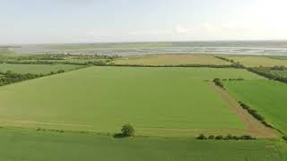
Bridgemarsh Island - Essex 📍🌊⛵️ #WLEM #explore #travel #videography #drone
Bridgemarsh Island - Essex 📍🌊⛵️ #WLEM #explore #travel #videography #drone
Bridgemarsh Island - Essex 📍🏖️🌊 #WLEM #explore #travel #videography #drone
CATAMARAN CREEKSEA AND BRIDGEMARSH ISLAND
CATAMARAN SAILING AROUND BRIDGEMARSH ISLAND FROM CREEKSEA SAILING CLUB ...
CATAMARAN SAILING AROUND BRIDGEMARSH ISLAND FROM CREEKSEA SAILING CLUB RIVER CROUCH ESSEX TWO ...
SWFYC Bridgemarsh Rally 2024
Another attempt to for a brave group of dinghy sailers to navigate ...
Another attempt to for a brave group of dinghy sailers to navigate round Bridgemarsh Island. The wind really picked up in the ...
High Speed RS Aero Versus Support Bike Race Round Bridgemarsh Island - A Yodare Adventure
Sailing round Bridgemarsh island on the River Crouch in Essex provided ...
Sailing round Bridgemarsh island on the River Crouch in Essex provided a high speed race between support bike Earl and Yoda ...
Saltmarsh 75 Challenge Section 2
This section offers expansive views of the River Crouch from the heady ...
This section offers expansive views of the River Crouch from the heady heights of the 'Burnham Cliffs' and takes you past ...
Clayhill Vineyard - Relax
Footage in May 2020 over the Cafe, Vines, Farmland and the River ...
Footage in May 2020 over the Cafe, Vines, Farmland and the River Crouch, Bridgemarsh Island and Creek. Looking East, down ...
Sailing in 30 Knot Winds | Benfleet to Bridge Marsh Marina on the River Crouch
Join us on an exhilarating sailing adventure from Benfleet Yacht Club ...
Join us on an exhilarating sailing adventure from Benfleet Yacht Club to Bridge Marsh Marina along the beautiful River Crouch in ...
FS2020 - Flight down the River Crouch (Essex)
FS2020 Flight down the River Crouch - flying across RSPB Wallasea ...
FS2020 Flight down the River Crouch - flying across RSPB Wallasea Island, Burnham on Crouch, Althorne, Bridgemarsh Island ...
River Crouch, Essex, UK - August 2020
We sailed to the River Crouch, Battle Bridge stayeed at Burnham, ...
We sailed to the River Crouch, Battle Bridge stayeed at Burnham, Cambridge and Bridgemarsh Marinas, also sailed into the River ...
Canewdon & Wallasea Island Marina 2.7k DJI Phantom 3 Advanced
All shot on the Phantom 3 Advanced.
All shot on the Phantom 3 Advanced.
Bridgemarsh: The Unstoppable Force
Can no one beat us? This week Bridgemarsh go up against Railway and ...
Can no one beat us? This week Bridgemarsh go up against Railway and dominate them 8-0. Still undefeated in 2015 COYY.
Essex Cup | Bridgemarsh Vs Toby FC Res | GOAL OF THE SEASON ?!?!
Epic Drone Cinematic | Muddy River, Bridge & Island
Flying cinematic style over muddy waters, crossing a bridge and ...
Flying cinematic style over muddy waters, crossing a bridge and revealing an island surrounded by raw nature. Captured with ...
Bridgemarsh vs Shoebury Town | Semi Final |
The Fight to Save Chippewa Lake's Bridge: Floating Island and Resident Resilience
The Fight to Save Chippewa Lake's Bridge: Floating Island and ...
The Fight to Save Chippewa Lake's Bridge: Floating Island and Community Resilience #fok #jameen_bikau_hai.
Old Bridge Marsh Oak Island (OKI) Drone
YauponDrone is doing a series of Oak Island landmarks, spots of ...
YauponDrone is doing a series of Oak Island landmarks, spots of interest and events from the air. Equipment: DJI drone @ 2.7K ...
Ghosts of the Outer Banks: Pea Island’s Bridge to Nowhere
Just south of the Pea Island Visitor Center, hidden among the marshes ...
Just south of the Pea Island Visitor Center, hidden among the marshes of North Carolina's Outer Banks, lie the weathered wooden ...
Bateman Island The Breach
This is a shot video of the removal of the land bridge to Bateman ...
This is a shot video of the removal of the land bridge to Bateman Island taken over r a couple of weeks time showing the breach of ...
Glastonbury almost an island again! #avalon #somersetuk #glastonbury
A short video of the flooding across the fields from Pomparles Bridge. ...
A short video of the flooding across the fields from Pomparles Bridge. We've just had yet another storm with more rain predicted.
Bridgemarsh vs Rochford Town | PROMOTION TO PREM | Goal of the season???!
A good win that secures promotion to the Prem with 2 games to play. A ...
A good win that secures promotion to the Prem with 2 games to play. A contender for goal of the season after some lovely 1 touch ...
Bridgemarsh Crossbar Challenge
Bridgemarsh take on the Crossbar Challenge luckily someone hit the ...
Bridgemarsh take on the Crossbar Challenge luckily someone hit the bar! Unfortunately not the full team. Song: The Beta Band ...
RIVER CROUCH AT WALLASEA ISLAND
JUST MESSING WITH THE VIDEO ON MY PHONE.
JUST MESSING WITH THE VIDEO ON MY PHONE.
skipper 12 and 14 from creeksea sailing club
we took rays skipper 12 and malcoms skipper 14 for a sail up to ...
we took rays skipper 12 and malcoms skipper 14 for a sail up to bridgemarsh island on the river crouch a good gusty afternoon ...
United Kingdom is classified as Developed region: G7: Group of Seven – Major advanced economies, including Canada, France, Germany, Italy, Japan, the United Kingdom, and the United States. The level of income is High income: OECD.
News – Latest Updates and Headlines from Bridgemarsh
Stay informed with the most recent news and important headlines from Bridgemarsh. Here’s a roundup of the latest developments.
Loading...
Please note: The data used here has been primarily extracted from satellite readings. Deviations from exact values may occur, particularly regarding the height of elevations and population density. Land area and coastline measurements refer to average values at mean high tide.