Broughton
Welcome to Broughton, a Temperate island in the North Atlantic Ocean, part of the majestic Atlantic Ocean. This guide offers a comprehensive overview of what makes Broughton unique – from its geography and climate to its population, infrastructure, and beyond. Dive into the details:
- Geography and Size: Explore the island’s size and location.
- Climate and Weather: Weather patterns and temperature.
- Topography and Nature: Uncover the natural wonders of the island.
- Infrastructure and Travelling: Insights on reaching, staying, and making the most of your visit.
- News and Headlines: Latest News.
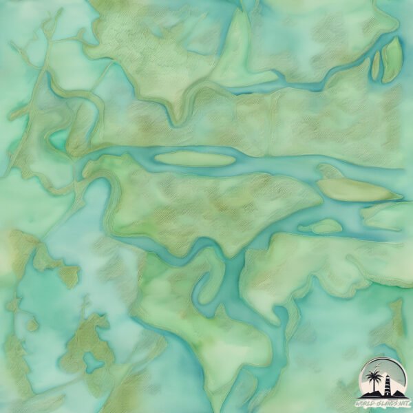
Geography and size of Broughton
Size: 12.3 km²
Coastline: 19.5 km
Ocean: Atlantic Ocean
Sea: North Atlantic Ocean
Continent: North America
Broughton is a Medium Island spanning 12 km² with a coastline of 20 km.
Archipel: –
Tectonic Plate: North America – Covers North America and parts of the Atlantic and Arctic Oceans, characterized by diverse geological features and varying levels of seismic activity.
The geographic heart of the island is pinpointed at these coordinates:
Latitude: 31.32289443 / Longitude: -81.40919291
Climate and weather of Broughton
Climate Zone: Temperate
Climate Details: Humid Subtropical Climate
Temperature: Hot Summer
Climate Characteristics: With continuous rainfall and hot summers, this climate is common in some coastal regions, supporting diverse vegetation.
Topography and nature of Broughton
Timezone: UTC-05:00
Timezone places: America/New_York
Max. Elevation: 2 m
Mean Elevation: 1 m
Vegetation: Wetland
Tree Coverage: 17%
The mean elevation is 1 m. The highest elevation on the island reaches approximately 2 meters above sea level. The island is characterized by Plains: Flat, low-lying lands characterized by a maximum elevation of up to 200 meters. On islands, plains are typically coastal lowlands or central flat areas.
Dominating Vegetation: Wetland
These areas are saturated with water, either permanently or seasonally, and support aquatic plants. Wetlands are important for biodiversity and water filtration. Broughton has a tree cover of 17 %.
Vegetation: 6 vegetation zones – Very Highly Diverse Island
Islands in this range are ecological powerhouses, showcasing a wide array of vegetation zones. Each zone, from lush rainforests to arid scrublands, coastal mangroves to mountainous regions, contributes to a complex and interdependent ecosystem. These islands are often hotspots of biodiversity, supporting numerous species and intricate ecological processes.
Infrastructure and Travelling to Broughton
Does the island have a public airport? no.
There is no public and scheduled airport on Broughton. The nearest airport is Brunswick Golden Isles Airport, located 7 km away.
Does the island have a major port? no.
There are no major ports on Broughton. The closest major port is DARIEN, approximately 3 km away.
The mean population of Broughton is 0 per km². Broughton is Uninhabited. The island belongs to United States of America.
Continuing your journey, Wolf is the next notable island, situated merely km away.
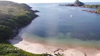
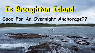
Broughton Island Part 1


United States of America is classified as Developed region: G7: Group of Seven – Major advanced economies, including Canada, France, Germany, Italy, Japan, the United Kingdom, and the United States. The level of income is High income: OECD.
News – Latest Updates and Headlines from Broughton
Stay informed with the most recent news and important headlines from Broughton. Here’s a roundup of the latest developments.
Please note: The data used here has been primarily extracted from satellite readings. Deviations from exact values may occur, particularly regarding the height of elevations and population density. Land area and coastline measurements refer to average values at mean high tide.