Cagbuli
Welcome to Cagbuli, a Tropical island in the South China Sea, part of the majestic Pacific Ocean. This guide offers a comprehensive overview of what makes Cagbuli unique – from its geography and climate to its population, infrastructure, and beyond. Dive into the details:
- Geography and Size: Explore the island’s size and location.
- Climate and Weather: Weather patterns and temperature.
- Topography and Nature: Uncover the natural wonders of the island.
- Infrastructure and Travelling: Insights on reaching, staying, and making the most of your visit.
- News and Headlines: Latest News.
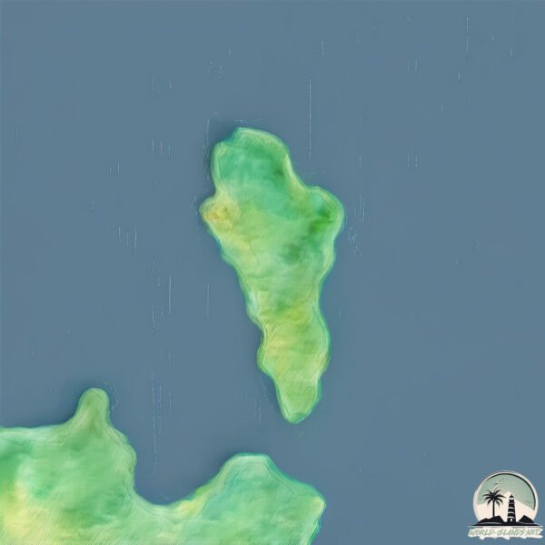
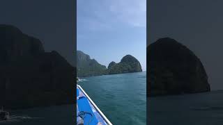
Geography and size of Cagbuli
Size: 1.658 km²
Coastline: 6.9 km
Ocean: Pacific Ocean
Sea: South China Sea
Continent: Asia
Cagbuli is a Small Island spanning 1.7 km² with a coastline of 6.9 km.
Archipel: Malay Archipelago – The world’s largest archipelago, located between mainland Southeast Asia and Australia, known for its immense biodiversity and cultural diversity.
Tectonic Plate: Sunda – Extends across Southeast Asia, encompassing parts of the Sunda Shelf, known for its interaction with the Australian Plate, contributing to volcanic activity in Indonesia.
The geographic heart of the island is pinpointed at these coordinates:
Latitude: 11.4349048 / Longitude: 119.50144932
Climate and weather of Cagbuli
Climate Zone: Tropical
Climate Details: Tropical Monsoon Climate
Temperature: Hot
Climate Characteristics: Characterized by heavy rainfall, high humidity, and uniformly high temperatures, but with a distinct short dry season. It features a seasonal reversal of prevailing wind directions.
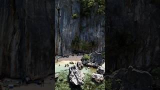
Topography and nature of Cagbuli
Timezone: UTC+08:00
Timezone places: Australia/Perth
Max. Elevation: 43 m
Mean Elevation: 30 m
Vegetation: Evergreen Needleleaf Forest
Tree Coverage: 86%
The mean elevation is 30 m. The highest elevation on the island reaches approximately 43 meters above sea level. The island is characterized by Plains: Flat, low-lying lands characterized by a maximum elevation of up to 200 meters. On islands, plains are typically coastal lowlands or central flat areas.
Dominating Vegetation: Evergreen Needleleaf Forest
Dominated by evergreen coniferous trees such as pines and firs, which retain their needle-like leaves throughout the year. These forests are often found in cooler climates. Cagbuli has a tree cover of 86 %.
Vegetation: 5 vegetation zones – Highly Diverse Island
With five different vegetation zones, these islands offer a rich tapestry of ecosystems. The variety could include dense forests, open meadows, wetlands, coastal zones, and more. This level of diversity supports an intricate web of life, with each zone playing a vital role in the overall ecological health and balance of the island.
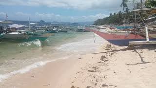
Infrastructure and Travelling to Cagbuli
Does the island have a public airport? no.
There is no public and scheduled airport on Cagbuli. The nearest airport is El Nido Airport, located 26 km away.
Does the island have a major port? no.
There are no major ports on Cagbuli. The closest major port is PUERTO PRINCESA, approximately 206 km away.
The mean population of Cagbuli is 168 per km². Cagbuli is Moderately Inhabited. The island belongs to Philippines.
Continuing your journey, Iloc is the next notable island, situated merely km away.
Cagbuli Island, Teneguiban, Elnido, PalawanPH


Philippines is classified as Emerging region: G20: Group of Twenty – Major economies comprising both developed and emerging countries, representing the world’s largest economies. The level of income is Lower middle income.
News – Latest Updates and Headlines from Cagbuli
Stay informed with the most recent news and important headlines from Cagbuli. Here’s a roundup of the latest developments.
Please note: The data used here has been primarily extracted from satellite readings. Deviations from exact values may occur, particularly regarding the height of elevations and population density. Land area and coastline measurements refer to average values at mean high tide.