Calder
Welcome to Calder, a Tropical island in the Coral Sea, part of the majestic Pacific Ocean. This guide offers a comprehensive overview of what makes Calder unique – from its geography and climate to its population, infrastructure, and beyond. Dive into the details:
- Geography and Size: Explore the island’s size and location.
- Climate and Weather: Weather patterns and temperature.
- Topography and Nature: Uncover the natural wonders of the island.
- Infrastructure and Travelling: Insights on reaching, staying, and making the most of your visit.
- News and Headlines: Latest News.
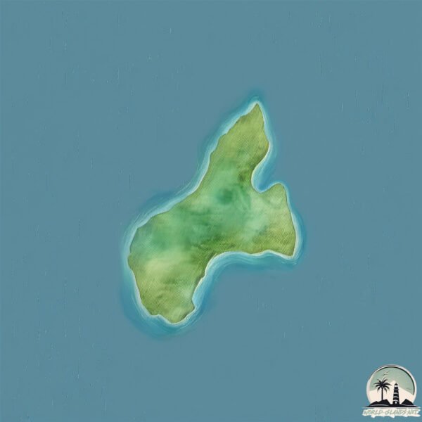
Geography and size of Calder
Size: 1.525 km²
Coastline: 7.3 km
Ocean: Pacific Ocean
Sea: Coral Sea
Continent: Oceania
Calder is a Small Island spanning 1.5 km² with a coastline of 7.3 km.
Archipel: –
Tectonic Plate: Australia – A major tectonic plate covering Australia, New Zealand, and parts of the Indian and Pacific Oceans, known for its relative stability and occasional seismic activity.
The geographic heart of the island is pinpointed at these coordinates:
Latitude: -20.7721172 / Longitude: 149.61954314
Climate and weather of Calder
Climate Zone: Tropical
Climate Details: Tropical Savanna, Wet
Temperature: Hot
Climate Characteristics: Defined by distinct wet and dry seasons with high temperatures year-round. Pronounced rainfall occurs during the wet season, while the dry season is marked by drought.
Topography and nature of Calder
Timezone: UTC+10:00
Timezone places: Australia/Sydney
Max. Elevation: 42 m
Mean Elevation: 25 m
Vegetation: Evergreen Broadleaf Forest
Tree Coverage: 50%
The mean elevation is 25 m. The highest elevation on the island reaches approximately 42 meters above sea level. The island is characterized by Plains: Flat, low-lying lands characterized by a maximum elevation of up to 200 meters. On islands, plains are typically coastal lowlands or central flat areas.
Dominating Vegetation: Evergreen Broadleaf Forest
Characterized by dense, lush canopies of broadleaf trees that retain their leaves year-round. These forests are typically found in tropical and subtropical regions and are known for their high biodiversity. Calder has a tree cover of 50 %.
Vegetation: 2 vegetation zones – Low Diversity Island
Islands with two distinct vegetation zones offer slightly more ecological variety. These zones could be due to differences in elevation, moisture, or other environmental factors. While still limited in biodiversity, these islands may offer a contrast between the two zones, such as a coastline with mangroves and an inland area with grassland.
Infrastructure and Travelling to Calder
Does the island have a public airport? no.
There is no public and scheduled airport on Calder. The nearest airport is Mackay Airport, located 65 km away.
Does the island have a major port? no.
There are no major ports on Calder. The closest major port is MACKAY, approximately 58 km away.
The mean population of Calder is 1 per km². Calder is Gently Populated. The island belongs to Australia.
Continuing your journey, Scawfell is the next notable island, situated merely km away.
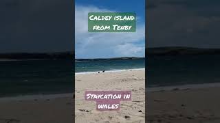
Tour of CALDEY ISLAND | a tropical island near Tenby owned by Cistercian monks


Australia is classified as Developed region: nonG7: Developed economies outside of the Group of Seven, characterized by high income and advanced economic structures. The level of income is High income: OECD.
News – Latest Updates and Headlines from Calder
Stay informed with the most recent news and important headlines from Calder. Here’s a roundup of the latest developments.
Please note: The data used here has been primarily extracted from satellite readings. Deviations from exact values may occur, particularly regarding the height of elevations and population density. Land area and coastline measurements refer to average values at mean high tide.