Welcome to Carache, a Tropical island in the North Atlantic Ocean, part of the majestic Atlantic Ocean. This guide offers a comprehensive overview of what makes Carache unique – from its geography and climate to its population, infrastructure, and beyond. Dive into the details:
Geography and size of Carache
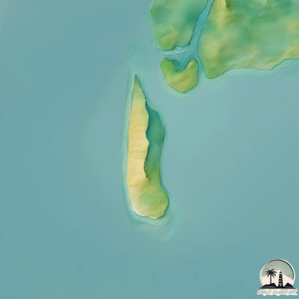
Size: 1.891 km²
Coastline: 8.4 km
Ocean: Atlantic Ocean
Sea: North Atlantic Ocean
Continent: Africa
Carache is a Small Island spanning 1.9 km² with a coastline of 8.4 km.
Archipel: Bijagós Islands – Located off the coast of Guinea-Bissau in West Africa, these islands are known for their unique biodiversity and traditional African culture.
Tectonic Plate: Africa – One of the world’s largest tectonic plates, covering the African continent and parts of the surrounding oceans, known for its stability with some active rift zones.
The geographic heart of the island is pinpointed at these coordinates:
Latitude: 11.41943923 / Longitude: -16.30755561
Climate and weather of Carache
Climate Zone: Tropical
Climate Details: Tropical Savanna, Wet
Temperature: Hot
Climate Characteristics: Defined by distinct wet and dry seasons with high temperatures year-round. Pronounced rainfall occurs during the wet season, while the dry season is marked by drought.
Topography and nature of Carache
Timezone: UTC±00:00
Timezone places: Europe/Lisbon
Max. Elevation: 4 m
Mean Elevation: 2 m
Vegetation: Mangrove Forest
Tree Coverage: 60%
The mean elevation is 2 m. The highest elevation on the island reaches approximately 4 meters above sea level. The island is characterized by Plains: Flat, low-lying lands characterized by a maximum elevation of up to 200 meters. On islands, plains are typically coastal lowlands or central flat areas.
Dominating Vegetation: Mangrove Forest
Found in coastal areas and river deltas, these unique wetland ecosystems are adapted to saline conditions and are crucial for coastal protection and biodiversity. Carache has a tree cover of 60 %.
Vegetation: 2 vegetation zones – Low Diversity Island
Islands with two distinct vegetation zones offer slightly more ecological variety. These zones could be due to differences in elevation, moisture, or other environmental factors. While still limited in biodiversity, these islands may offer a contrast between the two zones, such as a coastline with mangroves and an inland area with grassland.
Infrastructure and Travelling to Carache
Does the island have a public airport? no.
There is no public and scheduled airport on Carache. The nearest airport is Osvaldo Vieira International Airport, located 89 km away.
Does the island have a major port? no.
There are no major ports on Carache. The closest major port is BISSAU, approximately 89 km away.
The mean population of Carache is 9 per km². Carache is Gently Populated. The island belongs to Guinea-Bissau.
Continuing your journey, Ilha de Carache is the next notable island, situated merely km away.
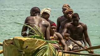
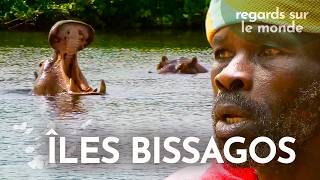
Bissagos Islands, on the Mysterious Islands of West Africa
We invite you to discover the Bissagos Islands, an isolated territory of Guinee Bissau, in West Africa. These sacred lands resemble ...Bissagos Islands, on the Mysterious Islands of West Africa
We invite you to discover the Bissagos Islands, an isolated territory ...
We invite you to discover the Bissagos Islands, an isolated territory of Guinee Bissau, in West Africa. These sacred lands resemble ...
🌍 Bissagos Islands: Carache & Kere — Beautiful, Remote… Sting Rays Included!
Île Carache aux Bijagos, la pêche aux coquillages by Expédition Ponant
Dans l'archipel des Bijagos en Guinée-Bissau, L'île Carache c'est une ...
Dans l'archipel des Bijagos en Guinée-Bissau, L'île Carache c'est une destination de découverte naturelle authentiques. j'ai ...
Into the Abyss: Dare to Venture Close to Carache Lake's Deadly Beauty
Join us on a daring adventure as we venture close to the treacherous ...
Join us on a daring adventure as we venture close to the treacherous Carache Lake in Russia. This captivating YouTube shorts ...
Caravela & Carache Islands - AUGUSTUS
JAZ PRODUÇÕES Visita às ilhas de Caravela e Carache. 11 de outubro de 2021.
JAZ PRODUÇÕES Visita às ilhas de Caravela e Carache. 11 de outubro de 2021.
The Bissagos Islands: A Journey into West Africa's Sacred Lands | Somewhere on Earth | Documentary
Somewhere on Earth invites you to discover the Bijagos Islands, an ...
Somewhere on Earth invites you to discover the Bijagos Islands, an isolated territory of Guinee Bissau, in West Africa.
CARACHE: "La Tierra de la Amable Libertad".
Carache: Según Américo Briceño Valero, Carache se comenzó a formar en ...
Carache: Según Américo Briceño Valero, Carache se comenzó a formar en 1561. Fue declarado pueblo de doctrina con el ...
Amazing Quest: Stories from Bissagos Islands | Somewhere on Earth: Bijagós | Master documentary
Amazing Quest: Stories from Bissagos Islands | Somewhere on Earth: ...
Amazing Quest: Stories from Bissagos Islands | Somewhere on Earth: Bijagós | Master documentary Somewhere on Earth invites ...
Fachadas Coloniales, Cultura, Panorámicas de Carache
He creado este vídeo con el Editor de vídeo de YouTube ...
elly고s to Guinea Bissau
To the Island of Carache, Guinea Bissau -- to the ends of the earth. ...
To the Island of Carache, Guinea Bissau -- to the ends of the earth. To the wastelands in the wilderness where God is ever present ...
Exploring Ilha De Kere: Unseen Paradise of West Africa #guineabissau #africa #ilhadekere #ilha
Kere Island , Bijagos Archipelago is part of the 88 islands marked as ...
Kere Island , Bijagos Archipelago is part of the 88 islands marked as proposed UNESCO world heritage site located in Guinea ...
Les îles Bissagos : la terre des guérisseurs en Afrique de l'Ouest | Vue sur Terre | Documentaire HD
Les îles Bissagos, un territoire isolé de la Guinée Bissau, en Afrique ...
Les îles Bissagos, un territoire isolé de la Guinée Bissau, en Afrique de l'Ouest. Ces terres sacrées ressemblent à un vaste delta ...
Bissagos Islands
The Bissagos Islands, also spelled Bijagós (Portuguese: Arquipélago ...
The Bissagos Islands, also spelled Bijagós (Portuguese: Arquipélago dos Bijagós), are a group of about 88 islands and islets ...
I'm rolling through the streets of the beautiful and friendly town of Carache in the state of Tru...
There are routes that are enjoyed with all five senses. 🏍️🏔️ Arriving ...
There are routes that are enjoyed with all five senses. 🏍️🏔️ Arriving in Carache and being greeted by this climate and the ...
Carnavales Carache 2016 Cuarta Parte
Desfile de Carrozas, Comparsas, y Trajes Individuales por las Calles ...
Desfile de Carrozas, Comparsas, y Trajes Individuales por las Calles de Carache.
A Lake you don't wanna spend Time at
shorts.
shorts.
Islas Bijagós: curanderos y rituales en la parte más remota de Guinea | Historias Vivas | Documental
En esta nueva aventura descubriremos las Islas Bijagós, un territorio ...
En esta nueva aventura descubriremos las Islas Bijagós, un territorio remoto de Guinea Bissau, en África Occidental. Estas tierras ...
DSP visita a Ilha de Carache
Mais uma visita do Presidente do PAIGC, Domingos Simões Pereira, ...
Mais uma visita do Presidente do PAIGC, Domingos Simões Pereira, consolida o compromisso de dialogar com o povo, conhecer ...
Manora Beach Karachi |Fishing in Karachi |Kemari to Manora |Beach by Boat 2022 |Fish caught in Sea
Kemarikarachi #Fishinginkarachi #Manorabeach #Beachbyboat2022 ...
Kemarikarachi #Fishinginkarachi #Manorabeach #Beachbyboat2022 #Fishcaughtinsea.
Amazing Quest: Madagascar, Malawi and More | Somewhere on Earth: Best Of Africa | Free Documentary
Somewhere on Earth - Best of Africa: Madagascar, Bissagos Islands, ...
Somewhere on Earth - Best of Africa: Madagascar, Bissagos Islands, Malawi, Cape Verde, Tanzania & Botswana | Free ...
visitando restaurantes en Carache
Carache agradecimiento a elcarachero.com
Binte
The market garden in the village of Binte in the island of Carache, ...
The market garden in the village of Binte in the island of Carache, and a tribute to Mary who has become a patron of WellFound.
Guinea-Bissau is classified as Least developed region: Countries that exhibit the lowest indicators of socioeconomic development, with the lowest Human Development Index ratings. The level of income is Low income.
News – Latest Updates and Headlines from Carache
Stay informed with the most recent news and important headlines from Carache. Here’s a roundup of the latest developments.
Loading...
Please note: The data used here has been primarily extracted from satellite readings. Deviations from exact values may occur, particularly regarding the height of elevations and population density. Land area and coastline measurements refer to average values at mean high tide.