Welcome to Caroline, a Polar island in the South Pacific Ocean, part of the majestic Pacific Ocean. This guide offers a comprehensive overview of what makes Caroline unique – from its geography and climate to its population, infrastructure, and beyond. Dive into the details:
Geography and size of Caroline
Size: 40.9 km²
Coastline: 65.8 km
Ocean: Pacific Ocean
Sea: South Pacific Ocean
Continent: South America
Caroline is a Medium Island spanning 41 km² with a coastline of 66 km.
Archipel: Andes fueguinos – A subregion of Tierra del Fuego in the southernmost tip of South America, known for its rugged mountain landscapes and remote beauty.
Tectonic Plate: Scotia – Situated in the Southern Ocean, surrounding the Scotia Sea, between South America and Antarctica, known for the Scotia Arc and active seismicity.
The geographic heart of the island is pinpointed at these coordinates:
Latitude: -55.4678967 / Longitude: -69.5154377
Climate and weather of Caroline
Climate Zone: Polar
Climate Details: Tundra
Temperature: Cold
Climate Characteristics: The tundra climate features long, extremely cold winters and short, cool summers. Vegetation is limited to mosses, lichens, and small shrubs due to the low temperatures and short growing seasons. Biodiversity is low, but some specialized species thrive.
Topography and nature of Caroline
Timezone: UTC-04:00
Timezone places: America/La_Paz
Max. Elevation: 465 m
Mean Elevation: 175 m
Vegetation: Herbaceous Cover
Tree Coverage: 36%
The mean elevation is 175 m. The highest elevation on the island reaches approximately 465 meters above sea level. The island is characterized by Hills: Gently sloping landforms with rounded tops, having a maximum elevation between 200 and 500 meters. Hills contribute to a varied landscape on islands.
Dominating Vegetation: Herbaceous Cover
Comprising mainly of grasses, herbs, and ferns, these areas are common in prairies, meadows, and savannas, and can vary widely in species composition. Caroline has a tree cover of 36 %.
Vegetation: 7 vegetation zones – Very Highly Diverse Island
Islands in this range are ecological powerhouses, showcasing a wide array of vegetation zones. Each zone, from lush rainforests to arid scrublands, coastal mangroves to mountainous regions, contributes to a complex and interdependent ecosystem. These islands are often hotspots of biodiversity, supporting numerous species and intricate ecological processes.
Infrastructure and Travelling to Caroline
Does the island have a public airport? no.
There is no public and scheduled airport on Caroline. The nearest airport is Malvinas Argentinas Airport, located 145 km away.
Does the island have a major port? no.
There are no major ports on Caroline. The closest major port is USHUAIA, approximately 146 km away.
The mean population of Caroline is 0 per km². Caroline is Uninhabited. The island belongs to Chile.
Continuing your journey, Hind is the next notable island, situated merely km away.
Caroline Islands | Wikipedia audio article
This is an audio version of the Wikipedia Article: Caroline Islands Listening is a more natural way of learning, when compared to ...Caroline Islands | Wikipedia audio article
This is an audio version of the Wikipedia Article: Caroline Islands ...
This is an audio version of the Wikipedia Article: Caroline Islands Listening is a more natural way of learning, when compared to ...
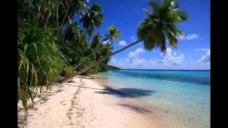
Caroline Island
Caroline Island - Slideshow.
Caroline Island - Slideshow.
Exploring the Wonders of Caroline Island
Discover Caroline Island's untouched beauty, rich biodiversity, and ...
Discover Caroline Island's untouched beauty, rich biodiversity, and the ancient survival techniques useful in modern scenarios.
This is the World's Most Remote Island..
The World's Most Remote Islands are the Pitcairn Islands located in ...
The World's Most Remote Islands are the Pitcairn Islands located in the south pacific ocean. The town here is known as ...
Caroline islands | meaning of Caroline islands
What is CAROLINE ISLANDS meaning? ---------- Susan Miller (2022, ...
What is CAROLINE ISLANDS meaning? ---------- Susan Miller (2022, August 28.) Caroline islands meaning ...
Caroline islands — CAROLINE ISLANDS definition
Meaning of CAROLINE ISLANDS ---------- Susan Miller (2023, April 24.) ...
Meaning of CAROLINE ISLANDS ---------- Susan Miller (2023, April 24.) What is Caroline islands definition?
On Caroline Islands Air to the Atoll of Pingelap
I was very fortunate to join Pohnpei State Governor Stevenson A. ...
I was very fortunate to join Pohnpei State Governor Stevenson A. Joseph and First Lady, Dr. Aina Garstang on a 4 hour trip to ...
Caroline - Southern Island
visit us on facebook.com/southernislandfanpage.
visit us on facebook.com/southernislandfanpage.
🇰🇮 Kiribati - The FIRST Country to See the Sun! | Shocking Facts You Didn’t Know! 🌅🏝️ #Kiribati
Welcome to Kiribati! A tiny island nation in the Pacific Ocean with ...
Welcome to Kiribati! A tiny island nation in the Pacific Ocean with some of the most mind-blowing facts! From being the first ...
Caroline Island Western Pacific
CAROLINE ISLAND - RACE 1 #turffontein 16-12-2024
Dive into the heart of horseracing - download the app “Racing Today” ...
Exploring the World's Most Isolated Islands A Journey Beyond Civilization
Embark on an extraordinary journey as we explore the world's most ...
Embark on an extraordinary journey as we explore the world's most isolated islands, just 2000 miles from civilization!
You Won't Believe Islands Like This Still Exist 🏝️ #Shorts
Ever heard of Caroline Island — the most pristine tropical island in ...
Ever heard of Caroline Island — the most pristine tropical island in the world? No tourists. No cities. Just crystal-clear lagoons, ...
First-time on a Caroline Island Air
Flight from Pohnpei State to Chuuk State.
Flight from Pohnpei State to Chuuk State.
“The Sun Rises Here Before Anywhere Else 🌅🌍”
Where on Earth does the sun rise first every single day? It's not ...
Where on Earth does the sun rise first every single day? It's not Japan, New Zealand, or Australia — it's a tiny island in the Pacific ...
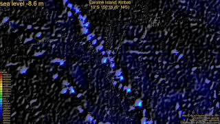
Caroline Island, Kiribati, sea level rise -135 - 65 m
The video shows the area around the Caroline Island in Kiribati, on an ...
The video shows the area around the Caroline Island in Kiribati, on an altitude-colored, relief-shaded map with present coastline ...
Caroline Island Blind Passage
s/v Araby sailing into Caroline Island (or Millennium Island, southern ...
s/v Araby sailing into Caroline Island (or Millennium Island, southern Kiribati).. Few boats have ever sailed through this blind pass ...
The Weirdest Island on Earth!
B-25 Mitchell aircraft fly in a formation over the Caroline Islands in the Pacifi...HD Stock Footage
CriticalPast is an archive of historic footage. The vintage footage in ...
CriticalPast is an archive of historic footage. The vintage footage in this video has been uploaded for research purposes, and is ...
Caroline Polachek - Welcome To My Island [Official Music Video]
New album 'Desire, I Want To Turn Into You" OUT NOW. Listen here: ...
New album 'Desire, I Want To Turn Into You" OUT NOW. Listen here:
https://ffm.to/diwttiy Directed and Edited by Matt Copson + ...
Caroline Island, Kiribati, (z+c) sea level rise -135 - 65 m
The video zooms in on the area around the Caroline Island in Kiribati, ...
The video zooms in on the area around the Caroline Island in Kiribati, on an altitude-colored, relief-shaded map with present ...
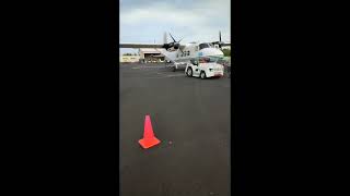
Welcome to Caroline Islands Air Partenavia P68 #pohnpei #micronesia
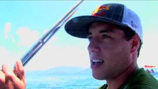
Pohnpei Surf Club - Caroline Islands
See more at ...
What's causing a mysterious hum on this Scottish island? - BBC World Service #shorts
Residents on the Scottish island of Lewis have been reporting ...
Residents on the Scottish island of Lewis have been reporting something strange... a mysterious hum. The BBC's Caroline Steel ...
Caroline Flack, former Love Island presenter, found dead | ITV News
TV presenter Caroline Flack has been found dead in her flat, her ...
TV presenter Caroline Flack has been found dead in her flat, her family has confirmed. In a statement, the family said: "We can ...
Chile is classified as Emerging region: G20: Group of Twenty – Major economies comprising both developed and emerging countries, representing the world’s largest economies. The level of income is Upper middle income.
News – Latest Updates and Headlines from Caroline
Stay informed with the most recent news and important headlines from Caroline. Here’s a roundup of the latest developments.
Loading...
Please note: The data used here has been primarily extracted from satellite readings. Deviations from exact values may occur, particularly regarding the height of elevations and population density. Land area and coastline measurements refer to average values at mean high tide.


![Caroline Polachek - Welcome To My Island [Official Music Video]](https://i.ytimg.com/vi/hxgcz_6GKX0/mqdefault.jpg)