Welcome to Castries, a Polar island in the Indian Ocean, part of the majestic Indian Ocean. This guide offers a comprehensive overview of what makes Castries unique – from its geography and climate to its population, infrastructure, and beyond. Dive into the details:
Geography and size of Castries
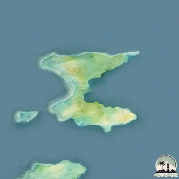
Size: 4.404 km²
Coastline: 19.8 km
Ocean: Indian Ocean
Sea: Indian Ocean
Continent: Seven seas (open ocean)
Castries is a Small Island spanning 4.4 km² with a coastline of 19.8 km.
Archipel: –
Tectonic Plate: Antarctica – Covers the Antarctic continent and extends outward, characterized by interactions with surrounding oceanic plates and known for its seismic activity along the periphery.
The geographic heart of the island is pinpointed at these coordinates:
Latitude: -48.68452973 / Longitude: 69.48826066
Climate and weather of Castries
Climate Zone: Polar
Climate Details: Tundra
Temperature: Cold
Climate Characteristics: The tundra climate features long, extremely cold winters and short, cool summers. Vegetation is limited to mosses, lichens, and small shrubs due to the low temperatures and short growing seasons. Biodiversity is low, but some specialized species thrive.
Topography and nature of Castries
Timezone: UTC+05:00
Timezone places: Asia/Karachi
Max. Elevation: 50 m
Mean Elevation: 30 m
Vegetation: Herbaceous Cover
Tree Coverage: 59%
The mean elevation is 30 m. The highest elevation on the island reaches approximately 50 meters above sea level. The island is characterized by Plains: Flat, low-lying lands characterized by a maximum elevation of up to 200 meters. On islands, plains are typically coastal lowlands or central flat areas.
Dominating Vegetation: Herbaceous Cover
Comprising mainly of grasses, herbs, and ferns, these areas are common in prairies, meadows, and savannas, and can vary widely in species composition. Castries has a tree cover of 59 %.
Vegetation: 6 vegetation zones – Very Highly Diverse Island
Islands in this range are ecological powerhouses, showcasing a wide array of vegetation zones. Each zone, from lush rainforests to arid scrublands, coastal mangroves to mountainous regions, contributes to a complex and interdependent ecosystem. These islands are often hotspots of biodiversity, supporting numerous species and intricate ecological processes.
Infrastructure and Travelling to Castries
Does the island have a public airport? no.
There is no public and scheduled airport on Castries. The nearest airport is Sir Charles Gaetan Duval Airport, located 3284 km away.
Does the island have a major port? no.
There are no major ports on Castries. The closest major port is PORT MATHURIN, approximately 3291 km away.
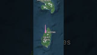
The mean population of Castries is per km². Castries is . The island belongs to France.
Continuing your journey, Howe is the next notable island, situated merely km away.
Castries, St. Lucia Cruise Port Guide – All The Info You Need!
Planning a cruise to St. Lucia? This video will help you navigate the port, explore the city, and discover hidden gems. We'll share ...Castries, St. Lucia Cruise Port Guide – All The Info You Need!
Planning a cruise to St. Lucia? This video will help you navigate the ...
Planning a cruise to St. Lucia? This video will help you navigate the port, explore the city, and discover hidden gems. We'll share ...
Welcome to the beautiful and epic island of St. Lucia 🏝️😍 #BucketlistTravel #caribbean #travelmore
This place is like if Hawaii and Norway had a baby Out of all the ...
This place is like if Hawaii and Norway had a baby Out of all the Caribbean Islands we have been to, this one is our personal ...
St Lucia Cruise Port Guide – Best Way to See the Island in One Day
Best Things To Do in St Lucia Travel Guide 4K
ST LUCIA: In this list of the best things to do in St Lucia travel ...
ST LUCIA: In this list of the best things to do in St Lucia travel guide, we show you around the top attractions in St Lucia. If you plan ...
ST. LUCIA FIRST IMPRESSIONS | Castries City Walking Tour (Vlog)
For our first day in St Lucia, we did everything that you need to do ...
For our first day in St Lucia, we did everything that you need to do in St. Lucia's capital city, Castries. We learned about St. Lucia's ...
What NOT to do in St. Lucia & what to do instead (MUST WATCH BEFORE VISITING!)
We should never have picked this cruise excursion to do when we were ...
We should never have picked this cruise excursion to do when we were in St. Lucia! We absolutely LOVED our snorkels and ...
ST. LUCIA Travel Guide 4K - Best Things To Do & Places To Visit
Explore the stunning beauty of St. Lucia in this comprehensive travel ...
Explore the stunning beauty of St. Lucia in this comprehensive travel guide. From the iconic Pitons to lush rainforests and pristine ...
10 IMPORTANT TIPS to know before traveling to ST. LUCIA!
Welcome to the beautiful island of St. Lucia, one of the most ...
Welcome to the beautiful island of St. Lucia, one of the most picturesque destinations in the Caribbean. From its stunning beaches ...
The Island's Delights, Castries, St. Lucia
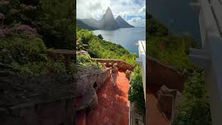
Journey to the Pitons - an UNESCO World Heritage Site and visit Sulfur ...
Journey to the Pitons - an UNESCO World Heritage Site and visit Sulfur Springs - the world's only walk-in volcano - followed by a ...
Top Things to Do at Castries, St. Lucia Cruise Port! 🚢🌊 #StLucia #CruiseAdventures #TravelTips
Explore Castries, St. Lucia! Discover vibrant local markets, relax at ...
Explore Castries, St. Lucia! Discover vibrant local markets, relax at stunning beaches, and hike the majestic Pigeon Island.
Watch This BEFORE You BOOK an Excursion in Saint Lucia | Yacht to Pitons Review #stlucia
Before you book that St. Lucia excursion... WATCH THIS FIRST! In this ...
Before you book that St. Lucia excursion... WATCH THIS FIRST! In this video, we reveal how we explored the stunning island of ...
Bay in Castries, St. Lucia island: aerial journey in the Caribbean
Saint Lucia is an Eastern Caribbean island nation with a pair of ...
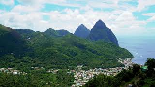
Saint Lucia is an Eastern Caribbean island nation with a pair of dramatically tapered mountains, the Pitons, on its west coast.
7 Places To Visit In Saint Lucia
7 Places to Visit in Saint Lucia. Here are our top 7 places to see in ...
7 Places to Visit in Saint Lucia. Here are our top 7 places to see in Saint Lucia. ▻ FREE BOOK: The Caribbean Travel Guide ...
Walking Tour of William Peter Boulevard | Castries St. Lucia’s Weekend Buzz
Take a Saturday stroll with us along William Peter Boulevard in the ...
Take a Saturday stroll with us along William Peter Boulevard in the heart of Castries, St. Lucia, just before the school term begins.
MOST BEAUTIFUL CARIBBEAN ISLAND! 🇱🇨 SAINT LUCIA
Rent a car on the island here ...
5 Things to Do in Saint Lucia 🇱🇨
“Miracle Fruits & Grapefruits in Castries, St. Lucia. This island is also abundant in breadfruit!
CASTRIES - ST. LUCIA, ONE OF THE MOST BEAUTIFUL ISLANDS IN THE EASTERN CARIBBEAN !! #castries
Amazing Caribbean island with so many friendly people .. just enjoyed ...
Amazing Caribbean island with so many friendly people .. just enjoyed my time there. #stlucia #caribbean #shorts #svenlucaworld ...
Castries, St. Lucia | Shopping and Tours #odysseyoftheseas 🚢 #royalcaribbean
Saint Lucia | Caribbean island |#2023 #shorts #travel #map #geography
SAINT LUCIA - Most beautiful island in the world? - TRAVEL GUIDE to ALL top sights in 4K
Saint Lucia is the ultimate honeymoon destination. It has the most ...
Saint Lucia is the ultimate honeymoon destination. It has the most beautiful nature and is the absolute highlight in the middle of ...
Top Things to Do in St. Lucia Cruise Port! 🌴🚢 #StLucia #CruiseAdventures
Ready for an adventure in St. Lucia Cruise Port? Explore the stunning ...
Ready for an adventure in St. Lucia Cruise Port? Explore the stunning Pitons, relax on sugar-sand beaches, and dive into vibrant ...
Here are 10 things to do in St. Lucia 🇱🇨 a beautiful island in the Eastern Caribbean #travel #top10
Here are 10 things to do in St. Lucia a beautiful island located in ...
Here are 10 things to do in St. Lucia a beautiful island located in the Eastern Caribbean, most known for its active volcano, ...
Saint Lucia: Caribbean’s Hidden Tropical Paradise!
Saint Lucia: Caribbean's Hidden Tropical Paradise ✨ Is Saint Lucia ...
Saint Lucia: Caribbean's Hidden Tropical Paradise ✨ Is Saint Lucia BETTER than Hawaii? Looking for the best flight deals?
Walking Through Bridge Street, Castries | The Bustling Heart of St. Lucia 🇱🇨
Join me on a walking tour of Bridge Street in Castries, St. Lucia, one ...
Join me on a walking tour of Bridge Street in Castries, St. Lucia, one of the busiest streets in the island's capital. From bustling ...
France is classified as Developed region: G7: Group of Seven – Major advanced economies, including Canada, France, Germany, Italy, Japan, the United Kingdom, and the United States. The level of income is High income: OECD.
News – Latest Updates and Headlines from Castries
Stay informed with the most recent news and important headlines from Castries. Here’s a roundup of the latest developments.
Loading...
Please note: The data used here has been primarily extracted from satellite readings. Deviations from exact values may occur, particularly regarding the height of elevations and population density. Land area and coastline measurements refer to average values at mean high tide.